Saint-Sulpice-les-Bois
Saint-Sulpice-les-Bois is a commune in the Corrèze department in central France.
Saint-Sulpice-les-Bois | |
|---|---|
.svg.png) Coat of arms | |
Location of Saint-Sulpice-les-Bois 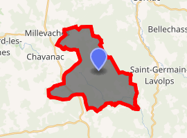
| |
 Saint-Sulpice-les-Bois  Saint-Sulpice-les-Bois | |
| Coordinates: 45°36′58″N 2°08′47″E | |
| Country | France |
| Region | Nouvelle-Aquitaine |
| Department | Corrèze |
| Arrondissement | Ussel |
| Canton | Plateau de Millevaches |
| Intercommunality | Haute-Corrèze Communauté |
| Government | |
| • Mayor (2014–2020) | Gérard Moratille |
| Area 1 | 22.92 km2 (8.85 sq mi) |
| Population (2017-01-01)[1] | 84 |
| • Density | 3.7/km2 (9.5/sq mi) |
| Time zone | UTC+01:00 (CET) |
| • Summer (DST) | UTC+02:00 (CEST) |
| INSEE/Postal code | 19244 /19250 |
| Elevation | 723–956 m (2,372–3,136 ft) (avg. 850 m or 2,790 ft) |
| 1 French Land Register data, which excludes lakes, ponds, glaciers > 1 km2 (0.386 sq mi or 247 acres) and river estuaries. | |
Geography
The Triouzoune has its source in the northwestern part of the commune; it flows southeast through the commune and forms part of its southeastern boundary.
History
The village was once called Taphaleschat. The name is derived from Taifals, a barbarian people (from Oltenia) settled in Gaul in the fifth century.
Population
| Historical population | ||
|---|---|---|
| Year | Pop. | ±% |
| 1962 | 60 | — |
| 1968 | 101 | +68.3% |
| 1975 | 102 | +1.0% |
| 1982 | 79 | −22.5% |
| 1990 | 71 | −10.1% |
| 1999 | 53 | −25.4% |
| 2008 | 70 | +32.1% |
See also
References
- "Populations légales 2017". INSEE. Retrieved 6 January 2020.
| Wikimedia Commons has media related to Saint-Sulpice-les-Bois. |
| Authority control |
|
|---|
This article is issued from Wikipedia. The text is licensed under Creative Commons - Attribution - Sharealike. Additional terms may apply for the media files.