Saint-Momelin
Saint-Momelin (West Flemish: Sint-Momelingn; Template:Lang-n;) is a commune in the Nord department in northern France.
Saint-Momelin | |
|---|---|
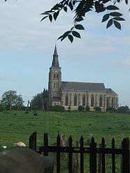 The church in Saint-Momelin | |
_Nord-France.svg.png) Coat of arms | |
Location of Saint-Momelin 
| |
 Saint-Momelin  Saint-Momelin | |
| Coordinates: 50°47′39″N 2°15′06″E | |
| Country | France |
| Region | Hauts-de-France |
| Department | Nord |
| Arrondissement | Dunkerque |
| Canton | Wormhout |
| Intercommunality | Communauté de communes des Hauts de Flandre |
| Government | |
| • Mayor (2014-2020) | Jean-Pierre Baudens |
| Area 1 | 6 km2 (2 sq mi) |
| Population (2017-01-01)[1] | 462 |
| • Density | 77/km2 (200/sq mi) |
| Time zone | UTC+01:00 (CET) |
| • Summer (DST) | UTC+02:00 (CEST) |
| INSEE/Postal code | 59538 /59143 |
| Elevation | 0–71 m (0–233 ft) (avg. 20 m or 66 ft) |
| 1 French Land Register data, which excludes lakes, ponds, glaciers > 1 km2 (0.386 sq mi or 247 acres) and river estuaries. | |
Politics
Presidential Elections 2nd Round
| Election | Winning Candidate | Party | % | |
|---|---|---|---|---|
| 2017 | Marine Le Pen | FN | 58.17 | |
| 2012 | Nicolas Sarkozy | UMP | 53.28 | |
| 2007 | Nicolas Sarkozy | UMP | 54.43 | |
| 2002 | Jacques Chirac | RPR | 76.50 | |
Heraldry
Arms of Saint-Momelin |
The arms of Saint-Momelin are blazoned : Gules, an escarbuncle pommy and fleury Or, the middle branch ending in a crozier Or, all within a bordure compony argent and sable. (Craywick and Saint-Momelin use the same arms.) |
See also
References
- "Populations légales 2017". INSEE. Retrieved 6 January 2020.
- http://www.lemonde.fr/data/france/presidentielle-2017//
| Wikimedia Commons has media related to Saint-Momelin. |
| Authority control |
|
|---|
This article is issued from Wikipedia. The text is licensed under Creative Commons - Attribution - Sharealike. Additional terms may apply for the media files.