Saint-Hilaire-sur-Benaize
Saint-Hilaire-sur-Benaize is a commune in the Indre department in central France.
Saint-Hilaire-sur-Benaize | |
|---|---|
 The church of Saint-Hilaire, in Saint-Hilaire-sur-Benaize | |
.svg.png) Coat of arms | |
Location of Saint-Hilaire-sur-Benaize 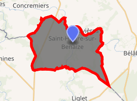
| |
 Saint-Hilaire-sur-Benaize  Saint-Hilaire-sur-Benaize | |
| Coordinates: 46°33′46″N 1°04′32″E | |
| Country | France |
| Region | Centre-Val de Loire |
| Department | Indre |
| Arrondissement | Le Blanc |
| Canton | Saint-Gaultier |
| Intercommunality | Val d'Anglin |
| Government | |
| • Mayor (2014–2020) | Serge Bégon |
| Area 1 | 32.61 km2 (12.59 sq mi) |
| Population (2017-01-01)[1] | 302 |
| • Density | 9.3/km2 (24/sq mi) |
| Time zone | UTC+01:00 (CET) |
| • Summer (DST) | UTC+02:00 (CEST) |
| INSEE/Postal code | 36197 /36370 |
| Elevation | 82–146 m (269–479 ft) (avg. 93 m or 305 ft) |
| 1 French Land Register data, which excludes lakes, ponds, glaciers > 1 km2 (0.386 sq mi or 247 acres) and river estuaries. | |
Geography
The commune is located in the parc naturel régional de la Brenne.
The river Benaize forms part of the commune's southern border, flows north through the commune, crossing the village of Saint-Hilaire-sur-Benaize, then flows into the Anglin, which forms part of the commune's northeastern border.
Population
| Historical population | ||
|---|---|---|
| Year | Pop. | ±% |
| 1793 | 794 | — |
| 1800 | 858 | +8.1% |
| 1806 | 717 | −16.4% |
| 1821 | 918 | +28.0% |
| 1831 | 1,010 | +10.0% |
| 1836 | 998 | −1.2% |
| 1841 | 927 | −7.1% |
| 1846 | 984 | +6.1% |
| 1851 | 996 | +1.2% |
| 1856 | 1,031 | +3.5% |
| 1861 | 1,005 | −2.5% |
| 1866 | 1,006 | +0.1% |
| 1872 | 993 | −1.3% |
| 1876 | 997 | +0.4% |
| 1881 | 1,009 | +1.2% |
| 1886 | 1,206 | +19.5% |
| 1891 | 927 | −23.1% |
| 1896 | 868 | −6.4% |
| 1901 | 902 | +3.9% |
| 1906 | 907 | +0.6% |
| 1911 | 897 | −1.1% |
| 1921 | 765 | −14.7% |
| 1926 | 716 | −6.4% |
| 1931 | 655 | −8.5% |
| 1936 | 670 | +2.3% |
| 1946 | 608 | −9.3% |
| 1954 | 554 | −8.9% |
| 1962 | 518 | −6.5% |
| 1968 | 463 | −10.6% |
| 1975 | 365 | −21.2% |
| 1982 | 329 | −9.9% |
| 1990 | 293 | −10.9% |
| 1999 | 303 | +3.4% |
| 2006 | 352 | +16.2% |
| 2009 | 358 | +1.7% |
See also
References
- "Populations légales 2017". INSEE. Retrieved 6 January 2020.
| Wikimedia Commons has media related to Saint-Hilaire-sur-Benaize. |
| Authority control |
|
|---|
This article is issued from Wikipedia. The text is licensed under Creative Commons - Attribution - Sharealike. Additional terms may apply for the media files.