Mauvières
Mauvières is a commune in the Indre department in central France.
Mauvières | |
|---|---|
_-_Mairie.jpg) The town hall in Mauvières | |
Location of Mauvières 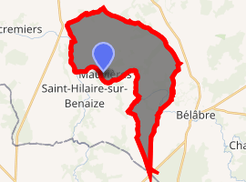
| |
 Mauvières  Mauvières | |
| Coordinates: 46°34′29″N 1°05′22″E | |
| Country | France |
| Region | Centre-Val de Loire |
| Department | Indre |
| Arrondissement | Le Blanc |
| Canton | Saint-Gaultier |
| Intercommunality | Val d'Anglin |
| Government | |
| • Mayor (2008–2014) | Raymond Patraud |
| Area 1 | 23.94 km2 (9.24 sq mi) |
| Population (2017-01-01)[1] | 310 |
| • Density | 13/km2 (34/sq mi) |
| Time zone | UTC+01:00 (CET) |
| • Summer (DST) | UTC+02:00 (CEST) |
| INSEE/Postal code | 36114 /36370 |
| Elevation | 84–147 m (276–482 ft) (avg. 72 m or 236 ft) |
| 1 French Land Register data, which excludes lakes, ponds, glaciers > 1 km2 (0.386 sq mi or 247 acres) and river estuaries. | |
Geography
The commune is located in the parc naturel régional de la Brenne.
The river Anglin forms most of the commune's western border.
Population
| Historical population | ||
|---|---|---|
| Year | Pop. | ±% |
| 1793 | 555 | — |
| 1800 | 440 | −20.7% |
| 1806 | 385 | −12.5% |
| 1821 | 534 | +38.7% |
| 1831 | 568 | +6.4% |
| 1836 | 619 | +9.0% |
| 1841 | 565 | −8.7% |
| 1846 | 694 | +22.8% |
| 1851 | 555 | −20.0% |
| 1856 | 628 | +13.2% |
| 1861 | 670 | +6.7% |
| 1866 | 651 | −2.8% |
| 1872 | 662 | +1.7% |
| 1876 | 607 | −8.3% |
| 1881 | 587 | −3.3% |
| 1886 | 641 | +9.2% |
| 1891 | 640 | −0.2% |
| 1896 | 602 | −5.9% |
| 1901 | 590 | −2.0% |
| 1906 | 593 | +0.5% |
| 1911 | 548 | −7.6% |
| 1921 | 508 | −7.3% |
| 1926 | 473 | −6.9% |
| 1931 | 444 | −6.1% |
| 1936 | 428 | −3.6% |
| 1946 | 397 | −7.2% |
| 1954 | 354 | −10.8% |
| 1962 | 332 | −6.2% |
| 1968 | 351 | +5.7% |
| 1975 | 270 | −23.1% |
| 1982 | 243 | −10.0% |
| 1990 | 305 | +25.5% |
| 1999 | 310 | +1.6% |
| 2009 | 334 | +7.7% |
See also
References
- "Populations légales 2017". INSEE. Retrieved 6 January 2020.
| Wikimedia Commons has media related to Mauvières. |
| Authority control |
|
|---|
This article is issued from Wikipedia. The text is licensed under Creative Commons - Attribution - Sharealike. Additional terms may apply for the media files.