Saint-Hilaire-des-Landes
Saint-Hilaire-des-Landes (Breton: Sant-Eler-al-Lann) is a commune in the Ille-et-Vilaine department in Brittany in northwestern France.
Saint-Hilaire-des-Landes Sant-Eler-al-Lann | |
|---|---|
_Ch%C3%A2teau_de_La_Haye_05.jpg) The Château de La Haye, in Saint-Hilaire-des-Landes | |
.svg.png) Coat of arms | |
Location of Saint-Hilaire-des-Landes 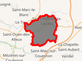
| |
 Saint-Hilaire-des-Landes  Saint-Hilaire-des-Landes | |
| Coordinates: 48°21′08″N 1°21′24″W | |
| Country | France |
| Region | Brittany |
| Department | Ille-et-Vilaine |
| Arrondissement | Fougères-Vitré |
| Canton | Antrain |
| Intercommunality | Coglai |
| Government | |
| • Mayor (2014–2020) | Claude Hamard |
| Area 1 | 18.27 km2 (7.05 sq mi) |
| Population (2017-01-01)[1] | 1,038 |
| • Density | 57/km2 (150/sq mi) |
| Time zone | UTC+01:00 (CET) |
| • Summer (DST) | UTC+02:00 (CEST) |
| INSEE/Postal code | 35280 /35140 |
| Elevation | 54–117 m (177–384 ft) (avg. 115 m or 377 ft) |
| 1 French Land Register data, which excludes lakes, ponds, glaciers > 1 km2 (0.386 sq mi or 247 acres) and river estuaries. | |
Geography
Saint-Hilaire-des-Landes is located 41 km (25 mi) northeast of Rennes and 37 km (23 mi) south of Mont Saint-Michel.
The adjacent communes are Le Tiercent, Baillé, Saint-Étienne-en-Coglès, Saint-Sauveur-des-Landes, Saint-Marc-sur-Couesnon, and Saint-Ouen-des-Alleux.
Population
| Historical population | ||
|---|---|---|
| Year | Pop. | ±% |
| 1793 | 1,659 | — |
| 1800 | 1,588 | −4.3% |
| 1806 | 1,542 | −2.9% |
| 1821 | 1,710 | +10.9% |
| 1831 | 1,789 | +4.6% |
| 1836 | 1,678 | −6.2% |
| 1841 | 1,608 | −4.2% |
| 1846 | 1,531 | −4.8% |
| 1851 | 1,661 | +8.5% |
| 1856 | 1,667 | +0.4% |
| 1861 | 1,671 | +0.2% |
| 1866 | 1,661 | −0.6% |
| 1872 | 1,563 | −5.9% |
| 1876 | 1,586 | +1.5% |
| 1881 | 1,690 | +6.6% |
| 1886 | 1,627 | −3.7% |
| 1891 | 1,549 | −4.8% |
| 1896 | 1,455 | −6.1% |
| 1901 | 1,393 | −4.3% |
| 1906 | 1,433 | +2.9% |
| 1911 | 1,414 | −1.3% |
| 1921 | 1,224 | −13.4% |
| 1926 | 1,257 | +2.7% |
| 1931 | 1,229 | −2.2% |
| 1936 | 1,228 | −0.1% |
| 1946 | 1,149 | −6.4% |
| 1954 | 1,128 | −1.8% |
| 1962 | 1,144 | +1.4% |
| 1968 | 1,010 | −11.7% |
| 1975 | 807 | −20.1% |
| 1982 | 756 | −6.3% |
| 1990 | 893 | +18.1% |
| 1999 | 922 | +3.2% |
| 2009 | 988 | +7.2% |
References
- "Populations légales 2017". INSEE. Retrieved 6 January 2020.
- Mayors of Ille-et-Vilaine Association (in French)
External links
| Wikimedia Commons has media related to Saint-Hilaire-des-Landes. |
- Geography of Brittany
- The page of the commune on infobretagne.com
- French Ministry of Culture list for Saint-Hilaire-des-Landes (in French)
| Authority control |
|
|---|
This article is issued from Wikipedia. The text is licensed under Creative Commons - Attribution - Sharealike. Additional terms may apply for the media files.