Saint-Basile Parish, New Brunswick
Saint-Basile is a Canadian parish in Madawaska County, New Brunswick.[2]
Saint-Basile St. Basil, St. Basile | |
|---|---|
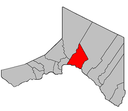 Location within Madawaska County. | |
| Coordinates: 47.36°N 68.255°W | |
| Country | |
| Province | |
| County | Madawaska |
| Established | 1792 |
| Area | |
| • Land | 129.61 km2 (50.04 sq mi) |
| Population (2016)[1] | |
| • Total | 592 |
| • Density | 4.6/km2 (12/sq mi) |
| • Pop 2011-2016 | |
| • Dwellings | 270 |
| Time zone | UTC-4 (AST) |
| • Summer (DST) | UTC-3 (ADT) |
Delineation
Saint-Basile Parish is defined in the Territorial Division Act[3] as being bounded:
- Southeasterly by Sainte-Anne [Parish]; northeasterly by the County line; southwesterly by the St. John River; and northwesterly by the lower line of grant numbered eighteen hundred and eight, near the mouth of the Madawaska River, granted to Simon Herbert in the year of our Lord one thousand eight hundred and twenty-five, and its northeasterly prolongation,[lower-alpha 1] including the islands in front, and excluding the Ordnance lands at the mouth of the Madawaska River, and all lands lying on the northwestern side of Green River[lower-alpha 2] from the mouth of Little Belone Brook[lower-alpha 3] at the Second Falls[lower-alpha 4] up stream to the Little Forks,[lower-alpha 5] except the part thereof heretofore described establishing the Parish of Rivière-Verte.
Communities
Parish population total does not include incorporated municipalities (in bold) and communities within their respective boundaries (in italics).
- Boniface Bridge
- Green River Settlement
- Jalbert
- Maillet
- Montagne-des-Therrien
- Rang-des-Lavoie
- Saint-Basile
- Iroquois
- St. Basile 10
Demographics
Population
| Canada census – Saint-Basile Parish, New Brunswick community profile | |||
|---|---|---|---|
| 2016 | 2011 | 2006 | |
| Population: | 592 (-17.4% from 2011) | 717 (-10.3% from 2006) | 799 (+13.3% from 2001) |
| Land area: | 129.61 km2 (50.04 sq mi) | 129.74 km2 (50.09 sq mi) | 129.73 km2 (50.09 sq mi) |
| Population density: | 4.6/km2 (12/sq mi) | 5.5/km2 (14/sq mi) | 6.2/km2 (16/sq mi) |
| Median age: | 47.5 (M: 48.0, F: 47.1) | 44.7 (M: 46.1, F: 42.9) | 42.3 (M: 43.6, F: 41.0) |
| Total private dwellings: | 270 | 313 | 400 |
| Median household income: | $58,048 | $46,535 | $47,973 |
| References: 2016[8] 2011[9] 2006[10] earlier[11] | |||
| Historical Census Data Saint-Basile Parish, New Brunswick | |||||||||||||||||||||||||||||
|---|---|---|---|---|---|---|---|---|---|---|---|---|---|---|---|---|---|---|---|---|---|---|---|---|---|---|---|---|---|
|
|
| |||||||||||||||||||||||||||
| [12][1] | |||||||||||||||||||||||||||||
Language
| Canada Census Mother Tongue - Saint-Basile Parish, New Brunswick[12] | ||||||||||||||||||
|---|---|---|---|---|---|---|---|---|---|---|---|---|---|---|---|---|---|---|
| Census | Total | French |
English |
French & English |
Other | |||||||||||||
| Year | Responses | Count | Trend | Pop % | Count | Trend | Pop % | Count | Trend | Pop % | Count | Trend | Pop % | |||||
2011 |
715 |
695 | 97.20% | 20 | 2.80% | 0 | 0.00% | 0 | 0.00% | |||||||||
2006 |
800 |
785 | 98.13% | 15 | 1.87% | 0 | 0.00% | 0 | 0.00% | |||||||||
2001 |
710 |
660 | 92.96% | 15 | 2.11% | 35 | 4.93% | 0 | 0.00% | |||||||||
1996 |
670 |
650 | n/a | 97.01% | 10 | n/a | 1.49% | 10 | n/a | 1.49% | 0 | n/a | 0.00% | |||||
See also
Footnotes
- The prolongation only extends a bit beyond the Iroquois River, after which the boundary follows an irregular path along various grants lines until it strikes the Green River, then turns left and follows grant lines until it rejoins the river at Étang Deuxième-Sault.[4]
- Also known as Rivière Verte; both forms are official.[5]
- Now officially Petit ruisseau Belone;[6] the boundary actually strikes to the east within Étang Deuxième-Sault.
- Also known as Deuxième Sault; both names are official.[7]
- Little Forks Branch Green River
References
- "Census Profile, 2016 Census Saint-Basile, Parish [Census subdivision], New Brunswick". Statistics Canada. Retrieved August 29, 2019.
- New Brunswick Provincial Archives - Saint-Basile Parish
- "Territorial Division Act (R.S.N.B. 1973, c. T-3)". Government of New Brunswick website. Retrieved 25 August 2016.
- "Crown Grant Reference Map Viewer". GeoNB. Government of New Brunswick. Retrieved 25 August 2016.
- "Green River". Canadian Geographical Names. Natural Resources Canada. Retrieved 25 August 2016.
- "Belone Brook". Canadian Geographical Names. Natural Resources Canada. Retrieved 25 August 2016.
- "Second Falls". Canadian Geographical Names. Natural Resources Canada. Retrieved 25 August 2016.
- "2016 Community Profiles". 2016 Canadian Census. Statistics Canada. February 21, 2017. Retrieved 2019-08-29.
- "2011 Community Profiles". 2011 Canadian Census. Statistics Canada. July 5, 2013. Retrieved 2014-03-28.
- "2006 Community Profiles". 2006 Canadian Census. Statistics Canada. March 30, 2011. Retrieved 2014-03-28.
- "2001 Community Profiles". 2001 Canadian Census. Statistics Canada. February 17, 2012.
- Statistics Canada: 1996, 2001, 2006, 2011 census
Places adjacent to Saint-Basile Parish, New Brunswick | ||||||||||
|---|---|---|---|---|---|---|---|---|---|---|
| ||||||||||
| Subdivisions |
|
|---|---|
| Cities | |
| Counties | |
| |
This article is issued from Wikipedia. The text is licensed under Creative Commons - Attribution - Sharealike. Additional terms may apply for the media files.