Saint-André-de-Roquepertuis
Saint-André-de-Roquepertuis is a commune in the Gard department in southern France.
Saint-André-de-Roquepertuis | |
|---|---|
 Town hall | |
.svg.png) Coat of arms | |
Location of Saint-André-de-Roquepertuis 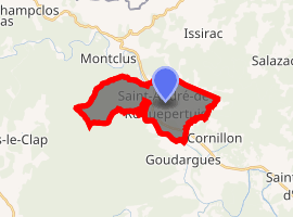
| |
 Saint-André-de-Roquepertuis  Saint-André-de-Roquepertuis | |
| Coordinates: 44°14′29″N 4°27′24″E | |
| Country | France |
| Region | Occitanie |
| Department | Gard |
| Arrondissement | Nîmes |
| Canton | Pont-Saint-Esprit |
| Intercommunality | ValCezArd |
| Government | |
| • Mayor (2008–2014) | Michel Coullomb |
| Area 1 | 12.18 km2 (4.70 sq mi) |
| Population (2017-01-01)[1] | 594 |
| • Density | 49/km2 (130/sq mi) |
| Time zone | UTC+01:00 (CET) |
| • Summer (DST) | UTC+02:00 (CEST) |
| INSEE/Postal code | 30230 /30630 |
| Elevation | 70–309 m (230–1,014 ft) (avg. 83 m or 272 ft) |
| 1 French Land Register data, which excludes lakes, ponds, glaciers > 1 km2 (0.386 sq mi or 247 acres) and river estuaries. | |
Population
| Historical population | ||
|---|---|---|
| Year | Pop. | ±% |
| 1806 | 692 | — |
| 1820 | 798 | +15.3% |
| 1831 | 827 | +3.6% |
| 1841 | 853 | +3.1% |
| 1851 | 824 | −3.4% |
| 1861 | 825 | +0.1% |
| 1872 | 694 | −15.9% |
| 1881 | 653 | −5.9% |
| 1891 | 653 | +0.0% |
| 1901 | 571 | −12.6% |
| 1911 | 514 | −10.0% |
| 1921 | 405 | −21.2% |
| 1931 | 401 | −1.0% |
| 1946 | 305 | −23.9% |
| 1962 | 279 | −8.5% |
| 1968 | 291 | +4.3% |
| 1975 | 288 | −1.0% |
| 1982 | 273 | −5.2% |
| 1990 | 361 | +32.2% |
| 1999 | 398 | +10.2% |
| 2008 | 523 | +31.4% |
See also
References
- "Populations légales 2017". INSEE. Retrieved 6 January 2020.
| Wikimedia Commons has media related to Saint-André-de-Roquepertuis. |
| Authority control |
|
|---|
This article is issued from Wikipedia. The text is licensed under Creative Commons - Attribution - Sharealike. Additional terms may apply for the media files.