Robiac-Rochessadoule
Robiac-Rochessadoule is a commune in the Gard department in southern France.
Robiac-Rochessadoule | |
|---|---|
 Train station | |
.svg.png) Coat of arms | |
Location of Robiac-Rochessadoule 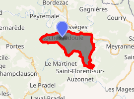
| |
 Robiac-Rochessadoule  Robiac-Rochessadoule | |
| Coordinates: 44°16′38″N 4°07′30″E | |
| Country | France |
| Region | Occitanie |
| Department | Gard |
| Arrondissement | Alès |
| Canton | Rousson |
| Intercommunality | Cévennes Actives |
| Government | |
| • Mayor (2001–2008) | Michel Planiol |
| Area 1 | 10.31 km2 (3.98 sq mi) |
| Population (2017-01-01)[1] | 840 |
| • Density | 81/km2 (210/sq mi) |
| Time zone | UTC+01:00 (CET) |
| • Summer (DST) | UTC+02:00 (CEST) |
| INSEE/Postal code | 30216 /30160 |
| Elevation | 147–628 m (482–2,060 ft) (avg. 150 m or 490 ft) |
| 1 French Land Register data, which excludes lakes, ponds, glaciers > 1 km2 (0.386 sq mi or 247 acres) and river estuaries. | |
Population
| Historical population | ||
|---|---|---|
| Year | Pop. | ±% |
| 1793 | 721 | — |
| 1800 | 706 | −2.1% |
| 1806 | 737 | +4.4% |
| 1821 | 1,064 | +44.4% |
| 1831 | 1,209 | +13.6% |
| 1836 | 1,344 | +11.2% |
| 1841 | 1,379 | +2.6% |
| 1846 | 2,770 | +100.9% |
| 1851 | 2,463 | −11.1% |
| 1856 | 4,598 | +86.7% |
| 1861 | 2,202 | −52.1% |
| 1866 | 3,009 | +36.6% |
| 1872 | 3,699 | +22.9% |
| 1876 | 4,692 | +26.8% |
| 1881 | 4,719 | +0.6% |
| 1886 | 4,165 | −11.7% |
| 1891 | 3,260 | −21.7% |
| 1896 | 3,293 | +1.0% |
| 1901 | 3,152 | −4.3% |
| 1906 | 3,399 | +7.8% |
| 1911 | 3,169 | −6.8% |
| 1921 | 3,066 | −3.3% |
| 1926 | 3,044 | −0.7% |
| 1931 | 2,764 | −9.2% |
| 1936 | 2,230 | −19.3% |
| 1946 | 2,157 | −3.3% |
| 1954 | 2,451 | +13.6% |
| 1962 | 1,897 | −22.6% |
| 1968 | 1,456 | −23.2% |
| 1975 | 1,045 | −28.2% |
| 1982 | 981 | −6.1% |
| 1990 | 808 | −17.6% |
| 1999 | 793 | −1.9% |
| 2008 | 830 | +4.7% |
See also
References
- "Populations légales 2017". INSEE. Retrieved 6 January 2020.
| Wikimedia Commons has media related to Robiac-Rochessadoule. |
| Authority control |
|
|---|
This article is issued from Wikipedia. The text is licensed under Creative Commons - Attribution - Sharealike. Additional terms may apply for the media files.