Saül, French Guiana
Saül is a commune of French Guiana, an overseas region and department of France located in South America.
Saül | |
|---|---|
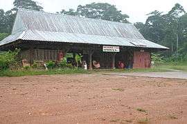 Saül's airfield: the terminal building | |
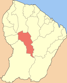 Location of the commune (in red) within French Guiana | |
Location of Saül 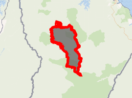
| |
| Coordinates: 3°37′22″N 53°12′34″W | |
| Country | France |
| Overseas region and department | French Guiana |
| Arrondissement | Saint-Laurent-du-Maroni |
| Intercommunality | Ouest Guyanais |
| Government | |
| • Mayor (2014-2020) | Marie-Hélène Charles |
| Area 1 | 4,475 km2 (1,728 sq mi) |
| Population (2012) | 151 |
| • Density | 0.034/km2 (0.087/sq mi) |
| Time zone | UTC−03:00 |
| INSEE/Postal code | 97352 /97314 |
| 1 French Land Register data, which excludes lakes, ponds, glaciers > 1 km2 (0.386 sq mi or 247 acres) and river estuaries. | |
It is very remote, surrounded by dense rainforest and, because there are no roads to the town, can only be reached by airplane.[1]
The principal activities in the town are gold mining and trekking through the many rainforest trails.[2] There is a tourist camp (Larozaly) and hotel (Les Eaux Claires) in the town.
Economy
Saül is situated in the Amazonian Forest and is not connected to any road system. Saül's economy is based on eco and scientific tourism. Tourists can reach the town by plane thanks to Air Guyane Express.[1] In July 2008, the REXMA corporation made an application for a gold mining permit. Due to environmental concerns, the French Government postponed the decision in October 2008. On 26 October 2012, Arnaud Montebourg, the French Industry Minister, approved the permit. The Mayor and the council were shocked by this decision as they are promoting and living off eco tourism.[3]
The inhabitants of Saül, the botanist Scott Mori, politicians such as Chantal Berthelot and José Gaillou, and many organizations like IUCN, Fédération Guyane Nature Environment and Rainforest Rescue protested against the decision to reward the permit.[4] Opposition grew from the possibility that the mine would cause the partial destruction of the Guiana Amazonian Park and the decline of water quality.
Climate
| Climate data for Saul | |||||||||||||
|---|---|---|---|---|---|---|---|---|---|---|---|---|---|
| Month | Jan | Feb | Mar | Apr | May | Jun | Jul | Aug | Sep | Oct | Nov | Dec | Year |
| Average high °C (°F) | 29 (84) |
28 (83) |
29 (84) |
29 (84) |
29 (84) |
29 (85) |
30 (86) |
31 (88) |
33 (91) |
33 (91) |
32 (90) |
30 (86) |
30 (86) |
| Average low °C (°F) | 21 (69) |
22 (71) |
22 (71) |
22 (71) |
22 (72) |
21 (69) |
19 (67) |
20 (68) |
20 (68) |
21 (69) |
21 (70) |
21 (69) |
21 (70) |
| Average precipitation cm (inches) | 25 (10) |
27 (10.6) |
31 (12.4) |
26 (10.1) |
33 (13) |
22 (8.8) |
13 (5) |
12 (4.6) |
5.3 (2.1) |
3.8 (1.5) |
9.7 (3.8) |
13 (5.3) |
221 (87.2) |
| Source: Weatherbase [5] | |||||||||||||
See also
References
- "Saül". Parc Amazonien Guyane (in French). Retrieved 26 June 2020.
- "Guide Saül". Petit Futé (in French). Retrieved 26 June 2020.
- "Gold mine approved in French Guiana's only national park". Mongabay News (in French). Retrieved 26 June 2020.
- "Guiana's living treasures are more valuable than gold". 2013. Retrieved on March.11.2013.
- "Weatherbase: Historical Weather for Saul, French Guiana". Weatherbase. 2011. Retrieved on November 24, 2011.
External links
- Saül at Annuaire-Mairie (in French)
| Wikimedia Commons has media related to Saül. |
| Authority control |
|
|---|