Rush Township, Schuylkill County, Pennsylvania
Rush Township is a township in Schuylkill County, Pennsylvania, United States. The population was 3,957 at the 2000 census. The township is served by Tamaqua Area School District.
Rush Township, Schuylkill County, Pennsylvania | |
|---|---|
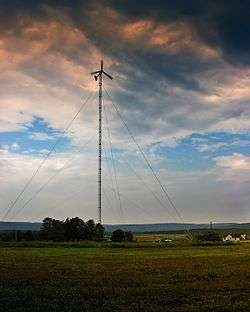 A wind turbine on Tuscarora State Park in Rush Township | |
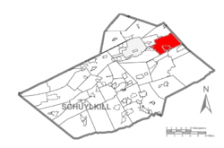 Map of Schuylkill County, Pennsylvania Highlighting Rush Township | |
 Map of Schuylkill County, Pennsylvania | |
| Country | United States |
| State | Pennsylvania |
| County | Schuylkill |
| Settled | 1800 |
| Incorporated | 1811 |
| Area | |
| • Total | 24.21 sq mi (62.70 km2) |
| • Land | 23.18 sq mi (60.04 km2) |
| • Water | 1.03 sq mi (2.66 km2) |
| Population (2010) | |
| • Total | 3,412 |
| • Estimate (2016)[2] | 3,320 |
| • Density | 143.21/sq mi (55.30/km2) |
| Time zone | UTC-5 (Eastern (EST)) |
| • Summer (DST) | UTC-4 (EDT) |
| Area code(s) | 570 Exchanges: 467,668,952 |
| FIPS code | 42-107-66760 |
Geography
According to the United States Census Bureau, the township has a total area of 23.9 square miles (61.8 km²), of which, 22.9 square miles (59.2 km²) of it is land and 1.0 square miles (2.6 km²) of it (4.27%) is water. It is in the Delaware watershed and is drained by the Schuylkill River via the Little Schuylkill River and by the Nesquehoning Creek into the Lehigh River. Its villages include Barnesville, Ginthers, Grier City (also in Delano Township), Haucks, Hometown, Park Crest (also in Ryan Township), Quakake, Still Creek, and Tamanend (also in Delano Township).
Neighboring municipalities
- Tamaqua (southeast)
- Schuylkill Township (south)
- Ryan Township (southwest)
- Delano Township (northwest)
- Kline Township (north)
- Packer Township, Carbon County (northeast)
- Nesquehoning, Carbon County (east)
Climate
Rush Township has a warm-summer humid continental climate (Dfb) and the hardiness zone is 6a. Average monthly temperatures in Hometown range from 25.2 °F in January to 69.7 °F in July. The average annual absolute minimum temperature in Hometown is -9.6 °F.
Demographics
| Historical population | |||
|---|---|---|---|
| Census | Pop. | %± | |
| 2010 | 3,412 | — | |
| Est. 2016 | 3,320 | [2] | −2.7% |
| U.S. Decennial Census[3] | |||
At the 2000 census there were 3,957 people in 1,419 households, including 1,058 families, in the township. The population density was 173.2 people per square mile (66.9/km²). There were 1,563 housing units at an average density of 68.4/sq mi (26.4/km²). The racial makeup of the township was 96.44% White, 2.35% African American, 0.03% Native American, 0.48% Asian, 0.03% Pacific Islander, 0.25% from other races, and 0.43% from two or more races. Hispanic or Latino of any race were 1.11%.[4]
Of the 1,419 households 26.2% had children under the age of 18 living with them, 65.3% were married couples living together, 6.8% had a female householder with no husband present, and 25.4% were non-families. 22.3% of households were one person and 13.2% were one person aged 65 or older. The average household size was 2.48 and the average family size was 2.90.
The age distribution was 18.3% under the age of 18, 9.8% from 18 to 24, 21.9% from 25 to 44, 26.3% from 45 to 64, and 23.8% 65 or older. The median age was 45 years. For every 100 females, there were 87.7 males. For every 100 females age 18 and over, there were 83.3 males.
The median household income was $42,664 and the median family income was $45,750. Males had a median income of $35,386 versus $27,473 for females. The per capita income for the township was $17,893. About 4.3% of families and 6.3% of the population were below the poverty line, including 7.7% of those under age 18 and 7.7% of those age 65 or over.
Transportation
STS bus route 45 serves the township along the Route 309 corridor, which runs north-to-south and intersects east-to-west Route 54 in Hometown. The bus route runs from Pottsville via Tamaqua to McAdoo. On Saturdays the Hometown auction bus 47 runs from Pottsville via Frackville, Shenandoah, and Mahanoy City to Hometown and McAdoo. Also, Carbon County Community Transit runs on Wednesdays from Hometown to Nesquehoning on Lynx 3 (via Tamaqua, Coaldale, Lansford, and Summit Hill).
References
- "2016 U.S. Gazetteer Files". United States Census Bureau. Archived from the original on August 24, 2017. Retrieved Aug 14, 2017.
- "Population and Housing Unit Estimates". Archived from the original on May 29, 2017. Retrieved June 9, 2017.
- "Census of Population and Housing". Census.gov. Archived from the original on April 26, 2015. Retrieved June 4, 2016.
- "U.S. Census website". United States Census Bureau. Archived from the original on 1996-12-27. Retrieved 2008-01-31.