Roviano
Roviano is a comune (municipality) in the Metropolitan City of Rome in the Italian region Latium, located about 45 kilometres (28 mi) northeast of Rome.
Roviano | |
|---|---|
| Comune di Roviano | |
 Coat of arms | |
Location of Roviano 
| |
 Roviano Location of Roviano in Italy 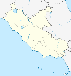 Roviano Roviano (Lazio) | |
| Coordinates: 42°2′N 12°59′E | |
| Country | Italy |
| Region | Latium |
| Metropolitan city | Rome (RM) |
| Government | |
| • Mayor | Laura Brancazi |
| Area | |
| • Total | 8.4 km2 (3.2 sq mi) |
| Elevation | 523 m (1,716 ft) |
| Population | |
| • Total | 1,444 |
| • Density | 170/km2 (450/sq mi) |
| Demonym(s) | Rovianesi |
| Time zone | UTC+1 (CET) |
| • Summer (DST) | UTC+2 (CEST) |
| Postal code | 00027 |
| Dialing code | 0774 |
| Patron saint | St. John the Baptist |
| Saint day | August 29 |
| Website | Official website |
Roviano borders the following municipalities: Anticoli Corrado, Arsoli, Cineto Romano, Mandela, Marano Equo, Riofreddo. It is home to polygonal walls dating to the late Aequi age, or to the early Roman domination. It has also a bridge dating to the reign of Nerva, over which the via Valeria crossed the Aniene river.
Other sights include the castle, built by the abbots of Italy, the medieval borough of Rovianello (destroyed by Muzio Colonna in 1585–90), the 14th century Porta Scaramuccia ("Skirmish Gate").
References
- "Superficie di Comuni Province e Regioni italiane al 9 ottobre 2011". Istat. Retrieved 16 March 2019.
- All demographics and other statistics: Italian statistical institute Istat.
- "Popolazione Residente al 1° Gennaio 2018". Istat. Retrieved 16 March 2019.
External links
This article is issued from Wikipedia. The text is licensed under Creative Commons - Attribution - Sharealike. Additional terms may apply for the media files.