Leaf River, Illinois
Leaf River is a village in Leaf River Township, Ogle County, Illinois, United States, along a stream of the same name. The population was 443 at the 2010 census, down from 555 in 2000.
Leaf River | |
|---|---|
Village | |
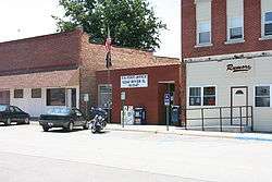
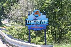 Sign seen when entering Leaf River | |
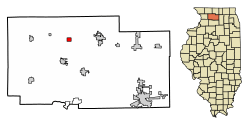 Location of Leaf River in Ogle County, Illinois. | |
 Leaf River Location within Ogle County  Leaf River Leaf River (Illinois) | |
| Coordinates: 42°07′35″N 89°24′11″W | |
| Country | United States |
| State | Illinois |
| County | Ogle |
| Township | Leaf River |
| Government | |
| • Village President | Timothy Mulford (R) |
| Area | |
| • Total | 0.83 sq mi (2.16 km2) |
| • Land | 0.83 sq mi (2.16 km2) |
| • Water | 0.00 sq mi (0.00 km2) |
| Elevation | 725 ft (221 m) |
| Population (2010) | |
| • Total | 443 |
| • Estimate (2018)[2] | 411 |
| • Density | 495.80/sq mi (191.34/km2) |
| Postal code | 61047 |
| Area code(s) | 815 |
| FIPS code | 17-42457 |
| Website | leafriver |
Geography
Leaf River is located at 42°7′35″N 89°24′11″W (42.126350, -89.402976).[3]
According to the 2010 census, Leaf River has a total area of 0.83 square miles (2.15 km2), all land.[4]
Demographics
| Historical population | |||
|---|---|---|---|
| Census | Pop. | %± | |
| 1890 | 339 | — | |
| 1900 | 507 | 49.6% | |
| 1910 | 469 | −7.5% | |
| 1920 | 388 | −17.3% | |
| 1930 | 382 | −1.5% | |
| 1940 | 415 | 8.6% | |
| 1950 | 444 | 7.0% | |
| 1960 | 546 | 23.0% | |
| 1970 | 633 | 15.9% | |
| 1980 | 637 | 0.6% | |
| 1990 | 546 | −14.3% | |
| 2000 | 555 | 1.6% | |
| 2010 | 443 | −20.2% | |
| Est. 2018 | 411 | [2] | −7.2% |
| U.S. Decennial Census[5] | |||
At the 2000 census there were 555 people, 214 households, and 154 families in the village. The population density was 647.6 people per square mile (249.2/km²). There were 235 housing units at an average density of 274.2 per square mile (105.5/km²). The racial makeup of the village was 98.20% White, 1.62% African American and 0.18% Native American. Hispanic or Latino of any race were 0.72%.[6]
Of the 214 households 32.7% had children under the age of 18 living with them, 58.9% were married couples living together, 9.8% had a female householder with no husband present, and 28.0% were non-families. 21.5% of households were one person and 5.1% were one person aged 65 or older. The average household size was 2.59 and the average family size was 3.07.
The age distribution was 26.5% under the age of 18, 8.1% from 18 to 24, 29.5% from 25 to 44, 23.2% from 45 to 64, and 12.6% 65 or older. The median age was 35 years. For every 100 females, there were 92.7 males. For every 100 females age 18 and over, there were 95.2 males.
The median household income was $36,528 and the median family income was $40,268. Males had a median income of $33,958 versus $21,000 for females. The per capita income for the village was $15,620. About 2.5% of families and 5.7% of the population were below the poverty line, including 3.1% of those under age 18 and 7.6% of those age 65 or over.
Facilities
The village is the home of Camp Kupugani, a private multicultural summer camp for boys and girls.
References
| Wikimedia Commons has media related to Leaf River, Illinois. |
- "2016 U.S. Gazetteer Files". United States Census Bureau. Retrieved Jun 29, 2017.
- "Population and Housing Unit Estimates". Retrieved March 21, 2020.
- "US Gazetteer files: 2010, 2000, and 1990". United States Census Bureau. 2011-02-12. Retrieved 2011-04-23.
- "G001 - Geographic Identifiers - 2010 Census Summary File 1". United States Census Bureau. Archived from the original on 2020-02-13. Retrieved 2015-08-04.
- "Census of Population and Housing". Census.gov. Retrieved June 4, 2015.
- "U.S. Census website". United States Census Bureau. Retrieved 2008-01-31.
Municipalities and communities of Ogle County, Illinois, United States | ||
|---|---|---|
| Cities | Map of Illinois highlighting Ogle County | |
| Villages | ||
| Townships | ||
| CDPs | ||
| Other unincorporated communities | ||
| Footnotes | ‡This populated place also has portions in an adjacent county or counties | |