Ripley Township, Montgomery County, Indiana
Ripley Township is one of eleven townships in Montgomery County, Indiana, United States. As of the 2010 census, its population was 977 and it contained 456 housing units.[2]
Ripley Township | |
|---|---|
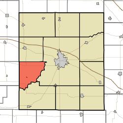 Location in Montgomery County | |
| Coordinates: 39°59′44″N 87°02′41″W | |
| Country | |
| State | |
| County | Montgomery |
| Government | |
| • Type | Indiana township |
| Area | |
| • Total | 31.61 sq mi (81.9 km2) |
| • Land | 31.58 sq mi (81.8 km2) |
| • Water | 0.03 sq mi (0.08 km2) 0.09% |
| Elevation | 781 ft (238 m) |
| Population (2010) | |
| • Total | 977 |
| • Density | 30.9/sq mi (11.9/km2) |
| Time zone | UTC-5 (Eastern (EST)) |
| • Summer (DST) | UTC-4 (EDT) |
| ZIP codes | 47916, 47933, 47990 |
| Area code(s) | 765 |
| GNIS feature ID | 453803 |
History
Abijah O'Neall II House and Yount's Woolen Mill and Boarding House are listed on the National Register of Historic Places.[3]
Geography
According to the 2010 census, the township has a total area of 31.61 square miles (81.9 km2), of which 31.58 square miles (81.8 km2) (or 99.91%) is land and 0.03 square miles (0.078 km2) (or 0.09%) is water.[2]
Cities, towns, villages
Unincorporated towns
- Deer Mill at 39.947543°N 87.055565°W
- Hibernia at 40.004211°N 87.001119°W
- Taylor Corner at 40.025043°N 87.01612°W
- Yountsville at 40.024766°N 86.980008°W
(This list is based on USGS data and may include former settlements.)
Cemeteries
The township contains these five cemeteries: Fruits, O'Neal, Sparks, Stonebraker and Yountsville.
Landmarks
- Shades State Park (north quarter)
School districts
- South Montgomery Community School Corporation
Political districts
- Indiana's 4th congressional district
- State House District 41
- State Senate District 23
References
- "Ripley Township, Montgomery County, Indiana". Geographic Names Information System. United States Geological Survey. Retrieved 2009-09-27.
- United States Census Bureau 2008 TIGER/Line Shapefiles
- IndianaMap
- "US Board on Geographic Names". United States Geological Survey. October 25, 2007. Retrieved 2017-05-09.
- "Population, Housing Units, Area, and Density: 2010 - County -- County Subdivision and Place -- 2010 Census Summary File 1". United States Census. Archived from the original on 2020-02-12. Retrieved 2013-05-10.
- "National Register Information System". National Register of Historic Places. National Park Service. July 9, 2010.
External links
- Indiana Township Association
- United Township Association of Indiana
- City-Data.com page for Ripley Township
Places adjacent to Ripley Township, Montgomery County, Indiana | |
|---|---|
Municipalities and communities of Montgomery County, Indiana, United States | ||
|---|---|---|
| City | Map of Indiana highlighting Montgomery County | |
| Towns | ||
| Townships | ||
| CDP | ||
| Other unincorporated communities | ||
| Footnotes | ‡This populated place also has portions in an adjacent county or counties | |
This article is issued from Wikipedia. The text is licensed under Creative Commons - Attribution - Sharealike. Additional terms may apply for the media files.