Republic Township, Michigan
Republic Township is a civil township of Marquette County in the U.S. state of Michigan. The population was 1,106 at the 2000 census. The unincorporated community of Republic is located within the township.
Republic Township, Michigan | |
|---|---|
 Location within Marquette County (red) and an administered portion of the Republic community (pink) | |
 Republic Township Location within the state of Michigan | |
| Coordinates: 46°21′9″N 88°1′15″W | |
| Country | United States |
| State | Michigan |
| County | Marquette |
| Area | |
| • Total | 119.6 sq mi (309.7 km2) |
| • Land | 113.2 sq mi (293.2 km2) |
| • Water | 6.3 sq mi (16.4 km2) |
| Elevation | 1,558 ft (475 m) |
| Population (2000) | |
| • Total | 1,106 |
| • Density | 9.8/sq mi (3.8/km2) |
| Time zone | UTC-5 (Eastern (EST)) |
| • Summer (DST) | UTC-4 (EDT) |
| ZIP code | 49879 |
| Area code(s) | 906 |
| FIPS code | 26-68000[1] |
| GNIS feature ID | 1626964[2] |
| Website | Official website |
Geography
According to the United States Census Bureau, the township has a total area of 119.6 square miles (309.7 km²), of which 113.2 square miles (293.2 km²) is land and 6.3 square miles (16.4 km²) (5.31%) is water.
Communities
- South Republic is an unincorporated community in the township
- Witch Lake is an unincorporated community in the township
Demographics
As of the census[1] of 2000, there were 1,106 people, 493 households, and 347 families residing in the township. The population density was 9.8 per square mile (3.8/km²). There were 983 housing units at an average density of 8.7 per square mile (3.4/km²). The racial makeup of the township was 97.20% White, 1.81% Native American, 0.45% from other races, and 0.54% from two or more races. Hispanic or Latino of any race were 0.09% of the population.
There were 493 households out of which 22.1% had children under the age of 18 living with them, 58.2% were married couples living together, 7.3% had a female householder with no husband present, and 29.6% were non-families. 25.8% of all households were made up of individuals and 12.8% had someone living alone who was 65 years of age or older. The average household size was 2.23 and the average family size was 2.63.
In the township the population was spread out with 19.0% under the age of 18, 4.2% from 18 to 24, 22.6% from 25 to 44, 31.2% from 45 to 64, and 23.1% who were 65 years of age or older. The median age was 48 years. For every 100 females, there were 106.0 males. For every 100 females age 18 and over, there were 104.6 males.
The median income for a household in the township was $27,500, and the median income for a family was $33,472. Males had a median income of $27,813 versus $19,375 for females. The per capita income for the township was $15,524. About 6.9% of families and 11.2% of the population were below the poverty line, including 12.7% of those under age 18 and 11.1% of those age 65 or over.
History
Old M-95 – Michigamme River Bridge was listed on the National Register of Historic Places in 1999. Built in 1910, and modest in scale and design, it is technologically and historically significant as an embodiment of local bridge design before state standardization. It spans the Michigamme River on an abandoned roadway (now used as a private road) that was once M-95, immediately west of the current highway.
References
Municipalities and communities of Marquette County, Michigan, United States | ||
|---|---|---|
| Cities | 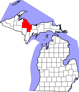 Map of Michigan highlighting Marquette County.svg | |
| Charter townships | ||
| Civil townships | ||
| CDPs | ||
| Unincorporated communities | ||
| Indian reservations | ||
| Footnotes | ‡This populated place also has portions in an adjacent county or counties | |