Ely Township, Michigan
Ely Township is a civil township of Marquette County in the U.S. state of Michigan. The population was 2,010 at the 2000 census.
Ely Township, Michigan | |
|---|---|
 Location within Marquette County | |
 Ely Township Location within the state of Michigan | |
| Coordinates: 46°25′49″N 87°47′59″W | |
| Country | United States |
| State | Michigan |
| County | Marquette |
| Area | |
| • Total | 140.6 sq mi (364.1 km2) |
| • Land | 137.7 sq mi (356.5 km2) |
| • Water | 2.9 sq mi (7.5 km2) |
| Elevation | 1,411 ft (430 m) |
| Population (2000) | |
| • Total | 2,010 |
| • Density | 14.6/sq mi (5.6/km2) |
| Time zone | UTC-5 (Eastern (EST)) |
| • Summer (DST) | UTC-4 (EDT) |
| ZIP code | |
| FIPS code | 26-25820[1] |
| GNIS feature ID | 1626237[2] |
Communities
- Clarksburg was settled in 1862 along the Escanaba River. The Michigan Iron Company had a blast furnace here. It was platted in 1881. The post office closed in 1894.[3]
- Greenwood is an unincorporated community on US 41/M-28 approximately three miles west of Ishpeming.[4] Greenwood was a station on the Duluth, South Shore and Atlantic Railway and was first platted in 1865. It was the site of the blast furnaces of the Michigan Iron Company and was first known as "Greenwood Furnace".[5] A post office with that name operated from March 1867 until October 1875, the year the furnaces were closed.[6][7]
- South Greenwood is an unincorporated community approximately one mile south of US 41/M-28 at 46°28′23″N 87°47′11″W[8] The Greenwood Station on Duluth, South Shore and Atlantic Railway was located here.46°28′25″N 87°47′05″W.[9]
- Champion is a community to the west and the Champion ZIP code 49814 serves portions of western and northern Ely Township.[10]
- Snowville is an unincorporated community in the township
Geography
According to the United States Census Bureau, the township has a total area of 140.6 square miles (364 km2), of which 137.6 square miles (356 km2) is land and 2.9 square miles (7.5 km2) (2.07%) is water.
Demographics
As of the census[1] of 2000, there were 2,010 people, 726 households, and 564 families residing in the township. The population density was 14.6 per square mile (5.6/km²). There were 1,105 housing units at an average density of 8.0 per square mile (3.1/km²). The racial makeup of the township was 98.71% White, 0.10% African American, 0.65% Native American, 0.15% Asian, and 0.40% from two or more races. Hispanic or Latino of any race were 0.25% of the population.
There were 726 households out of which 34.6% had children under the age of 18 living with them, 68.3% were married couples living together, 5.1% had a female householder with no husband present, and 22.3% were non-families. 18.5% of all households were made up of individuals and 5.4% had someone living alone who was 65 years of age or older. The average household size was 2.77 and the average family size was 3.16.
In the township the population was spread out with 27.8% under the age of 18, 8.7% from 18 to 24, 28.4% from 25 to 44, 27.4% from 45 to 64, and 7.8% who were 65 years of age or older. The median age was 37 years. For every 100 females, there were 106.2 males. For every 100 females age 18 and over, there were 107.1 males.
The median income for a household in the township was $42,326, and the median income for a family was $46,739. Males had a median income of $36,786 versus $22,000 for females. The per capita income for the township was $16,901. About 2.7% of families and 5.1% of the population were below the poverty line, including 5.9% of those under age 18 and 4.4% of those age 65 or over.
References
Notes
- "U.S. Census website". United States Census Bureau. Retrieved 2008-01-31.
- U.S. Geological Survey Geographic Names Information System: Ely Township, Michigan
- Romig 1986, p. 118.
- U.S. Geological Survey Geographic Names Information System: Greenwood, Michigan
- Swineford's History of the Lake Superior Iron District, Its Mines and Furnaces: Appendix, Being a Review of Its Mines and Furnaces for 1872 By Alfred P. Swineford Published by Mining journal office, 1872
- Romig 1986.
- U.S. Geological Survey Geographic Names Information System: Greenwood Furnace Post Office (historical)
- U.S. Geological Survey Geographic Names Information System: South Greenwood, Michigan
- U.S. Geological Survey Geographic Names Information System: Greenwood Station
- 49814 5-Digit ZCTA, 498 3-Digit ZCTA - Reference Map - American FactFinder, U.S. Census Bureau, 2000 census
Sources
- Romig, Walter (October 1, 1986) [1973]. Michigan Place Names: The History of the Founding and the Naming of More Than Five Thousand Past and Present Michigan Communities. Great Lakes Books Series (Paperback). Detroit, Michigan: Wayne State University Press. ISBN 978-0-8143-1838-6.CS1 maint: ref=harv (link)
Municipalities and communities of Marquette County, Michigan, United States | ||
|---|---|---|
| Cities | 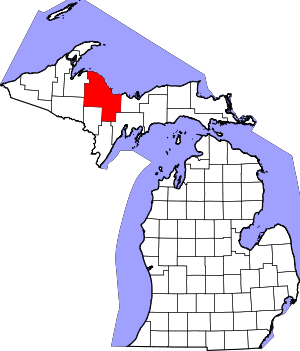 Map of Michigan highlighting Marquette County.svg | |
| Charter townships | ||
| Civil townships | ||
| CDPs | ||
| Unincorporated communities | ||
| Indian reservations | ||
| Footnotes | ‡This populated place also has portions in an adjacent county or counties | |