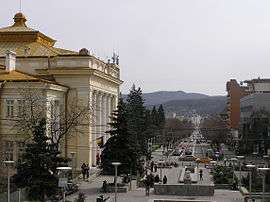
Râmnicu Vâlcea
Râmnicu Vâlcea (also spelled Rîmnicu Vîlcea, Romanian pronunciation: [ˈrɨmniku ˈvɨlt͡ʃe̯a]) (population: 92,573) is the capital city of Vâlcea County, Romania (in the historical province of Oltenia).
Râmnicu Vâlcea | |
|---|---|
 | |
 Coat of arms | |
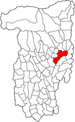 Location in Vâlcea County | |
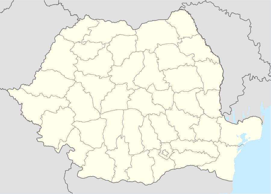 Râmnicu Vâlcea Location in Romania | |
| Coordinates: 45°6′17″N 24°22′32″E | |
| Country | |
| County | Vâlcea |
| Established | 1388 (first mention) |
| Government | |
| • Mayor | Mircia Gutău[1] (PER) |
| Area | 89.52 km2 (34.56 sq mi) |
| Elevation | 250 m (820 ft) |
| Population (2011)[2] | 98,776 |
| • Density | 1,100/km2 (2,900/sq mi) |
| Time zone | EET/EEST (UTC+2/+3) |
| Postal code | 240xxx |
| Area code | (+40) 02 50 |
| Vehicle reg. | VL |
| Website | www |
Geography and climate
Râmnicu Vâlcea is situated in the central-south area of Romania. Set at the foothills of the Southern Carpathians, the city is located at about 12 kilometres (7.5 mi) from the Cozia Mountains and about 40 kilometres (25 mi) from the Făgăraş and Lotrului Mountains. The southern limit of Râmnicu Vâlcea is formed by the Getic Plateau and the Oltului Valley.
The Olt River crosses the town of Râmnicu Vâlcea as well as the E81 road of European interest and one of the main national railway routes.
The climate is defined as Dfa" (humid continental with warm summers) bordering Cfa" (humid subtropical). Precipitation amount is higher in the summer, although not high enough in order to be a "Dwa" type climate.
| Month | Jan | Feb | Mar | Apr | May | Jun | Jul | Aug | Sep | Oct | Nov | Dec | Year |
|---|---|---|---|---|---|---|---|---|---|---|---|---|---|
| Average high °C (°F) | 3.9 (39.0) |
6.2 (43.2) |
11.5 (52.7) |
17.5 (63.5) |
22.9 (73.2) |
26.3 (79.3) |
28.6 (83.5) |
28.4 (83.1) |
23.3 (73.9) |
17.3 (63.1) |
10.2 (50.4) |
4.6 (40.3) |
16.7 (62.1) |
| Average low °C (°F) | −4.1 (24.6) |
−2.9 (26.8) |
1.0 (33.8) |
6.0 (42.8) |
10.8 (51.4) |
14.1 (57.4) |
15.8 (60.4) |
15.6 (60.1) |
11.4 (52.5) |
6.7 (44.1) |
1.5 (34.7) |
−2.5 (27.5) |
6.1 (43.0) |
| Average precipitation mm (inches) | 34.9 (1.37) |
32.4 (1.28) |
33.9 (1.33) |
56.4 (2.22) |
74.1 (2.92) |
83.2 (3.28) |
77.2 (3.04) |
81.3 (3.20) |
55.9 (2.20) |
47.8 (1.88) |
46.5 (1.83) |
53.0 (2.09) |
676.6 (26.64) |
| Average precipitation days | 10 | 8.7 | 9.7 | 12.2 | 13 | 12.4 | 9.6 | 9.5 | 8.9 | 8.2 | 9.6 | 11.4 | 123.2 |
| Source: World Weather Information[3] | |||||||||||||
History

| Historical population | ||
|---|---|---|
| Year | Pop. | ±% |
| 1912 | 9,628 | — |
| 1930 | 15,648 | +62.5% |
| 1948 | 17,238 | +10.2% |
| 1956 | 18,984 | +10.1% |
| 1966 | 23,867 | +25.7% |
| 1977 | 66,321 | +177.9% |
| 1992 | 113,624 | +71.3% |
| 2002 | 107,656 | −5.3% |
| 2011 | 92,573 | −14.0% |
| Source: Census data | ||
The area has been inhabited since Dacian and Roman times, and was the site of a castrum. A new fortress was built on the location during the Middle Ages. Râmnicu Vâlcea was first attested during the rule of Prince Mircea cel Bătrân, as "the princely town of Râmnic" (4 September 1388), and confirmed as the seat of a Vâlcea County during the same period (8 January 1392).
The town seal dates to 1505. Cetățuia, the actual fortress, served as the residence of Oltenian Bans and, from 1504, of the Orthodox bishops of the Râmnic Diocese; in 1529, Prince Radu of Afumați was killed in Cetățuia by a boyar conspiracy.
During the rules of Matei Basarab and Constantin Brâncoveanu, it became an important cultural center. It was here where the first paper mill and printing press in Romania were built (see Anthim the Iberian). The city was heavily damaged during the Habsburg takeover of Oltenia between 1718 and 1739, and its purpose was again reduced to that of a fortress.
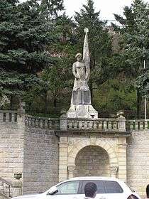
During the Wallachian Revolution, on 29 July 1848, Deșteaptă-te, române! (the current national anthem of Romania), with lyrics written by Andrei Mureșanu and music composed by Anton Pann (whose memorial house lies in the center of the town), was sung for the first time in Râmnicu Vâlcea. Gheorghe Magheru gathered his military force in Râureni, now part of the city, in an attempt to face the anti-revolutionary forces of Imperial Russia and the Ottoman Empire.
In the 1980s, the city was completely rebuilt in a style combining Socialist realism with local vernacular architecture.
The city was the center and peak point of the path of total darkness of the Solar eclipse of 11 August 1999. Around 2005 the city gained notoriety as a centre of cyber crime.[4]
Politics
The mayor of Râmnicu Vâlcea is Mircia Gutău of the Romanian Ecologist Party, following the 2016 local election. The Râmnicu Vâlcea Municipal Council, elected at the June 2016 local government elections, is made up of 22 councillors, with the following party composition:
| Party | Seats | Current Council | ||||||||
|---|---|---|---|---|---|---|---|---|---|---|
| Ecologist Party | 8 | |||||||||
| Social Democratic Party | 8 | |||||||||
| National Liberal Party | 4 | |||||||||
| Alliance of Liberals and Democrats | 2 | |||||||||
Sports
Râmnicu Vâlcea is home to SCM Râmnicu Vâlcea, which is a women's handball club that competes traditionally in the EHF Champions League.
Villages
The city administers thirteen villages: Aranghel, Căzănești, Copăcelu, Dealu Malului, Fețeni, Goranu, Lespezi, Poenari, Priba, Râureni, Săliștea, Stolniceni and Troian. Goranu, Fețeni, Lespezi and Săliștea were a separate commune, Goranu, until 1996, when they were merged into the city.
Natives
- Petre Alexandru
- Eugen I. Angelescu
- Mircea Angelescu
- Nicolae Bănicioiu
- Traian Boicescu
- Ion Emanuel Florescu
- Gheorghe I. Lahovary
- Gabriel Liiceanu
- Nicolae Manolescu
- Horia Moculescu
- Eugen Negrici
- Mihail Oromolu
- Dumitru Popescu
- Dem Rădulescu
- Dan Stuparu
- Dorel Zugrăvescu
See also
References
- "Results of the 2016 local elections". Central Electoral Bureau. Retrieved 3 April 2020.
- "Populaţia stabilă pe judeţe, municipii, oraşe şi localităti componenete la RPL_2011" (in Romanian). National Institute of Statistics. Retrieved 4 February 2014.
- "World Weather Information Service". Retrieved November 25, 2016.
- Bhattacharjee, Yudhijit (2011-01-31). "How a Remote Town in Romania Has Become Cybercrime Central". Wired. 19 (2). ISSN 1059-1028. Retrieved 2019-10-17.
External links
| Wikimedia Commons has media related to Râmnicu Vâlcea. |
- Râmnicu Vâlcea City Hall official site (in Romanian)

County seats of Romania (alphabetical order by county) | ||
|---|---|---|
| ||