Călimănești
Călimănești, often known as Călimănești-Căciulata, is a town in Vâlcea County, southern Romania. It is situated in the historical region of Oltenia and the northern part of the county, on the traditional route connecting the region to Transylvania, and at the southern end of the Olt River valley crossing the Southern Carpathians.
| Historical population | ||
|---|---|---|
| Year | Pop. | ±% |
| 1930 | 2,876 | — |
| 1948 | 3,329 | +15.8% |
| 1956 | 6,651 | +99.8% |
| 1966 | 6,735 | +1.3% |
| 1977 | 8,095 | +20.2% |
| 1992 | 9,131 | +12.8% |
| 2002 | 8,923 | −2.3% |
| 2011 | 7,622 | −14.6% |
| Source: Census data | ||
Călimănești | |
|---|---|
 | |
 Coat of arms | |
 Location in Vâlcea County | |
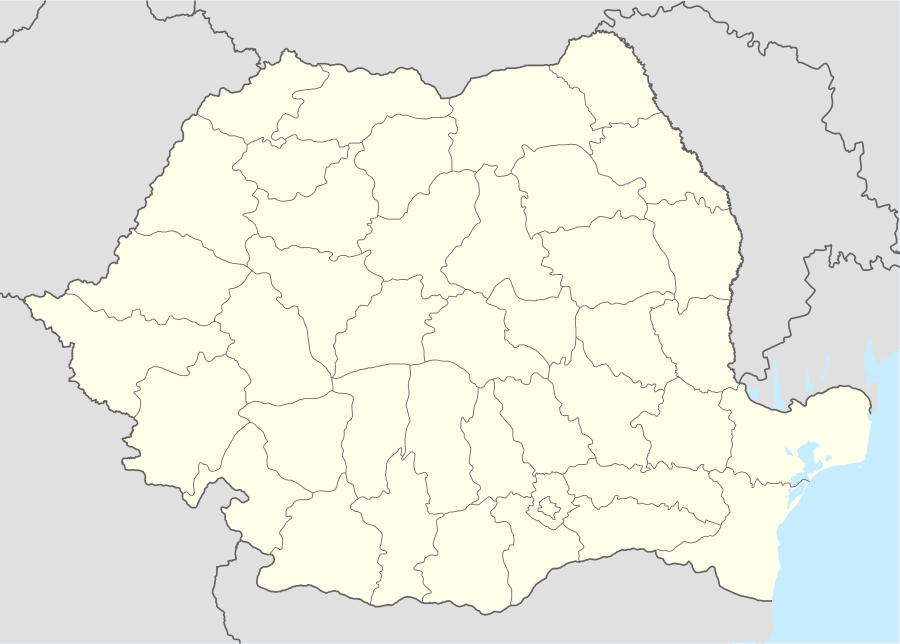 Călimănești Location in Romania | |
| Coordinates: 45°14′21″N 24°20′36″E | |
| Country | |
| County | Vâlcea |
| Government | |
| • Mayor | Florinel Constantinescu[1] (PNL) |
| Area | 104.5 km2 (40.3 sq mi) |
| Population (2011)[2] | 7,622 |
| • Density | 73/km2 (190/sq mi) |
| Time zone | EET/EEST (UTC+2/+3) |
| Vehicle reg. | VL |
| Website | www |
The location of several thermal springs, Călimănești-Căciulata is known as a spa town. During the 20th century, many hotels and treatment facilities were built in Căciulata, a northern area of the town which is close to Cozia Monastery. The Monastery was built by Mircea the Old in 1388 which is also the day of the city Călimănești and Râmnicu Vâlcea (just south on DN7).
Arutela Roman Fort is located here.
The area around the town is full of fresh water springs and spa waters that are not in use. The old town was a bit smaller, the island you see on river Olt was bigger and the road was on what is now the river bed. In 1918 it was the major point of invasion in Transylvania. The town is built along DN7. The second most used road in Romania, used by Romanians to travel up to Transylvania and recently often used to go to Hungary, Austria and many other EU nations.
The town administers five villages: Căciulata, Jiblea Nouă, Jiblea Veche, Seaca and Păușa.
Gallery
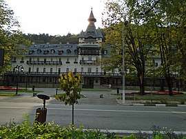
 Central Pavilion
 Ostrov Monastery
 Holy Trinity Church of the Cozia Monastery
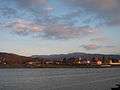 Olt River
Famous people
- Vlaicu Ionescu born in Jiblea [3], abstract expressionism painter, art merchant and famous writer about Nostradamus.
References
- "Results of the 2016 local elections". Central Electoral Bureau. Retrieved 6 April 2020.
- "Populaţia stabilă pe judeţe, municipii, oraşe şi localităti componenete la RPL_2011" (in Romanian). National Institute of Statistics. Retrieved 4 February 2014.
- https://anunt.uk/home/cultural/1385-despre-destinul-romaniei-cu-vlaicu-ionescu-fiul-spiritual-al-lui-nostradamus.html
External links
| Wikimedia Commons has media related to Călimănești. |
- Călimănești-Căciulata Site (in Romanian)