Punjabi Bagh
Punjabi Bagh is a locality in Delhi, India. It also is one of the three sub-zones of West Delhi.
Punjabi Bagh | |
|---|---|
District Subdivision | |
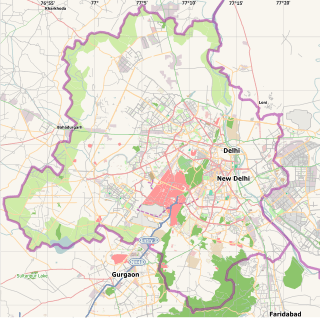 Punjabi Bagh Location in Delhi, India | |
| Coordinates: 28.667508°N 77.121255°E | |
| Country | |
| State | Delhi |
| District | West Delhi |
| Government | |
| • Body | Municipal Corporation Of Delhi (North) & Municipal Corporation Of Delhi (South) |
| Languages | |
| • Official | Hindi, English, Punjabi |
| Time zone | UTC+5:30 (IST) |
| PIN | 110026 |
| Nearest city | Gurgaon |
| Lok Sabha constituency | New Delhi & West Delhi |
| Vidhan Sabha constituency | Moti Nagar & Madipur |
| Civic agency | Municipal Corporation Of Delhi (North) & Municipal Corporation Of Delhi (South) |
History
It was previously called Refugees colony , but it was renamed as Punjabi Bagh in 1960.
In its earliest stages was the settlement for Hindus and Sikhs who moved from West Punjab during the partition. Not much later it started becoming the locality for big bungalows of wealthy traders, businessmen, and transporters. The area is famous for these huge bungalows mostly in the range of 280-550 square yards, some plots are in the range of 1100-2200 square yards. It has also thus developed an image as a posh locality, mostly residential.
Development
Punjabi Bagh has seen rapid commercial growth since the mid-90s with the opening of innumerable banks, Salons, restaurants such as Domino's, KFC, McDonald's, Wok in the Clouds, Nandos, Thai Wok, Bikanerwala, Cafe Pasha,[1] etc. Other establishments include health clubs, ice cream shops, sportswear showrooms like Adidas, Nike, Reebok etc. Shri Krishan Janmashathmi Mahotsav Punjabi Bagh is celebrated at Punjabi Bagh Stadium (known as Traffic Training Park).
The colony mostly consists of private houses on the bungalow pattern and are so-called "Kothis" (large bungalows). However apartments too exist. It houses some well known Delhi schools such as the Guru Nanak Public School, S.M. ARYA Public School (Punjabi Bagh), Hans Raj Model School, N C Jindal Public School (NCJPS), S.D. Public School (East Punjabi Bagh) and hospitals like Maharaja Agrasen Hospital, MGS Hospital and Oasis Homoeopathic Clinic & Pharmacy and Teeny Town Playhomes - Indoor Playground for Kids]]
Geography
Divided into 2 parts East and West by Ring Road. It is well connected to various parts of the city and has a fairly good bus network and roads. It is also well connected to the Delhi Metro with 3 stations within the main Punjabi Bagh Chowk area. The stations are Shivaji Park (Delhi Metro) and Punjabi Bagh (Delhi Metro) of the Green Line (Delhi Metro) and Punjabi Bagh West (Delhi Metro) of the recently-opened Pink Line (Delhi Metro).
The Western Part of Punjabi Bagh also has an ISKCON temple. ISKCON temple Punjabi Bagh is around 0.5 kilometers away from Punjabi Bagh Club on Road No.77(in the lane of mother’s pride school, it was established in September 2007.
For recreation and social gatherings there is a club called the Punjabi Bagh Club mainly for the residents offering a lot of facilities like swimming, Lawn Tennis, badminton, Roller skating, basketball, table tennis, squash, wedding lawns etc. It also has a well-equipped gymnasium and rooms for arranging parties and kids entertainment.
Neighboring areas include Ashoka Park, Karampura, Paschim Vihar, Moti Nagar, Paschim Puri, Pitam Pura and Rajouri Garden[2]
Transport
Inter-State Bus Terminal: 13 km;
Indira Gandhi International Airport Domestic Airport: 14 km;
Indira Gandhi International Airport International Airport: 16 km;
Connaught Place: 9 km;
New Delhi Railway Station: 10 km;
Old Delhi Railway Station: 11 km;
References
- "Qafe Pasha in Punjabi Bagh has some interesting Moroccan food on its menu". " THE HINDU". 22 July 2012.
- "District centres of Janakpuri, Rajouri generate maximum jobs: Ameya Abhyankar, deputy commissioner (west)". The Economic Times. 13 July 2012.