Inder Puri
Inder Puri (officially 'Indrapuri') a fairly small, self-contained residential colony located in the central-south part of New Delhi. It lies between Naraina and New Rajinder Nagar area and is an upscale neighborhood. Inderpuri has some of the wealthiest families residing, generally around A, B, C, R, EA and RA blocks. It is located next to the renowned Pusa Institute.
Inder Puri | |
|---|---|
neighbourhood | |
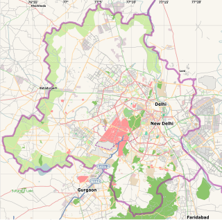 Inder Puri Location in New Delhi, India  Inder Puri Inder Puri (India) | |
| Coordinates: 28.630261°N 77.147148°E | |
| Country | |
| State | Delhi |
| District | Central Delhi |
| Metro | New Delhi |
| Languages | |
| • Official | Hindi |
| Time zone | UTC+5:30 (IST) |
| PIN | |
| Planning agency | Municipal Corporation of Delhi |
The area has a bus stop, retail shopping outlets, and various parks. It is well-known colony as it is close to shopping hubs such as Karol Bagh, and Rajouri Garden. It itself has a commercial area where one would get almost all household consumables and appliances. It has its own police station, post office, market, various banks branches and ATMs and multiple places of religious worship like temples, gurudwaras and a church.
With the expansion of Delhi towards west with Rohini and south with Dwarka, Inderpuri now actually falls right in the heart of Delhi. It is evident from the fact that Inderpuri now falls under the New Delhi Lok Sabha Parliamentary constituency, the most important parliamentary seat in India in terms of national significance. Inderpuri falls under the Rajinder Nagar assembly constituency. It is very close to the domestic airport, as well as to the New Delhi railway station plus also close to South Delhi areas like Safdarjung Enclave, Lajpat Nagar, South Extension and Greater Kailash. Inderpuri is also very close to Major hospitals like Sir Ganga Ram Hospital and BL Kapur Memorial hospital on Pusa Road. All India Institute of Medical Sciences, Army Base hospital and the Safdarjung hospital are also not far from Inderpuri. The area has a small railway station as well on the Delhi Ring Railway. Indian Bank Officers quarters is there in Inderpuri C Block.
One of the best parts about this locality is that its very accessible and in the city heart but is still very pollution free and relatively cooler throughout the year because it is surrounded by 3 large green tracts namely 1) Delhi cantonment 2) Pusa institute and 3) Delhi ridge on third side. A good but unexplored tourist spot nearby is the Delhi War Cemetery. Inderpuri has two Mariamman temples (South Indian), Murgan/kartik temple (South Indian), Arya Samaj Mandir, a Sanatan Dharm Mandir, two shiv temples, one hanuman mandir, one gurudwara and one church. It has four large parks namely Veer Ravindra kaura park, D Park, C park and Shastri Park [1]
Access
The Indira Gandhi International Airport is 12 km (domestic) and 16 km (international) from Inderpuri. The New Delhi railway station is 11 km away, and the Hazrat Nizamuddin Railway Station 19 km away. The Blue Line of the Delhi Metro has a stop at the Shadipur station within 3.4 km from Inderpuri. Moreover now the closest metro station is pink line metro station at naraina vihar.
See also
References
- "Pin Code of Inder puri Delhi". citypincode.in. Retrieved 6 March 2014.