Pueai Noi District
Pueai Noi (Thai: เปือยน้อย, pronounced [pɯ̄a̯j nɔ́ːj]) is a district (amphoe) in the southwestern part of Khon Kaen Province, northeastern Thailand.
Pueai Noi เปือยน้อย | |
|---|---|
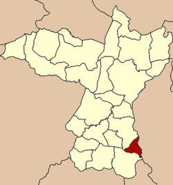 District location in Khon Kaen Province | |
| Coordinates: 15°52′17″N 102°54′20″E | |
| Country | Thailand |
| Province | Khon Kaen |
| Seat | Pueai Noi |
| Subdistrict | 4 |
| Muban | 32 |
| District established | 1977 |
| Area | |
| • Total | 173.0 km2 (66.8 sq mi) |
| Population (2010) | |
| • Total | 19,917 |
| • Density | 114.1/km2 (296/sq mi) |
| Time zone | UTC+7 (ICT) |
| Postal code | 40340 |
| Geocode | 4011 |
Geography
Neighboring districts are (from the south clockwise): Nong Song Hong and Ban Phai of Khon Kaen Province; Kut Rang and Na Chueak of Maha Sarakham Province.
History
The minor district (king amphoe) Phueai Noi was established on 17 January 1977, with the two tambons Phueai Noi and Wang Muang from Ban Phai District.[1] It was upgraded to a full district on 4 July 1994.[2]
Administration
The district is divided into four subdistricts (tambons), which are further subdivided into 32 villages (mubans). Pueai Noi is a subdistrict municipality (thesaban tambon) which covers parts of tambons Phueai Noi and Sa Kaeo, and Sa Kaeo a subdistrict municipality which covers the remaining areas of the two subdistricts. There are two tambon administrative organizations (TAO), one for each of the remaining subdistricts.
| No. | Name | Thai | Villages | Pop.[3] |
|---|---|---|---|---|
| 1. | Pueai Noi | เปือยน้อย | 7 | 4,468 |
| 2. | Wang Muang | วังม่วง | 8 | 6,359 |
| 3. | Kham Pom | ขามป้อม | 10 | 5,443 |
| 4. | Sa Kaeo | สระแก้ว | 7 | 3,647 |
References
- ประกาศกระทรวงมหาดไทย เรื่อง แบ่งท้องที่อำเภอบ้านไผ่ จังหวัดขอนแก่น ตั้งเป็นกิ่งอำเภอเปือยน้อย (PDF). Royal Gazette (in Thai). 94 (8 ง): 306. January 25, 1977.
- พระราชกฤษฎีกาตั้งอำเภอเปือยน้อย ... และอำเภอศรีวิไล พ.ศ. ๒๕๓๗ (PDF). Royal Gazette (in Thai). 111 (21 ก): 32–35. June 3, 1994.
- "Population statistics 2010". Department of Provincial Administration. Archived from the original on 2011-02-27. Retrieved 2011-04-14.