Portloman (civil parish)
Portloman (Irish: Port Lomáin)[1] is a civil parish in County Westmeath, Ireland. It is located about 6.5 kilometres (4 mi) north–west of Mullingar in hilly country on the western shore of Lough Owel.
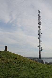
Communication mast and trigonometric point on Frewin Hill in Portloman parish
Portloman Port Lomáin | |
|---|---|
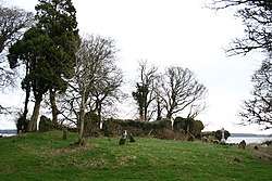 Church ruin and graveyard in the eponymous townland | |
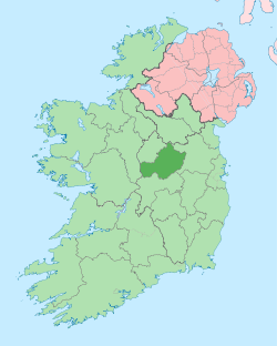
 Portloman Location of Portloman within County Westmeath in the Republic of Ireland | |
| Coordinates: 53°34′4″N 7°24′52″W | |
| Country | |
| Province | Leinster |
| County | County Westmeath |
| Irish grid reference | N388577 |
Portloman is one of 8 civil parishes in the barony of Corkaree in the Province of Leinster. The civil parish covers 2,595.8 acres (10.505 km2).
Portloman civil parish comprises 8 townlands: Ballard, Ballyboy, Balrath, Grangegeeth, Monroe, Portloman, Scurlockstown and Wattstown.
The neighbouring civil parishes are: Portnashangan to the north, Rathconnell (barony of Moyashel and Magheradernon) to the east, Templeoran (barony of Moygoish) to the south and west.[2][3]
References
- Portloman civil parish Logainm.ie Retrieved on 12 June 2015.
- Portloman civil parish, Co. Westmeath Townlands.ie Retrieved on 12 June 2015.
- Portloman civil parish, Co. Westmeath The IreAtlas Townland Data Base Retrieved on 12 June 2015.
External links
- Portloman civil parish at the IreAtlas Townland Data Base
- Portloman civil parish at Townlands.ie
- Portloman civil parish at Logainm.ie
This article is issued from Wikipedia. The text is licensed under Creative Commons - Attribution - Sharealike. Additional terms may apply for the media files.