Polish Hill (Pittsburgh)
Polish Hill (Polish: Polskie Wzgórze) is a neighborhood in Pittsburgh, Pennsylvania. Primarily a residential area, it is home to one of Pittsburgh's grandest neighborhood churches, the Immaculate Heart of Mary.
Polish Hill | |
|---|---|
 Immaculate Heart of Mary Church | |
 | |
| Coordinates: 40.457°N 79.965°W | |
| Country | United States |
| State | Pennsylvania |
| County | Allegheny County |
| City | Pittsburgh |
| Area | |
| • Total | 0.255 sq mi (0.66 km2) |
| Population (2010)[1] | |
| • Total | 1,274 |
| • Density | 5,000/sq mi (1,900/km2) |

History
Large numbers of Polish immigrants settled the neighborhood after the mid 1800s. They were attracted to the many jobs in Pittsburgh's burgeoning steel industry, which immigrants could perform even before learning much English. After World War II, construction of highways were supported by the federal government, and new residential areas were developed in the suburbs. Polish Hill and other neighborhoods began to lose population as some of its more established residents joined the suburban movement, a process seen in many established cities in the US. At the same time, Polish Hill has many residents who are descendants of the immigrant ancestors and is attracting new residents who value its scale, walkability, and proximity to jobs and amenities.
Surrounding Pittsburgh neighborhoods
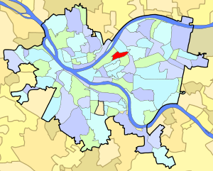
Polish Hill has five borders with the Pittsburgh neighborhoods of Lower Lawrenceville to the north, North Oakland to the southeast, Upper Hill District to the south, Bedford Dwellings to the southwest and the Strip District to the west and northwest. Polish Hill also runs catty-corner (without a direct border) with Bloomfield to the east with its meeting point at the center of the Bloomfield Bridge.[2]
Government
Polish Hill is represented in the Pittsburgh City Council through the council member for District 7.
See also
References
- "PGHSNAP 2010 Raw Census Data by Neighborhood". Pittsburgh Department of City Planning PGHSNAP Utility. 2012. Retrieved 28 June 2013. External link in
|publisher=(help) - "Pittsburgh map". City of Pittsburgh. Archived from the original on April 1, 2009. Retrieved April 3, 2009.
- Toker, Franklin (1994) [1986]. Pittsburgh: An Urban Portrait. Pittsburgh: University of Pittsburgh Press. ISBN 0-8229-5434-6.