Phra Pradaeng District
Phra Pradaeng (Thai: พระประแดง, pronounced [pʰráʔ prā.dɛ̄ːŋ]) is a district (amphoe) of Samut Prakan Province in Thailand.
Phra Pradaeng พระประแดง | |
|---|---|
ภาคกลาง | |
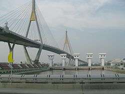 Bhumibol Bridge (Mega Bridge) crossing the Chao Phraya River | |
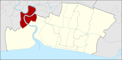 District location in Thailand | |
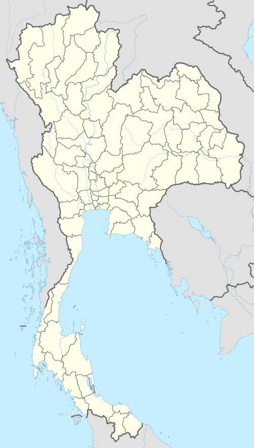 Phra Pradaeng Location in Thailand | |
| Coordinates: 13°39′30″N 100°32′2″E | |
| Country | Thailand |
| Province | Samut Prakan |
| Seat | Talat |
| Tambon | 15 |
| Area | |
| • Total | 73.370 km2 (28.328 sq mi) |
| Population (2019) | |
| • Total | 196,129 |
| • Density | 2,673.14/km2 (6,923.4/sq mi) |
| Time zone | UTC+7 (thailand :21:07:50) |
| Postal code | 10130 |
| Geocode | 1104 |
Geography
Neighboring districts are (from the west clockwise) Thung Khru District, Rat Burana District, Yan Nawa District, Khlong Toei District, Phra Khanong District and Bang Na District (all Bangkok), and the districts Mueang Samut Prakan, and Phra Samut Chedi of Samut Prakan. The district is on a bend of the Chao Phraya River.
History
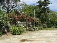
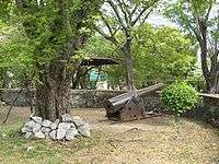
Phra Pradeang was the original center of the area south of Bangkok near the mouth of the Chao Phraya River. Originally named Nakhon Khuan Khan (นครเขื่อนขันธ์), it was settled by Mon people. In 1815, King Rama II built the Pom Phlaeng Faifa Fort at the river's bend. The fort is now a small park and is accessible to visitors.
In 1819, the new town Mueang Samut Prakan (or Paknam) was established. Due to economic problems in the early-1930s, several administrative entities were abolished, including Phra Phradaeng Province, which had its districts assigned to Samut Prakan and Thonburi effective 1 April 1932.[1]
A two kilometre tramway across the neck of the Phra Pradaeng river bend opened in 1908 and closed c. 1940. Operated by a private company, the motorised trams connected with motorboat services to Bangkok and to Paknam at each end of the line. The tram cut a considerable time off the up and downriver journey by avoiding the long river bend.
Administration
The district is divided into 15 sub-districts (tambons), which are further subdivided into 67 villages (mubans). The town (thesaban mueang) Phra Pradaeng covers the tambon Talad, the town Lat Luang, the tambon Bang Phueng, Bang Chak, and Bang Kharu. The township (thesaban tambon) Samrong Thai administers tambons Samrong Tai, Samrong, Samron Klang, Bang Hua Suea, and Bang Ya Phraek. There are six tambon administrative organizations (TAO) for the tambon not covered by the municipalities.
| No. | Name | Thai name | Villages | Pop. | |
|---|---|---|---|---|---|
| 1. | Talat | ตลาด | - | 9,501 | |
| 2. | Bang Phueng | บางพึ่ง | - | 24,515 | |
| 3. | Bang Chak | บางจาก | - | 22,281 | |
| 4. | Bang Khru | บางครุ | - | 26,129 | |
| 5. | Bang Ya Phraek | บางหญ้าแพรก | - | 21,339 | |
| 6. | Bang Hua Suea | บางหัวเสือ | - | 12,427 | |
| 7. | Samrong Tai | สำโรงใต้ | - | 13,007 | |
| 8. | Bang Yo | บางยอ | 10 | 11,307 | |
| 9. | Bang Kachao | บางกะเจ้า | 9 | 5,161 | |
| 10. | Bang Nam Phueng | บางน้ำผึ้ง | 11 | 4,904 | |
| 11. | Bang Krasop | บางกระสอบ | 11 | 2,892 | |
| 12. | Bang Ko Bua | บางกอบัว | 13 | 7,235 | |
| 13. | Song Khanong | ทรงคนอง | 13 | 7,716 | |
| 14. | Samrong | สำโรง | - | 15,686 | |
| 15. | Samrong Klang | สำโรงกลาง | - | 12,029 |
Attractions
Notable people
- Sompote Sands, film director
- Chintara Sukapatana, actress
References
- พระบรมราชโองการ ประกาศ ยุบรวมท้องที่บางมณฑลและบางจังหวัด (PDF). Royal Gazette (in Thai). 48 (0 ก): 576. February 21, 1932.
External links
| Wikimedia Commons has media related to Phra Pradaeng District. |
- http://www.phrapradaeng.org (Thai only)