Parkdale, Michigan
Parkdale is an unincorporated community and census-designated place in Manistee Township, Manistee County, Michigan, United States. Its population was 704 as of the 2010 census.[1] The community is in the southwest corner of the township, on the northern edge of Manistee Lake where the Manistee River enters the lake. It is on US 31 near the junction with M-55 on the northern boundary of the Manistee city limits.
Parkdale, Michigan | |
|---|---|
 Parkdale, Michigan  Parkdale, Michigan | |
| Coordinates: 44°16′03″N 86°18′10″W | |
| Country | United States |
| State | Michigan |
| County | Manistee |
| Area | |
| • Total | 1.548 sq mi (4.01 km2) |
| • Land | 1.548 sq mi (4.01 km2) |
| • Water | 0 sq mi (0 km2) |
| Elevation | 600 ft (200 m) |
| Population | |
| • Total | 704 |
| • Density | 450/sq mi (180/km2) |
| Time zone | UTC-5 (Eastern (EST)) |
| • Summer (DST) | UTC-4 (EDT) |
| Area code(s) | 231 |
| GNIS feature ID | 634378[2] |
Geography
According to the U.S. Census Bureau, the community has an area of 1.548 square miles (4.01 km2), all of it land.[1]
History
The community had a rural post office from April 1897 to September 1898 and again from October 1898 to April 1900.[3] From 1927 until 2003, Parkdale was the southern terminus of M-110.[4]
References
- "2010 Census Gazetteer Files - Places: Michigan". U.S. Census Bureau. Retrieved June 1, 2018.
- "Parkdale". Geographic Names Information System. United States Geological Survey.
- Romig, Walter (1986) [1973]. Michigan Place Names. Detroit, Michigan: Wayne State University Press. ISBN 0-8143-1838-X.
- M-110 at Michigan Highways
Municipalities and communities of Manistee County, Michigan, United States | ||
|---|---|---|
| City | 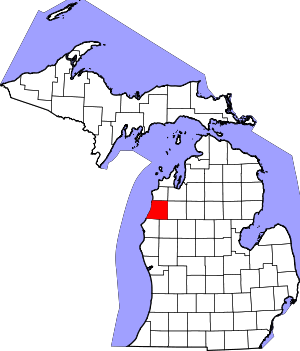 Map of Michigan highlighting Manistee County.svg | |
| Villages | ||
| Charter township | ||
| General law townships | ||
| CDPs | ||
| Other unincorporated communities | ||
| Indian reservation | ||
| Footnotes | ‡This populated place also has portions in an adjacent county or counties | |
This article is issued from Wikipedia. The text is licensed under Creative Commons - Attribution - Sharealike. Additional terms may apply for the media files.