Papakura
Papakura is a suburb of Auckland, in northern New Zealand. It is located on the shores of the Pahurehure Inlet, approximately 32 kilometres south of the Auckland CBD. It is under the authority of the Auckland Council.
Papakura | |
|---|---|
| Country | New Zealand |
| Local authority | Auckland City |
| Electoral ward | Manurewa-Papakura Ward |
| Established | 1943 |
| Population (2009) | |
| • Total | 28,010 |
| Train station(s) | Papakura railway station |
| Hospitals(s) | Counties Care, Papakura Private Practice |
| Wattle Downs | Takanini | Ardmore |
| (Towards Manukau Harbour) |
|
Red Hill |
| Pahurehure, Rosehill | Drury | Opaheke |
Papakura is a Māori word believed to have originated from papa, meaning earth or flat (abbreviation of Papatūānuku) and kura meaning red,[1] reflecting the rich, fertile soil upon which the community was founded.
History
An old highway, the Great South Road, runs through Papakura, forming its main street. The road was constructed during the New Zealand Wars to transport supplies to the Waikato campaign. It was guarded by armed constabulary and was a designated military road.
During the major reformation of local government in 1989, Papakura became a district. Prior to that time, a smaller area was known as Papakura City, which was a small city of New Zealand, but the new district included parts of the surrounding rural countryside that had previously been part of Manukau City. After the major change "Papakura City" went to "Papakura District", and instead of being an independent city, the area was amalgamated, including it into the Auckland Region. The whole district counts as part of the Auckland urban area for statistical purposes, forming part of its southern boundary.
From October 2010, after a review of the Royal Commission on Auckland Governance, the entire Auckland Region was amalgamated into a single city authority. As well as the Papakura District, other territorial authorities such as North Shore City, Rodney District, Waitakere City, Auckland City, Manukau City, and the Franklin District were abolished and the entire area was dissolved into a single Auckland city council. The suburb of Papakura and other suburbs of the Papakura District are now in the Manurewa-Papakura Ward of the Auckland Council.
Military Camp
The Papakura Military Camp was established on the outskirts of the town in 1939 and remains an important army base for New Zealand.[2] Built by the Stevenson family it incorporates the New Zealand SAS training area.[3] In the early 2000s some land was set aside for new housing developments.
Education
The following schools are located in Papakura (schools in Takanini are excluded):
Primary education
- Papakura Normal School is a coeducational full primary school with the state system. It has a decile rating of 3.
- Papakura Central School is a coeducational full state primary school with a decile rating of 5.
- Papakura South School is a coeducational full state primary school. It has a decile rating of 1.
- Kelvin Road School is a coeducational state contributing primary school. It has a decile rating of 1.
- Edmund Hillary School is a coeducational state full primary school. It has a decile rating of 1.
- Cosgrove School is a coeducational state contributing primary school. It has a decile rating of 2.
- St Mary's School is a state integrated coeducational school. It has a decile rating of 4.
- Park Estate Primary is a state integrated coeducational contributing to Rosehill Intermediate and on to Rosehill College
- Opaheke School
- Kereru Park Campus
Intermediate education
- Mansell Senior School
- Papakura Intermediate
- Rosehill Intermediate
Secondary education
Facilities
Government
In addition to the Local Council Chambers, Papakura is served by a large Police Department; one of Auckland's busiest stations, a District Courthouse, and a WINZ office. In the Pitcairn sexual assault trial of 2004, the Papakura Courthouse was where the Pitcairn Supreme Court sat to hear the case.
Armed Forces
Papakura once served a large military population, but now only the SAS special forces are based at Papakura.[4] Nearby houses were originally Army Homes, but are now in private hands.
Transport
State Highway 1 and the North Island Main Trunk railway run through the Papakura District. SH 1 ran down Great South Road through central Papakura until 1965, when it was bypassed by the Auckland Southern Motorway.[5]
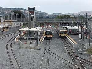
Train and bus services provide the bulk of public transport, with frequent trains on the Southern Line between Papakura and the CBD (Britomart). Recent investment has focused on upgrading and refurbishing the region's trains and suburban railway stations, most recently with the opening of a modern station facility at the town centre. Papakura is the final stop for most southbound public transport in Auckland, and Papakura is the third busiest station on the rail network. Drawn by frequent services into and out of the city, rail commuters come from Papakura itself, Franklin County and the northern Waikato. Though the motorway and Great South Road flow relatively freely at peak times, road commuters are affected by the acute traffic congestion as they get closer to metropolitan Auckland.
Sport and Recreation
Some notable sports facilities include an indoor-outdoor swimming pool, an international-quality athletics track, a sports stadium, and venues for rugby, netball, cricket, golf, tennis, badminton, soccer, and many other sports. The council also operates a library and a theatre. Papakura also has a number of skate parks, and a skate bowl.
Papakura is home to association football club Papakura City, who compete in the Lotto Sport Italia NRFL Division 2, rugby union club Papakura RFC, and rugby league club Papakura Sea Eagles, who compete in the Auckland Rugby League's Fox Memorial competition (division 1).
Notable people
- Jerome Kaino - Auckland Blues / All Blacks
- Sir Edmund Hillary- Mountaineer and explorer
- Fleur Adcock – Poet
- Katrina Grant – Southern Steel netballer and Silver Ferns netballer
- Lance Hamilton – Cricketer
- Reg Mombassa – Artist and musician
- P-Money – hip-hop DJ
- Blair Pocock – Cricketer
- Kieran Read – All Black
- Joe Rokocoko – Rugby union player
- David Sabine – Cricketer
- Kimberley Smith – Long-distance runner
- John Walker- Olympic gold medallist
- George Hawkins – New Zealand MP
- Keven Mealamu – All Black
- John Afoa - All Blacks
References
- "1000 Māori place names". New Zealand Ministry for Culture and Heritage. 6 August 2019.
- "17. – Auckland places – Te Ara: The Encyclopedia of New Zealand". Teara.govt.nz. 1 July 2015. Retrieved 22 February 2016.
- "Our History". Archived from the original on 24 February 2012. Retrieved 12 April 2013.
- "Forces and Locations". New Zealand Defence Force. Retrieved 19 August 2006.
- "Auckland Motorways 2008" (PDF). New Zealand Transport Agency. Retrieved 3 February 2017.
External links
- Papakura Normal School
- Papakura High School
- Photographs of Papakura held in Auckland Libraries' heritage collections.