Palen Creek, Queensland
Palen Creek is a rural locality in the Scenic Rim Region, Queensland, Australia.[2] It borders New South Wales.[3] In the 2016 census, Palen Creek had a population of 280 people.[1]
| Palen Creek Queensland | |||||||||||||||
|---|---|---|---|---|---|---|---|---|---|---|---|---|---|---|---|
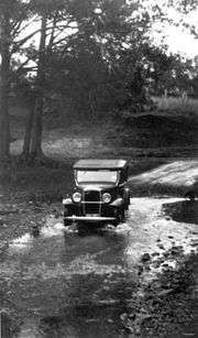 Driving across Palen Creek, 1934 | |||||||||||||||
 Palen Creek | |||||||||||||||
| Coordinates | 28.2886°S 152.8069°E | ||||||||||||||
| Population | 280 (2016 census)[1] | ||||||||||||||
| • Density | 2.78/km2 (7.19/sq mi) | ||||||||||||||
| Postcode(s) | 4287 | ||||||||||||||
| Area | 100.8 km2 (38.9 sq mi) | ||||||||||||||
| Time zone | AEST (UTC+10:00) | ||||||||||||||
| Location |
| ||||||||||||||
| LGA(s) | Scenic Rim Region | ||||||||||||||
| State electorate(s) | Scenic Rim | ||||||||||||||
| Federal Division(s) | Wright | ||||||||||||||
| |||||||||||||||
Tylerville is a neighbourhood within Palen Creek (28.2931°S 152.7847°E).[4]
Geography
The terrain is rugged with many sloped sections heavily vegetated. Lower elevations start at around 90 metres (300 ft) above sea level while in the south the McPherson Range climbs above 600 metres (2,000 ft). In the southeast lies multiple sections of Palen State Forest and part of Mount Barney National Park. On the slopes of Mount Giles in the west is another forest reserve. Between the two, the Mount Lindesay Highway winds along the valley floor.
Palen Creek (the creek from which the locality takes its name) rises in the south of locality, just north of the border with New South Wales (28.3596°S 152.7606°E). It then flows north through the locality towards Rathdowney, where it becomes a tributary of the Logan River (28.2239°S 152.8583°E).[5][3]
The Palen Creek Correctional Centre is located on the highway in the south west (28.3259°S 152.7695°E). The facility can hold up to 170 low-security prisoners in a campus style rural environment.[6]
History
In 1877, 15,500 acres (6,300 ha) were resumed from the Melcombe and Palen pastoral runs and offered for selection on 17 April 1877.[7]
Timber was an important early industry and there were two sawmills, one at Palen Creek owned by Campbells and one at Tylerville owned by Alfred John Raymond. These no longer exist.[8][9][10][11][12]
Palen Creek Provisional School opened on 23 October 1893. On 1 January 1909 it became Palen Creek State School. It and closed in 1962.[13] It was located near the Palen Creek School Road junction with the Mount Lindesay Highway (approx 28.2774°S 152.8002°E).[14]
Tylerville State School opened on 18 January 1909. It closed on 1962.[13] It was located on Mount Lindesay Highway (28.3157°S 152.7761°E).[14]
At the 2011 census Palen Creek and surrounds recorded a population of 219.[15]
In the 2016 census, Palen Creek had a population of 280 people.[1]
Heritage listings
Palen Creek has the following heritage-listed sites:
- 11605 Mount Lindesay Highway: St James Catholic Church and cemetery (28.2843°S 152.7930°E)[16]
Education
There are no schools in Palen Creek. The nearest primary school is Rathdowney State School in neighbouring Rathdowney. The nearest secondary schools are Beaudesert State High School in Beaudesert and Boonah State High School in Boonah.[3]
References
- Australian Bureau of Statistics (27 June 2017). "Palen Creek (SSC)". 2016 Census QuickStats. Retrieved 20 October 2018.

- "Palen Creek - locality in Scenic Rim Region (entry 45180)". Queensland Place Names. Queensland Government. Retrieved 27 January 2020.
- "Queensland Globe". State of Queensland. Retrieved 3 May 2020.
- "Tylerville - neighbourhood in the Scenic Rim Region (entry 35692)". Queensland Place Names. Queensland Government. Retrieved 3 May 2020.
- "Palen Creek - watercourse in the Scenic Rim Region (entry 25831)". Queensland Place Names. Queensland Government. Retrieved 4 May 2020.
- "Palen Creek Correctional Centre". Department of Community Safety. Archived from the original on 29 March 2016. Retrieved 27 March 2016.
- "Proclamations under the New Land Acts". The Brisbane Courier. Queensland, Australia. 2 March 1877. p. 3. Retrieved 19 February 2020 – via Trove.
- "History of Rathdowney". Rathdowney Information Centre and Historical Museum. Archived from the original on 3 May 2020. Retrieved 4 May 2020.
- "BORDER TRIDE". The Brisbane Courier. Queensland, Australia. 3 March 1914. p. 4. Retrieved 4 May 2020 – via Trove.
- "THE UPPER LOGAN". The Brisbane Courier. Queensland, Australia. 27 September 1913. p. 12. Retrieved 4 May 2020 – via Trove.
- "MR. H. G. GRAY". The Beaudesert Times. Queensland, Australia. 24 September 1948. p. 5. Retrieved 4 May 2020 – via Trove.
- "COUNTRY NEWS". The Queenslander. Queensland, Australia. 6 December 1902. p. 1235. Retrieved 4 May 2020 – via Trove.
- Queensland Family History Society (2010), Queensland schools past and present (Version 1.01 ed.), Queensland Family History Society, ISBN 978-1-921171-26-0
- "Mt Lindsay" (Map). Queensland Government. 1944. Archived from the original on 29 April 2020. Retrieved 29 April 2020.
- Australian Bureau of Statistics (31 October 2012). "Palen Creek (State Suburb)". 2011 Census QuickStats. Retrieved 28 March 2016.
- "Local Heritage Register" (PDF). Scenic Rim Regional Council. Archived from the original (PDF) on 24 September 2015. Retrieved 9 February 2015.
External links
![]()