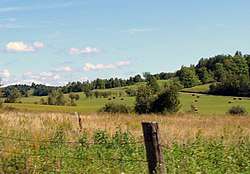
Ogden, Quebec
Ogden is a municipality of about 750 people in Memphrémagog Regional County Municipality in the Estrie region of Quebec, Canada. It includes the hamlets of Tomifobia (formerly Smith's Mills)[5] and Graniteville.
Ogden | |
|---|---|
Municipality | |
 | |
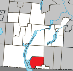 Location within Memphrémagog RCM | |
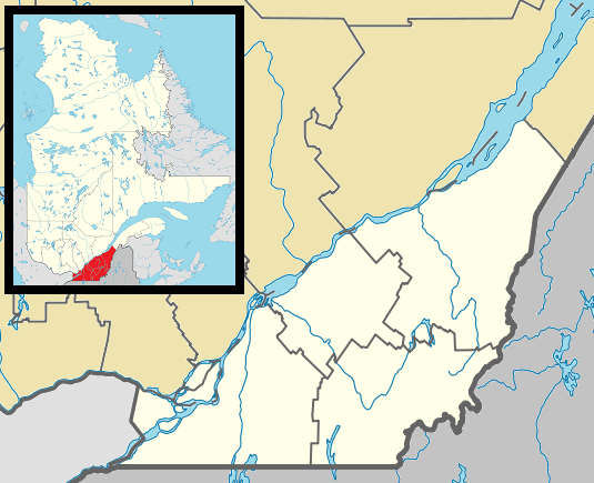 Ogden Location in southern Quebec | |
| Coordinates: 45°03′N 72°08′W[1] | |
| Country | |
| Province | |
| Region | Estrie |
| RCM | Memphrémagog |
| Constituted | January 23, 1932 |
| Government | |
| • Mayor | Richard Violette |
| • Federal riding | Compton—Stanstead |
| • Prov. riding | Orford |
| Area | |
| • Total | 84.10 km2 (32.47 sq mi) |
| • Land | 74.77 km2 (28.87 sq mi) |
| Population (2011)[4] | |
| • Total | 770 |
| • Density | 10.3/km2 (27/sq mi) |
| • Pop 2006-2011 | |
| • Dwellings | 522 |
| Time zone | UTC−5 (EST) |
| • Summer (DST) | UTC−4 (EDT) |
| Postal code(s) | J0B 3E3 |
| Area code(s) | 819 |
| Highways | |
| Website | www |
Demographics
Population
Population trend:[6]
| Census | Population | Change (%) |
|---|---|---|
| 2011 | 770 | |
| 2006 | 762 | |
| 2001 | 762 | |
| 1996 | 769 | |
| 1991 | 746 | N/A |
Language
Mother tongue (2011)[4]
| Language | Population | Pct (%) |
|---|---|---|
| French only | 365 | 47.1% |
| English only | 375 | 48.4% |
| English and non-official language | 5 | 0.7% |
| Both English and French | 15 | 1.9% |
| Other languages | 15 | 1.9% |
See also
References
- Reference number 45244 of the Commission de toponymie du Québec (in French)
- "Ministère des Affaires municipales, des Régions et de l'Occupation du territoire: Ogden". Archived from the original on 2011-12-27. Retrieved 2012-03-11.
- Parliament of Canada Federal Riding History: COMPTON--STANSTEAD (Quebec)
- 2011 Statistics Canada Census Profile: Ogden, Quebec
- "Liste des municipalités" (in French). Memphrémagog Regional County Municipality. Archived from the original on 2009-08-05. Retrieved 2009-10-12.
- Statistics Canada: 1996, 2001, 2006, 2011 census
External links

Places adjacent to Ogden, Quebec | |
|---|---|
| Cities & Towns | |
|---|---|
| Municipalities |
|
| Townships | |
| Villages | |
| |
This article is issued from Wikipedia. The text is licensed under Creative Commons - Attribution - Sharealike. Additional terms may apply for the media files.