Oberheimbach
Oberheimbach is an Ortsgemeinde – a municipality belonging to a Verbandsgemeinde, a kind of collective municipality – in the Mainz-Bingen district in Rhineland-Palatinate, Germany.
Oberheimbach | |
|---|---|
 Coat of arms | |
Location of Oberheimbach within Mainz-Bingen district 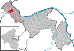 | |
 Oberheimbach  Oberheimbach | |
| Coordinates: 50°01′25″N 07°47′09″E | |
| Country | Germany |
| State | Rhineland-Palatinate |
| District | Mainz-Bingen |
| Municipal assoc. | Rhein-Nahe |
| Government | |
| • Mayor | Gerhard Leinberger |
| Area | |
| • Total | 8.72 km2 (3.37 sq mi) |
| Elevation | 140 m (460 ft) |
| Population (2018-12-31)[1] | |
| • Total | 546 |
| • Density | 63/km2 (160/sq mi) |
| Time zone | CET/CEST (UTC+1/+2) |
| Postal codes | 55413 |
| Dialling codes | 06743 |
| Vehicle registration | MZ |
| Website | www.oberheimbach.de |
The inhabitants of this small place are known colloquially as Uhlen.
Geography
Location
Oberheimbach lies between Koblenz and Bad Kreuznach in the valley of the Heimbach. The winegrowing centre belongs to the Verbandsgemeinde of Rhein-Nahe, whose seat is in Bingen am Rhein, although that town is not within its bounds. Since 2003, Oberdiebach has been part of the Rhine Gorge UNESCO World Heritage Site.
History
In 983, Oberheimbach had its first documentary mention.
Politics
Economy and infrastructure
Winegrowing
| Biggest winegrowing centres in the growing region |
Ranking among all Rhineland-Palatinate winegrowing centres by vineyard area |
Vineyards under cultivation |
Grape varieties | |
|---|---|---|---|---|
| White | Red | |||
| ha | % | |||
Middle Rhine |
445 | 85.3 | 14.7 | |
| Boppard | 265 | 64 | 86.9 | 13.1 |
| Oberheimbach | 279 | 59 | 89.7 | 10.3 |
Oberheimbach is characterized by winegrowing, and with 59 ha of vineyards under cultivation, it is the biggest winegrowing centre on the Middle Rhine after Boppard (64 ha).
Transport
Bundesstraße 9, which links Mainz with Koblenz, lies northeast of the municipality, roughly 2 km away. The Rheinböllen interchange on the Autobahn A 61 lies roughly 15 km away. The nearest railway station is in Niederheimbach on the Mainz-Koblenz line.
References
- "Bevölkerungsstand 2018 - Gemeindeebene". Statistisches Landesamt Rheinland-Pfalz (in German). 2019.
External links
| Wikimedia Commons has media related to Oberheimbach. |
- Municipality’s official webpage (in German)