Hahnheim
Hahnheim is an Ortsgemeinde – a municipality belonging to a Verbandsgemeinde, a kind of collective municipality – in the Mainz-Bingen district in Rhineland-Palatinate, Germany.
Hahnheim | |
|---|---|
 Coat of arms | |
Location of Hahnheim within Mainz-Bingen district 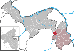 | |
 Hahnheim  Hahnheim | |
| Coordinates: 49°51′38″N 8°14′12″E | |
| Country | Germany |
| State | Rhineland-Palatinate |
| District | Mainz-Bingen |
| Municipal assoc. | Rhein-Selz |
| Government | |
| • Mayor | Sigrid Mangold-Wegner (SPD) |
| Area | |
| • Total | 6.39 km2 (2.47 sq mi) |
| Elevation | 124 m (407 ft) |
| Population (2018-12-31)[1] | |
| • Total | 1,572 |
| • Density | 250/km2 (640/sq mi) |
| Time zone | CET/CEST (UTC+1/+2) |
| Postal codes | 55278 |
| Dialling codes | 06737 |
| Vehicle registration | MZ |
| Website | www.hahnheim.de |
Geography
Location
Hahnheim lies between Mainz and Worms on the river Selz. The winegrowing centre belongs to the Verbandsgemeinde Rhein-Selz, whose seat is in Oppenheim.
Politics
Municipal council
The council is made up of 17 council members, counting the part-time mayor, with seats apportioned thus:
| CDU | SPD | FWG | Total | |
| 2004 | 4 | 5 | 7 | 16 |
(as at municipal election held on 13 June 2004)
Coat of arms
The municipality's arms might be described thus: Per fess gules and argent, a cock repassant counterchanged.
Culture and sightseeing
Jewish graveyard
In the countryside towards Köngernheim on the highway going towards Bundesstraße 420 is an old Jewish graveyard.
Biotopes
In the countryside, especially along the Selz and on the former Alzey–Bodenheim railway right-of-way – the “Amiche” – several biotopes have been established.
Economy and infrastructure
Transport
The municipality is crossed by the L 432 state road. Bundesstraße 420 lies 2 km to the south. The A 60 and A 63 autobahns can be reached by car in 20 and 10 minutes respectively.
References
- "Bevölkerungsstand 2018 - Gemeindeebene". Statistisches Landesamt Rheinland-Pfalz (in German). 2019.
External links
| Wikimedia Commons has media related to Hahnheim. |
- Municipality’s official webpage (in German)
| Authority control |
|
|---|