Dienheim
Dienheim is an Ortsgemeinde – a municipality belonging to a Verbandsgemeinde, a kind of collective municipality – in the Mainz-Bingen district in Rhineland-Palatinate, Germany.
Dienheim | |
|---|---|
 Coat of arms | |
Location of Dienheim within Mainz-Bingen district 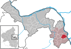 | |
 Dienheim  Dienheim | |
| Coordinates: 49°50′25″N 8°21′2″E | |
| Country | Germany |
| State | Rhineland-Palatinate |
| District | Mainz-Bingen |
| Municipal assoc. | Rhein-Selz |
| Government | |
| • Mayor | Norbert Jochem |
| Area | |
| • Total | 9.90 km2 (3.82 sq mi) |
| Highest elevation | 120 m (390 ft) |
| Lowest elevation | 90 m (300 ft) |
| Population (2018-12-31)[1] | |
| • Total | 2,221 |
| • Density | 220/km2 (580/sq mi) |
| Time zone | CET/CEST (UTC+1/+2) |
| Postal codes | 55276 |
| Dialling codes | 06133 |
| Vehicle registration | MZ |
| Website | www |
Geography
Location
Dienheim lies between Mainz and Worms, in Rhenish Hesse. The winemaking centre belongs to the Verbandsgemeinde Rhein-Selz, whose seat is in Oppenheim.
History
In the 8th century, Dienheim had its first documentary mention. The village passed in Charlemagne’s time to the Fulda Abbey. Later it ended up as an Imperial pledge in Electoral Palatinate’s ownership.[2]
From the early 13th century, the Barons of Dienheim are witnessed, later, from the 16th to 18th century, being assigned to the Rhenish Knightly District’s (Rheinischer Ritterkreis) canton of Oberrheinstrom.[3]
Politics
Town council
The council is made up of 17 council members, counting the part-time mayor, with seats apportioned thus:
| SPD | CDU | FWG | Total | |
| 2004 | 5 | 4 | 7 | 16 seats |
(as at municipal election held on 13 June 2004)
Coat of arms
The municipality's arms might be described thus: Per pale sable and argent a lion rampant Or armed gules and a cross of the first.[4]
Town partnerships

Economy and infrastructure
Transport
Highways
The municipality lies on Bundesstraße 9 linking Mainz with Worms. Since December 2007, the B 9, which had until then run through the built-up area, has run instead along a bypass alongside the railway line.
The Autobahnen A 60 and A 63 can each be reached in roughly 20 minutes.
Local public transport
Once the Mainz-Ludwigshafen railway line is integrated into the RheinNeckar S-Bahn in 2015, there will be a stop somewhere near the sporting ground.
References
- "Bevölkerungsstand 2018 - Gemeindeebene". Statistisches Landesamt Rheinland-Pfalz (in German). 2019.
- Gerhard Köbler, Historisches Lexikon der deutschen Länder: Die deutschen Territorien vom Mittelalter bis zur Gegenwart, 3., verbesserte, um ein Register erweiterte Auflage, C. H. Beck, München 1990, Dienheim (Reichsdorf) p. 110.
- Gerhard Köbler, Historisches Lexikon der deutschen Länder: Die deutschen Territorien vom Mittelalter bis zur Gegenwart, 3., verbesserte, um ein Register erweiterte Auflage, C. H. Beck, München 1990, Dienheim (Freiherren, Reichsritter) p. 110.
- The tinctures named here are the ones in the German blazon; the Or (gold) and gules (red) are not rendered in the image of the arms used in this article
External links
| Wikimedia Commons has media related to Dienheim. |
- Municipality’s official webpage (in German)
| Authority control |
|
|---|