Nyanga, Cape Town
Nyanga is a township in the Western Cape, South Africa. Its name in Xhosa means ‘moon’ and it is one of the oldest black townships in Cape Town. It was established as a result of the migrant labour system. In 1948[2] black migrants were forced to settle in Nyanga as Langa became too small. Nyanga was one of the poorest places in Cape Town and is still is one of the dangerous parts of Cape Town. In 2001 its unemployment was estimated at around 56% [3] and HIV/AIDS is a huge community issue. The township is known as the "murder capital" of South Africa.[4]
Nyanga | |
|---|---|
 Top: Zolani Recreational Centre. Middle: Nyanga taxi rank. Bottom left: Nyanga Community Health Centre. Bottom right: government built RDP houses that are common in the area. | |
 Nyanga  Nyanga | |
| Coordinates: 33°59′S 18°35′E | |
| Country | South Africa |
| Province | Western Cape |
| Municipality | City of Cape Town |
| Area | |
| • Total | 3.09 km2 (1.19 sq mi) |
| Population (2011)[1] | |
| • Total | 57,996 |
| • Density | 19,000/km2 (49,000/sq mi) |
| Racial makeup (2011) | |
| • Black African | 98.8% |
| • Coloured | 0.3% |
| • Indian/Asian | 0.1% |
| • White | 0.2% |
| • Other | 0.7% |
| First languages (2011) | |
| • Xhosa | 90.2% |
| • English | 3.0% |
| • Sotho | 1.6% |
| • Other | 5.1% |
| Time zone | UTC+2 (SAST) |
| Postal code (street) | 7755 |
| PO box | 7750 |
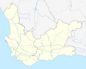
Nyanga is situated 26 km (16 mi) from Cape Town along N2 highway, close to the Cape Town International Airport and next to the townships of Gugulethu and Crossroads.
History
The neighborhood was established in 1946 and proclaimed a township in the same year for migrant labour predominantly from the Eastern Cape. It was initially established as a spillover once the neighborhood of Langa was fully occupied.[5]
Residents of Nyanga were active in joining a national call to protest against the apartheid laws passed in 1960. Later they were active in the 1976 student uprisings against the use of Afrikaans as first language in schools.[6] Nyanga became notorious for its black on black faction fighting that was allegedly perpetrated by police in the early eighties. The local authorities (izibonda) grouped themselves according to their background and used that as their criteria when allocating land.
These cultural differences were allegedly used by the police to stir up violence, and elements of the community were infiltrated by the apartheid regime. This led to emergence of the notoriously violent group called "the witdoeke" (the white scarfs). As a result of these fights Tambo square was formed.[7]
Nyanga is made up by nine townships (Lusaka, KTC, Old Location, Maumau, Zwelitsha, Maholweni "Hostels", Black City, White City, Barcelona, Kanana and Europe).
Nyanga is one of the world's most dangerous areas, and had the highest number of murders (262) in South Africa during 2012.[8]
See also
References
- "Main Place Nyanga". Census 2011.
- Catherine Besteman (2008). Transforming Cape Town. University of California Press. ISBN 978-0-520-94264-6.
- "City of Cape Town by Ward". capetown.gov.za. Retrieved 2012-08-15.
- "Zille aims to close 25 000 shebeens". IOL News. Retrieved 17 September 2013.
- Leander (2013-11-08). "Nyanga Township". South African History Online. Retrieved 2019-02-16.
- sahoboss (2011-03-31). "Cape Schools Join the Revolt". South African History Online. Retrieved 2019-02-16.
- "Archived copy". Archived from the original on 2013-09-03. Retrieved 2013-08-30.CS1 maint: archived copy as title (link)
- Sesant, Siyabonga. "Crime still rife in Nyanga".
.svg.png)