Brackenfell
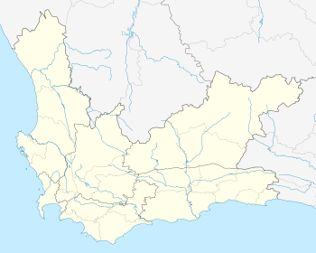
Brackenfell is a town in the Western Cape province of South Africa at the gateway to the Cape Winelands. Organisationally and administratively it is included in the City of Cape Town Metropolitan Municipality as a Northern Suburb and is about 30 kilometres (19 mi) east of Cape Town City Bowl. In Brackenfell a variety of property situated on the foothills of the Bottelary Hills can be found.[2][3][4]
Brackenfell | |
|---|---|
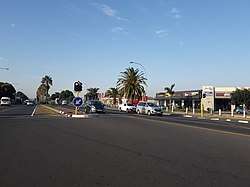 Brackenfell Central Business District with its main road, Old Paarl Road | |
 Brackenfell  Brackenfell | |
| Coordinates: 33°52′00″S 18°41′00″E | |
| Country | South Africa |
| Province | Western Cape |
| Municipality | City of Cape Town |
| Established | 1913 |
| Area | |
| • Total | 25.27 km2 (9.76 sq mi) |
| Population (2011)[1] | |
| • Total | 44,842 |
| • Density | 1,800/km2 (4,600/sq mi) |
| Racial makeup (2011) | |
| • Black African | 9.8% |
| • Coloured | 9.0% |
| • Indian/Asian | 0.8% |
| • White | 79.0% |
| • Other | 1.4% |
| First languages (2011) | |
| • Afrikaans | 71.1% |
| • English | 20.8% |
| • Xhosa | 3.4% |
| • Other | 4.7% |
| Time zone | UTC+2 (SAST) |
| Postal code (street) | 7560, 7561, 7562 |
| PO box | 7561 |
| Area code | 021 |
The Bracken Nature Reserve, situated in the Ruwari suburban area, was once a quarry site and was later declared a nature reserve after some negotiations between the Cape Town City Council and the Stellenbosch Divisional Council.
Brackenfell offers schools, shopping malls and medical services, and many different sporting facilities.
History
The earliest activity on what today is known as Brackenfell was when the “de Clapmuts” was a refreshment post. Brackenfell specifically form part of Klapmutsberg, better known as de Bottelarij. In 1712 the area known as “Kruispad” was transferred to Selie, J. Kruispad was owned by Brink, A. and in 1901 he sold it to a Scottish Immigrant Walton, G.H. The flora on this farm reminded him of the same in Scotland. He call it Brackenfell (Bracken means fern; Fell means hill). The richness of granite in the area let to the farm being sold to a Brick company in 1903 and a granite quarry was established. Activity here stopped in 1948. In 1904 a railway station was established. [5] [6] [7]
Brackenfell used to be a major road crossing during the earlier days of Cape Town, but today it is a well-known suburb located behind the 'boerewors gordyn’ which translates to sausage curtain, meaning; people living in this area, braai (barbecue) boerewors very often. “Gordyn” curtain is just by figure of speech. It's all said tongue-in-the-cheek.
Geography
Brackenfell is located on the outskirts of the Cape Metropole (greater Cape Town metropolitan area). It is located on the north-western rural-urban fringe of the metropolitan area. Being on the outskirts of the city and at the gateway of the Cape Winelands means that Stellenbosch, Paarl and Durbanville's wine farms are in easy access. [8]
Located more or less halfway between the Cape Town city centre and Paarl, Brackenfell is approximately 30 km north-east of the Cape Town CBD and 35 km south-west of Paarl.[9][10]
The suburb is bordered by Kraaifontein in the east, Kuilsrivier in the south, Durbanville in the north and Bellville in the west.
Suburban areas
- Arauna (residential)
- Bracken Heights (residential)
- Brackenfell Industria (industrial)
- Brackenfell North (residential)
- Brackenfell South (residential)
- Burgundy (residential)
- Cape Gate (commercial)
- De Oude Spruit (residential)
- De Tuin (residential)
- Edenpark (residential)
- Everite (industrial)
- Ferndale (residential)
- Morgenster (residential)
- Morgenster Hoogtes (residential)
- Normande (residential
- Northpine (residential)
- Protea Heights (residential)
- Protea Village (residential)
- Ruwari (residential)
- Sonkring (residential)
- Springbokpark (residential)
- Vredekloof (residential)
- Vredekloof Heights (residential)
- Vredekloof Rand (residential)
- Welgeleë (residential)
Economy
Brackenfell is home to many retail companies' head offices such as Shoprite, Checkers (falls under Shoprite) as well as Food Lover's Market. Shoprite-Checkers have a new distribution centre which was completed in 2019 in the Brackengate 2 Business Park named the Cilmore Distribution Centre. [11][12][13]
Industrialisation
The industrialisation in Brackenfell is rapidly increasing with the current second phase of the Brackengate Business Park known as Brackengate 2. The Brackengate area is located is along the R300 highway.
The initial Brackengate known as Brackengate Business Park includes Food Lover's Market's head office and have light industrial businesses. The second section or phase of the Brackengate area is known as Brackengate 2 which includes Shoprite and Checkers' distribution centre and other industrial companies and stores. [14][15]
Other industrial areas in Brackenfell include Okavango Park and Brackenfell Industria.
Shopping
Brackenfell is also home to one of the largest shopping centres in the Western Cape province, Cape Gate Shopping Centre. Cape Gate Shopping Centre is located in the shopping district of Cape Gate which is along the N1 with over 160 stores.[16][17]
Other shopping centres in Brackenfell include the Brackenfell Shopping Centre, Fairbridge Mall and Brackenfell Centre which are on Old Paarl Road, the Glengarry Shopping Centre located in the northern suburb of Vredekloof and Boulevard Square located in the southern suburb of Protea Heights.[18][19][20][21][22]
Schools
- Bastion Primary School
- Brackenfell High School
- Brackenfell Primary School
- Brooklands Primary School
- Curro (private primary school)
- Curro Castle (private nursery / pre-primary school)
- Destinatus Private School
- Northpine Primary School
- Northpine Technical High School
- Paarl School
- Protea Heights Academy (high school)
- Vredekloof Primary School
Road network
Brackenfell is considered one of the Cape Town's most strategically located suburbs, located between two major highways, the N1 and R300. Another important route is the R101 (Old Paarl Road) which is the town's main road. The Old Paarl Road, as the name suggests links to Paarl as well as Bellville, Kraaifontein and Worcester.
Many metropolitan routes also run through the town such as the M23, M25, M73, M100 and M137. These routes connect to surrounding suburbs such as Durbanville, Bellville and Kraaifontein. The M23 also connects to Stellenbosch, a town near the Cape Metropole.
Coat of arms
Brackenfell was a municipality from 1970 to 1996. In November 1971, the council registered a coat of arms at the Bureau of Heraldry.[23]
The arms, designed by Cornelis Pama, were Per chevron embowed Or and Vert, three shot balls counterchanged, i.e. a shield divided by a curved chevron-shaped line into gold and green, with two green balls at the top and a golden ball at the bottom. The crest was three ferns with the motto Tenax in fide.
Trivia
- Currently, Brackenfell (together with Kuilsriver) uses the prefix "CFR-" in their registered motor vehicles (since approximately 2000 the prefix "CF-" which had formerly been allocated to Grahamstown has also been allocated to these suburbs).
- Kanonkop (directly translated to cannon head) Brackenfell's highest point in Ruwari, was used as a signal point with its signal cannons in the 1700s. Cannons can be seen at Brackenfell High School and Bastion Primary School.
- In Vredekloof Street in Vredekloof (a residential area of Brackenfell) the bird, the Cape Robin nest and is commonly known as Jan Frederik.
- The popular cooking and grill sauce Jimmy's Sauces CC is produced in Brackenfell and is sold not only in South Africa but also all over the world.
External links
References
- "Main Place Brackenfell". Census 2011.
- "Brackenfell in Western Cape Area Overview | C4 Property Group". www.c4propertygroup.co.za. Retrieved 20 June 2020.
- "Brackenfell". www.sa-venues.com. Retrieved 20 June 2020.
- "Distance Cape-Town, Western-Cape, ZAF > Brackenfell, City-of-Cape-Town, Western-Cape, ZAF - Air line, driving route, midpoint". www.distance.to. Retrieved 21 June 2020.
- "Brackenfell". Retrieved 2 May 2018.
- Raper, R.E. "Dictionary of Southern African Place Names". Retrieved 2 May 2018.
- Rossouw, E. "Brackenfell Geskiedenis van dorp en sy plase (Translated: Brackenfell, History of town and it farms)". Retrieved 2 May 2018.
- "The 11 best places in Brackenfell, Cape Town — Best Price Guarantee". www.afristay.com. Retrieved 22 June 2020.
- "Distance Brackenfell, City-of-Cape-Town, Western-Cape, ZAF > Paarl, Cape-Winelands, Western-Cape, ZAF - Air line, driving route, midpoint". www.distance.to. Retrieved 20 June 2020.
- "Distance Brackenfell, City-of-Cape-Town, Western-Cape, ZAF > Cape-Town, Western-Cape, ZAF - Air line, driving route, midpoint". www.distance.to. Retrieved 20 June 2020.
- "Shoprite Holdings | Contact Shoprite Holdings". www.shopriteholdings.co.za. Retrieved 4 June 2020.
- "Contact". Food Lovers Market. Retrieved 4 June 2020.
- "Take a look: Inside Shoprite's massive warehouse - which operates in near total silence". BusinessInsider. Retrieved 4 June 2020.
- "Easily find Commercial and Industrial properties to let and for sale in South Africa with Anvil Property Smith". ANVIL Property Smith. Retrieved 4 June 2020.
- "Brackengate 2 | LEASE SECURE, CUSTOM-BUILT PREMISES ON CAPE TOWN'S R300". Retrieved 4 June 2020.
- "Cape Gate Shopping Centre". capegatecentre.co.za. Retrieved 20 June 2020.
- Writer, Staff. "These are the biggest shopping malls in South Africa – BusinessTech". Retrieved 20 June 2020.
- "Brackenfell Shopping Centre | Retail Shops to let in Brackenfell". www.rennieproperty.co.za. Retrieved 20 June 2020.
- "Fairbridge Mall". TravelGround. Retrieved 20 June 2020.
- "Brackenfell Hyper | Shopping Centre - Convenience Made Easy". Brackenfell Centre. Retrieved 20 June 2020.
- "Glengarry Shopping Centre | Vredekloof, Durbanville - Right Here For You!". Glengarry Shopping Centre. Retrieved 20 June 2020.
- "HERE. Maps for Life". mobile.here.com. Retrieved 20 June 2020.
- http://www.national.archsrch.gov.za%5B%5D
Communities of City of Cape Town Metropolitan Municipality, Western Cape | ||
|---|---|---|
Seat: Cape Town | ||
| Atlantic Seaboard | .svg.png) City of Cape Town within South Africa | |
| Blaauwberg | ||
| Cape Flats | ||
| City Centre | ||
| Helderberg | ||
| Northern Suburbs | ||
| Southern Suburbs | ||
| South Peninsula | ||