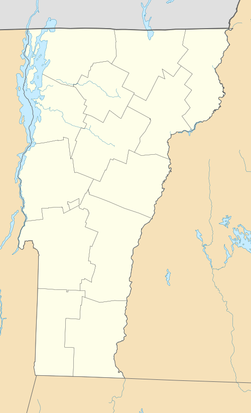
North Bennington, Vermont
North Bennington is an incorporated village in the town of Bennington in Bennington County, Vermont, United States. The population was 1,643 at the 2010 census.[6]
North Bennington, Vermont | |
|---|---|
 | |
 North Bennington Location within the state of Vermont | |
| Coordinates: 42°55′49″N 73°14′33″W | |
| Country | United States |
| State | Vermont |
| County | Bennington |
| Area | |
| • Total | 1.89 sq mi (4.89 km2) |
| • Land | 1.86 sq mi (4.82 km2) |
| • Water | 0.03 sq mi (0.07 km2) |
| Elevation | 640 ft (195 m) |
| Population (2010) | |
| • Total | 1,643 |
| • Estimate (2018)[2] | 1,613 |
| • Density | 866.27/sq mi (334.45/km2) |
| Time zone | UTC-5 (Eastern (EST)) |
| • Summer (DST) | UTC-4 (EDT) |
| ZIP code | 05257 |
| Area code | 802 |
| FIPS code | 50-49075[3] |
| GNIS feature ID | 1461213[4] |
North Bennington Historic District | |
| Location | VT 67 and VT 67A, North Bennington, Vermont |
| Coordinates | 42°55′48″N 73°14′35″W |
| Architectural style | Greek Revival, Italianate |
| NRHP reference No. | 80000328[5] |
| Added to NRHP | August 29, 1980 |
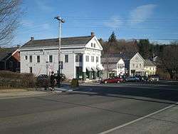
The North Bennington Historic District was added to the National Register of Historic Places in 1980. The district covers an area of 112 acres (0.45 km2) and includes 164 contributing buildings and two contributing sites. It is home to the Park-McCullough Historic House, a well-preserved, 35-room, Victorian country house. The H.C. White site, at the southern end of the village, was added to the Register in 2009.
North Bennington's boundary with Bennington cuts across the grounds of Bennington College. North Bennington is home to several manufacturing companies, including Dion Snowshoes, National Hanger Company, PortaBrace and Sterling Gun Drills.
Geography
North Bennington is located in the northwest part of the town of Bennington and is bordered to the north by the town of Shaftsbury. The southern border of the village follows the Walloomsac River. Vermont Route 67 passes through the village, leading northeast to South Shaftsbury and west to the New York state line, where it becomes New York State Route 67, continuing on to North Hoosick. Vermont Route 67A intersects VT 67 in the center of North Bennington and leads southeast to downtown Bennington.
Bennington College occupies a hill on the southeast border of the village.
According to the United States Census Bureau, the village has a total area of 1.89 square miles (4.89 km2), of which 1.86 square miles (4.82 km2) is land and 0.027 square miles (0.07 km2), or 1.40%, is water.[6]
Demographics
| Historical population | |||
|---|---|---|---|
| Census | Pop. | %± | |
| 1900 | 670 | — | |
| 1910 | 663 | −1.0% | |
| 1920 | 818 | 23.4% | |
| 1930 | 933 | 14.1% | |
| 1940 | 992 | 6.3% | |
| 1950 | 1,327 | 33.8% | |
| 1960 | 1,437 | 8.3% | |
| 1970 | 984 | −31.5% | |
| 1980 | 1,685 | 71.2% | |
| 1990 | 1,520 | −9.8% | |
| 2000 | 1,428 | −6.1% | |
| 2010 | 1,643 | 15.1% | |
| Est. 2018 | 1,613 | [2] | −1.8% |
| U.S. Decennial Census[7] | |||
At the 2010 census,[3] there were 1,643 people, 464 households and 263 families residing in the village. The population density was 864.7 per square mile (342.3/km²). There were 510 housing units at an average density of 283.3/sq mi (106.3/km²). The racial makeup was 95.5% White, 3.0% African American, 0.7% Native American, 2.0% Asian, 0.1% Pacific Islander, 1.2% from other races, and 2.3% from two or more races. Hispanic or Latino of any race were 2.0% of the population.
There were 464 households of which 25.6% had children under the age of 18 living with them, 44.2% were couples living together and joined in either marriage or civil union, 8.2% had a female householder with no husband present, 4.3% had a male householder with no female present, and 43.3% were non-families. 43.3% of all households were made up of individuals and 19.4% had someone living alone who was 65 years of age or older. The average household size was 2.23 and the average family size was 2.90.
29.6% of the population were under the age of 19, 24.0% from 20 to 24, 19.7% from 25 to 44, 13.8% from 45 to 64, and 19.4% who were 65 years of age or older. The median age was 29 years. For every 100 females, there were 73.5 males. For every 100 females age 18 and over, there were 67.3 males.
The median household income was $39,861 and the median family income was $61,875. Males had a median income of $26,250 and females $29,063. The per capita income was $19,774. About 3.5% of families and 20.0% of the population were below the poverty line, including 6.5% of those under age 18 and 4.7% of those age 65 or over.
Transportation
North Bennington is crossed by:


Local public transportation by bus is provided by the Green Mountain Express' Brown Line on weekdays.
Until 1953 the Rutland Railroad ran passenger trains Green Mountain Flyer and Mount Royal through North Bennington.[8]
Notable people
- Hiland Hall, U.S. congressman from Vermont
- Shirley Jackson, author (The Lottery, The Haunting of Hill House), lived in North Bennington
- Jamaica Kincaid, author (Lucy); lived in North Bennington
- John G. McCullough, 49th Governor of Vermont
References
- "2018 U.S. Gazetteer Files". United States Census Bureau. Retrieved Feb 16, 2020.
- "Population and Housing Unit Estimates". Retrieved June 4, 2019.
- "U.S. Census website". United States Census Bureau. Retrieved 2008-01-31.
- "US Board on Geographic Names". United States Geological Survey. 2007-10-25. Retrieved 2008-01-31.
- "National Register Information System". National Register of Historic Places. National Park Service. March 13, 2009.
- "Geographic Identifiers: 2010 Demographic Profile Data (G001): North Bennington village, Vermont". U.S. Census Bureau, American Factfinder. Archived from the original on February 12, 2020. Retrieved April 30, 2014.
- "Census of Population and Housing". Census.gov. Retrieved June 4, 2015.
- American Rails, "Green Mountain Flyer" https://www.american-rails.com/grn-mtn-fyr.html
External links
| Wikimedia Commons has media related to North Bennington, Vermont. |
- The Fund for North Bennington, community non-profit organization
Municipalities and communities of Bennington County, Vermont, United States | ||
|---|---|---|
| Towns | 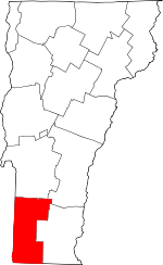 Map of Vermont highlighting Bennington County | |
| Villages | ||
| CDPs |
| |
| Other communities | ||
| Footnotes | ‡ Disincorporated | |
| Topics | |
|---|---|
| Lists by state |
|
| Lists by insular areas | |
| Lists by associated state | |
| Other areas | |
| Related | |
| |
| Authority control |
|
|---|