Noosaville, Queensland
Noosaville is a town and suburb in Noosa in the Shire of Noosa, Queensland, Australia.[2][3] In the 2016 census, Noosaville had a population of 8,124 people.[1]
| Noosaville Noosa, Queensland | |||||||||||||||
|---|---|---|---|---|---|---|---|---|---|---|---|---|---|---|---|
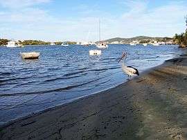 A pelican on Noosa River, Noosaville | |||||||||||||||
 Noosaville | |||||||||||||||
| Coordinates | 26.3980°S 153.0616°E | ||||||||||||||
| Population | 8,124 (2016 census)[1] | ||||||||||||||
| • Density | 314.9/km2 (815.5/sq mi) | ||||||||||||||
| Postcode(s) | 4566 | ||||||||||||||
| Area | 25.8 km2 (10.0 sq mi) | ||||||||||||||
| Time zone | AEST (UTC+10:00) | ||||||||||||||
| Location |
| ||||||||||||||
| LGA(s) | Shire of Noosa | ||||||||||||||
| State electorate(s) | Noosa | ||||||||||||||
| Federal Division(s) | Wide Bay | ||||||||||||||
| |||||||||||||||
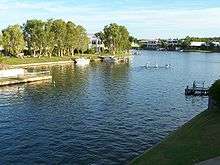
Geography
.jpg)
Noosaville is bounded by the Noosa River to the north, Weyba Creek to the east, the shoreline of Lake Weyba (the lake being within the suburb).[4]
Lake Weyba is in the south-east of the suburb (26.4392°S 153.0742°E) and is 9.77 square kilometres (3.77 sq mi).[4] Weyba is believed to mean place of stingrays or place of flying squirrels.[5][6]
The land in the north of the locality near the river is predominantly residential including the Noosa Waters canal estate (26.4052°S 153.0597°E).
The southern part of the suburb including Lake Webya is undeveloped, apart from Noosa Aerodrome (26.4246°S 153.0679°E), the only commercial airstrip in the Shire of Noosa.[7]
In the west of the suburb there is a mix of residential areas and industrial areas,[4] including the Noosa Civic (26.4152°S 153.0492°E), a major shopping centre which serves the Noosa community.[8]
History
The name Noosa comes from the headland Noosa Head, which is a corruption of a Kabi word nuthuru meaning ghost or shadow.[2]
Noosa Waters canal estate was developed by the Hooker Corporation in the 1980s.[9]
Good Shepherd Lutheran College opened on 28 January 1986.[10]
The Noosaville Public Library building opened in 1993.[11]
Noosaville State School opened on 29 January 1996.[10]
St Teresa's Catholic College opened on 26 January 2004.[10]
Although historically and currently within the Shire of Noosa, between 2008 and 2013 the Shire of Noosa was abolished and Noosaville was within Sunshine Coast Region.[12]
In the 2016 census, Noosaville had a population of 8,124 people.[1]
Heritage listings
.jpg)
Noosaville has a number of heritage-listed sites, including:
- Russell Street (26.3945°S 153.0739°E): Noosa River Caravan Park[13]
Amenities
The Noosa Shire Council has a library located at 7 Wallace Drive, Wallace Park (26.4012°S 153.0501°E).[14][15]
Education
Noosaville State School is a government primary (Early Childhood-6) school for boys and girls at 75 Beckmans Road (26.4095°S 153.0291°E).[16][17] In 2017, the school had an enrolment of 487 students with 41 teachers (33 full-time equivalent) and 23 non-teaching staff (17 full-time equivalent).[18] It includes a special education program.[16][19]
Good Shepherd Lutheran College is a private primary and secondary (Prep-12) school for boys and girls at 115 Eumundi Road (26.4085°S 153.0493°E).[16][20] In 2017, the school had an enrolment of 1,006 students with 68 teachers (63 full-time equivalent) and 76 non-teaching staff (51 full-time equivalent).[18]
St Teresa's Catholic College is a Catholic secondary (7-12) school for boys and girls at Sea Eagle Drive (26.4064°S 153.0323°E).[16][21] In 2017, the school had an enrolment of 877 students with 67 teachers (64 full-time equivalent) and 38 non-teaching staff (30 full-time equivalent).[18]
There is no government secondary school in Noosaville. The nearest government secondary school is Sunshine Beach State High School in Sunshine Beach.[4]
Attractions
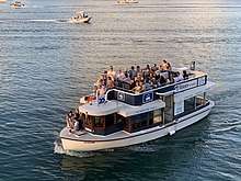
A ferry service operates along the Noosa River from Noosa Heads via Noosaville to Tewantin with timetabled regular services and tourist cruises.[22]
References
- Australian Bureau of Statistics (27 June 2017). "Noosaville (SSC)". 2016 Census QuickStats. Retrieved 20 October 2018.

- "Noosaville - town in Shire of Noosa (entry 24505)". Queensland Place Names. Queensland Government. Retrieved 27 January 2020.
- "Noosaville - suburb in Shire of Noosa (entry 48810)". Queensland Place Names. Queensland Government. Retrieved 27 January 2020.
- "Queensland Globe". State of Queensland. Retrieved 14 April 2020.
- "Noosa Community Guide 2005 Part D" (PDF). Archived from the original (PDF) on 24 July 2008. Retrieved 19 December 2006.
- "South East Queensland - Place Names". Archived from the original on 22 August 2006. Retrieved 19 December 2006.
- "Noosa Shire Planning Scheme". Noosa Shire Council. 11 December 2019. Archived from the original on 14 April 2020. Retrieved 14 April 2020.
- "Home". Noosa Civic. Archived from the original on 14 April 2020. Retrieved 14 April 2020.
- Edwards, D E (September 1998). Conflict and Controversy:The Changing Development Pattern of The Noosa Shire 1910-1980 (PDF). Retrieved 7 December 2017.
- Queensland Family History Society (2010), Queensland schools past and present (Version 1.01 ed.), Queensland Family History Society, ISBN 978-1-921171-26-0
- "Queensland Public Libraries Statistical Bulletin 2016-2017" (PDF). Public Libraries Connect. November 2017. Archived (PDF) from the original on 30 January 2018. Retrieved 29 January 2018.
- "About Noosa". Noosa Shire Council. Archived from the original on 29 February 2020. Retrieved 27 February 2020.
- "Noosa River Caravan Park (entry 602706)". Queensland Heritage Register. Queensland Heritage Council. Retrieved 14 July 2013.
- "Noosa Libraries". Noosa Council. Archived from the original on 7 June 2017. Retrieved 19 January 2018.
- "Noosaville Library". State Library of Queensland. Archived from the original on 21 March 2019. Retrieved 29 January 2018.
- "State and non-state school details". Queensland Government. 9 July 2018. Archived from the original on 21 November 2018. Retrieved 21 November 2018.
- "Noosaville State School". Archived from the original on 21 April 2013. Retrieved 21 November 2018.
- "ACARA School Profile 2017". Archived from the original on 22 November 2018. Retrieved 22 November 2018.
- "Noosaville SS - Special Education Program". Archived from the original on 21 April 2013. Retrieved 21 November 2018.
- "Good Shepherd Lutheran College". Archived from the original on 24 January 2019. Retrieved 21 November 2018.
- "St Teresa's Catholic College". Archived from the original on 27 December 2012. Retrieved 21 November 2018.
- "Ferry". Noosa Marina. Retrieved 14 April 2020.
External links
| Wikimedia Commons has media related to Noosaville, Queensland. |
- "Noosa Heads and Noosaville". Queensland Places. University of Queensland.
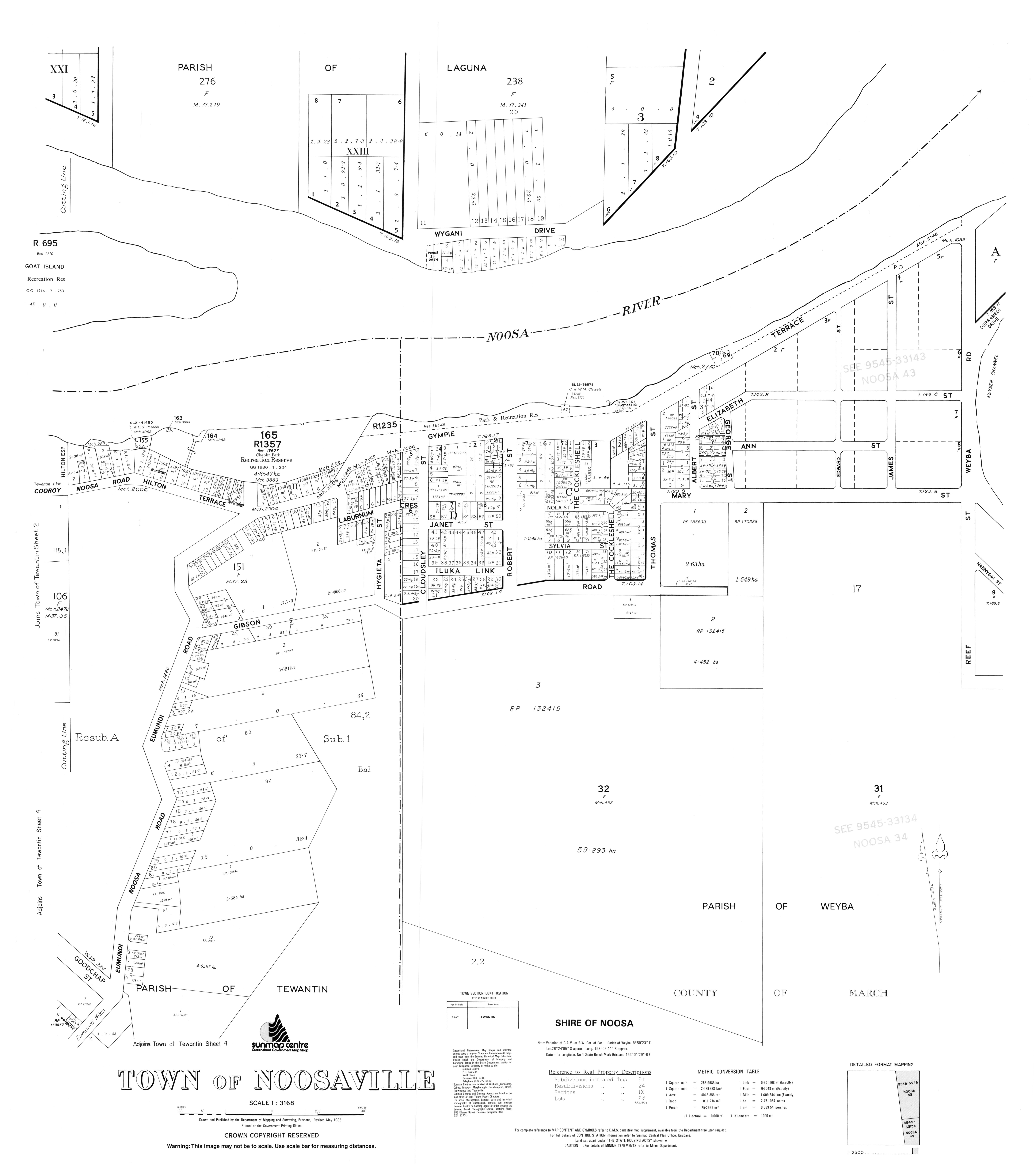
- "Town of Noosaville" (Map). Queensland Government. 1985.