Nonthaburi
Nonthaburi (Thai: นนทบุรี, pronounced [nōn.tʰáʔ.bū.rīː]) is the principal city of the district and province of the same name in Thailand.
Nonthaburi นนทบุรี | |
|---|---|
| City of Nonthaburi เทศบาลนตรนนทบุรี | |
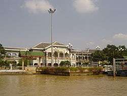 Nonthaburi Museum, formerly Nonthaburi Provincial Hall | |
 Seal | |
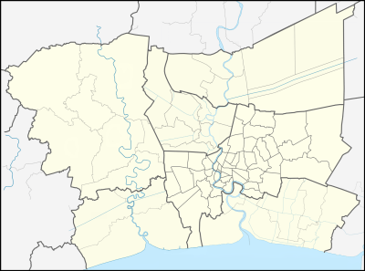 Nonthaburi Location in Bangkok Metropolitan Region 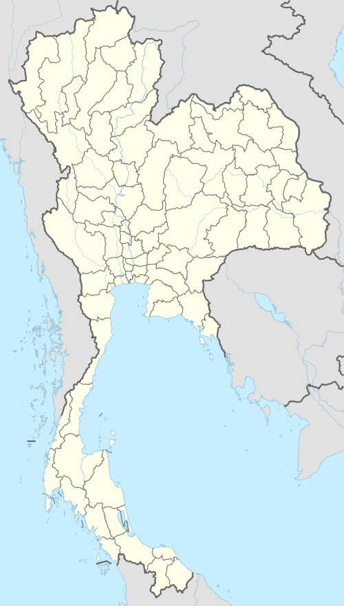 Nonthaburi Location in Thailand | |
| Coordinates: 13°51′03″N 100°31′20″E | |
| Country | |
| Province | Nonthaburi |
| District | Mueang Nonthaburi |
| Incorporated (town) | 14 February 1936 |
| Incorporated (city) | 24 September 1995 |
| Government | |
| • Type | City Municipality |
| • Mayor | Mrs. Sukanya Suksan |
| Area | |
| • Total | 38.90 km2 (15.02 sq mi) |
| Area rank | 12th |
| Population (2019)[1] | |
| • Total | 254,375 (Registered residents) |
| • Rank | 1st (excl. Bangkok) |
| • Density | 6,539/km2 (16,940/sq mi) |
| Time zone | UTC+7 (ICT) |
| Postcode | 11000 |
| Calling code | 02 |
| Website | nakornnont |
On 15 February 1936 Nonthaburi town municipality (thesaban mueang) was established, which only covered Suan Yai subdistrict (tambon) just 2.5 sq.km.[2] On 25 September 1995 Nonthaburi was upgraded to city municipality (thesaban nakhon) by enlargement of the city with four more subdistricts, Talat Khwan (8.2 sq.km.), Bang Khen (9.0 sq.km.), Bang Kraso (11.2 sq.km.) and Tha Sai (8.0 sq.km.), covering a total of 38.9 sq.km.[3] As of 31 December 2019, it has a registered population of 254,375,[1] making it the most populous city municipality in Thailand (excluding Bangkok). There are 93 communities (chumchon), although not directly chosen by the local citizens, which provides advice and recommendations to local administrative organizations. Due to its location close to Bangkok the city is considered a suburb of Bangkok, part of the Bangkok Metropolitan Area, or Greater Bangkok.
Nonthaburi is served by public transport systems including the Bangkok Mass Transit Authority bus system, the Chao Phraya Express Boat, and the newly opened MRT Purple Line.,
Nonthaburi is known for its temple and market such as Wat Chaloem Phra Kiat, Wat Chomphuwek, Wat Chotikaram, Wat Khema Phirataram, Wat Prasat, Wat Sangkhathan and so on.
Koh Kret (Pak Kret District)
Koh Kret is a small island located in Chao Phraya River in the province of Nonthaburi, and is some 2 kilometers long and 1 kilometer wide. In 1722, during the reign of King Thaisa of Ayutthaya, the island was called Khlong Lat Kret Noi which means a shortcut to Kret canal. Later, the current diverted, making the canal larger and turning the cape there into an island. Koh Kret has prospered since the Ayutthaya period as evident from the many temples on the island that are from that period. However, it may have been deserted when the Burmese sacked Ayutthaya. When Ayutthaya was reclaimed, King Taksin the Great relocated the Mon people who found religion here. The Mon people on the island came during the Thon Buri period and during the reign of King Rama II.
References
- "รายงานสถิติจำนวนประชากรและบ้านประจำปี พ.ศ.2562" [Statistics, population and house statistics for the year 2019]. Registration Office Department of the Interior, Ministry of the Interior (in Thai). 31 December 2019. Retrieved 10 March 2020.
- "พระราชกฤษฎีกา จัดตั้งเทศบาลเมืองนนทบุรี จังหวัดนนทบุรี พุทธศักราช ๒๔๗๙" [Royal Decree Establishing of Nonthaburi town municipality, Nonthaburi province, Buddhist Era 2479 (1936)] (PDF). Royal Thai Government Gazette. 53: 1196–1200. 14 February 1936. Retrieved 10 December 2019, effectively on 15 February 1936
- "พระราชกฤษฎีกา จัดตั้งเทศบาลนครนนทบุรี จังหวัดนนทบุรี พ.ศ.๒๕๓๘" [Royal Decree Establishing Nonthaburi city municipality, Nonthaburi province, B.E.2538 (1995)] (PDF). Royal Thai Government Gazette. 112 (40 Kor): 29–32. 24 September 1995. Retrieved 10 December 2019, effectively on 25 September 1995
External links
- Official website


Nonthaburi | ||
|---|---|---|
| Main article |  | |
| Capital |
| |
| Districts (amphoe) | ||
| Related topics |
| |
| Neighboring areas | ||
| 1,000,000 and more |
|
|---|---|
| 500,000–999,999 |
|
| 200,000–499,999 |
|
| 100,000–299,999 | |