Noctorum
Noctorum is a suburb of Birkenhead, Merseyside, England, in the Metropolitan Borough of Wirral. At the 2001 Census the population of Noctorum was 4,990 (2,360 males, 2,630 females).[1]
| Noctorum | |
|---|---|
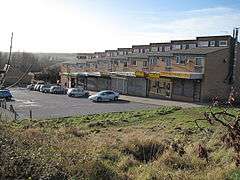 Shops adjoining Townfield Close | |
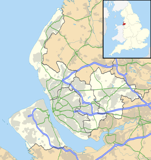 Noctorum Location within Merseyside | |
| Population | 4,990 (2001 Census)[1] |
| OS grid reference | SJ285875 |
| • London | 179 mi (288 km)[2] SE |
| Metropolitan borough | |
| Metropolitan county | |
| Region | |
| Country | England |
| Sovereign state | United Kingdom |
| Post town | PRENTON |
| Postcode district | CH43 |
| Dialling code | 0151 |
| ISO 3166 code | GB-WRL |
| Police | Merseyside |
| Fire | Merseyside |
| Ambulance | North West |
| UK Parliament | |
Due to a redefining of post towns by the Royal Mail in 2003, Noctorum is identified as being within Prenton (which is in fact a geographically separate suburb of Birkenhead), yet this was only a postal change and Noctorum itself still remains a part of Birkenhead.
History
The name Noctorum is of Old Irish origin, originally Cnocc Tirim, meaning 'Dry Hill'.[3] This may be in reference to Bidston Hill, of which Noctorum is situated on its western slope. The name may long pre-date the Norse-Irish settlement in the early 10th century and go back to a Hibernian settlement of the west coast in the Sub-Roman period (early 5th century).
Noctorum appears as Chenoterie (Norman French) in the Domesday Book of 1086.[4] "Chêne" (French for oak) may be used here as in the Wirral hamlet of Landican (Old Welsh/Brythonic) called Landechene, the Oak Enclosure in the Norman French of the Doomsday Book.
Noctorum Lane is the site of Rathmore, a Grade II listed house designed by Edmund Kirby[5] and built in the 1880s.
Noctorum was a township of the parish of Woodchurch, in the Wirral Hundred. The population was 17 in 1801, 32 in 1851 and 212 in 1901.[6] It was added to Birkenhead civil parish in 1933 and part of the County Borough of Birkenhead, within the geographical county of Cheshire, until local government reorganisation on 1 April 1974.
Geography
Noctorum is in the northern part of the Wirral Peninsula, approximately 4.5 km (2.8 mi) south-south-east of the Irish Sea at Leasowe, 6.5 km (4.0 mi) east-north-east of the Dee Estuary at Caldy and 4 km (2.5 mi) west of the River Mersey at Tranmere. Noctorum is situated on the western side of the Bidston to Storeton ridge, with the area at an elevation of between 10–60 m (33–197 ft) above sea level.[7]
Neighbouring places | |
|---|---|
Community
Ridgeway High School and the Discovery City Learning Centre (containing Ridgeway Library) is situated within this suburb. There is also a large council estate located here.
Transport
Upton railway station is the nearest station to Noctorum. It is located on the Borderlands Line between Bidston and Wrexham.
See also
References
- Wirral 2001 Census: Noctorum, Metropolitan Borough of Wirral, archived from the original on 29 September 2007, retrieved 3 July 2007
- "Coordinate Distance Calculator". boulter.com. Retrieved 6 March 2016.
- What's in a Name?, icliverpool.co.uk, retrieved 26 June 2007
- Cheshire L-Z, The Domesday Book Online, retrieved 16 January 2009
- "Noctorum Lane brochure" (PDF).
- Cheshire Towns & Parishes: Noctorum, GENUKI UK & Ireland Genealogy, retrieved 1 May 2008
- "SRTM & Ordnance Survey Elevation Data in PHP". Retrieved 1 November 2016.
Bibliography
- Mortimer, William Williams (1847). The History of the Hundred of Wirral. London: Whittaker & Co. p.286.
External links
| Wikimedia Commons has media related to Noctorum, Birkenhead. |