Liscard
Liscard is an area of the town of Wallasey, in the Metropolitan Borough of Wirral, Merseyside, England. The most centrally located of Wallasey's townships, it is the main shopping area of the town, with many shops located in the Cherry Tree Shopping Centre. At the 2001 Census the population was recorded at 14,301,[2] increasing to 15,574 at the 2011 Census.[3]
| Liscard | |
|---|---|
 Liscard shopping centre | |
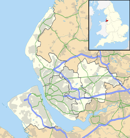 Liscard Location within Merseyside | |
| Population | 15,574 (2011 CensusWard) |
| OS grid reference | SJ307919 |
| • London | 180 mi (290 km)[1] SE |
| Metropolitan borough | |
| Metropolitan county | |
| Region | |
| Country | England |
| Sovereign state | United Kingdom |
| Post town | WALLASEY |
| Postcode district | CH44 |
| Dialling code | 0151 |
| ISO 3166 code | GB-WRL |
| Police | Merseyside |
| Fire | Merseyside |
| Ambulance | North West |
| UK Parliament | |
History
The first mention of the settlement was circa 1260 as Lisnekarke. The name is from Welsh Llys carreg, with the name meaning "hall at the rock" or "...cliff".[4] In the past the name has been spelt as Liscak (1260), Lisecair (c.1277), Lysenker (1295) and Lyscart (1417).[5][6]
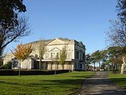
Liscard Hall was built in 1835 by a Liverpool merchant, Sir John Tobin. Its grounds later became Central Park. A “model farm” was also developed nearby by the Tobin family. The former Grade II listed mansion later became an art college within Central Park. It was damaged by a suspicious fire on 7 July 2008,[7] after being left empty and inadequately secured by Wirral Council and was subsequently completely demolished.[8] The decision has not yet been made as to what will be done with the site.
.JPG)
Liscard Battery was built in 1858 to help protect shipping on the River Mersey and defend the port of Liverpool. It was equipped with seven 10-inch guns. Set back from the river and hidden by new building, it was known as "the snake in the grass" to local inhabitants. The battery was obsolete by 1912, and sold on, and houses were erected on top, and now the site has an odd appearance with only the curtain wall and ornate crenellated gatehouse surviving to this day.
The area originally had a railway station as part of the Wirral Railway. Known as Liscard and Poulton railway station, it was part of a branch line which included Seacombe railway station as its terminus. This branch is long-closed and its route now forms the approach to the Kingsway Tunnel.
Geography
Liscard is in the north-eastern part of the Wirral Peninsula, less than 2.5 km (1.6 mi) south-south-east of the Irish Sea at New Brighton, about 11 km (6.8 mi) east-north-east of the Dee Estuary at West Kirby and about 1 km (0.62 mi) west-north-west of the River Mersey at Egremont. Liscard is situated at an elevation of around 35 m (115 ft) above sea level.[9]
Liscard is situated 4.8 km (3 mi) from Birkenhead, and 6.4 km (4 mi) from Liverpool via the Kingsway Tunnel.
Neighbouring places | |
|---|---|
Governance
Liscard is part of the Wallasey parliamentary constituency and represented since 1992 by Angela Eagle, a Labour Party MP, who retained her seat in the 2015 general election.
The area is also a local government ward of the Metropolitan Borough of Wirral, taking in the majority of Egremont, and is represented by three Labour Party councillors: Tom Usher, Bernie Mooney and Janette Williamson. The most recent local elections took place on 3 May 2012.
| Party | Candidate | Votes | % | ± | |
|---|---|---|---|---|---|
| Liberal Democrats | Daniel CLEIN | 121 | 2.59 | ||
| Conservative | Karen HAYES ~ | 1673 | 35.85 | ||
| Labour | Bernie MOONEY | 2523 | 54.06 | ||
| Green | Kenny PEERS | 146 | 3.13 | ||
| UKIP | Linda Ellen WILLIAMS | 304 | 4.37 | ||
~ indicates retiring councillor
Community
The area is largely residential and contains mainly high-density semi-detached and terraced housing. Central Park is now the largest park in Wallasey, It has two areas for young children, with swings, slides and other games, large areas of greenery and a popular walled garden. There is also a cricket ground and a large duck pond. It links Liscard to Poulton and Egremont.
Education
Liscard includes the Oldershaw Academy, a secondary school with specialist status as a Business and Enterprise College and Liscard Primary School.
References
- "Coordinate Distance Calculator". boulter.com. Retrieved 6 March 2016.
- 2001 Census: Liscard, Office for National Statistics, retrieved 19 March 2008
- "Ward population 2011". Retrieved 1 June 2015.
- Wirral Historic Settlement Study, Merseyside Historic Characterisation Project, Museum of Liverpool, 2011, p.50
- Place Names: Liscard, National Museums Liverpool, archived from the original on 7 June 2011, retrieved 19 March 2008
- Coates, R (1997–98), Liscard and Irish names in northern Wirral, Journal of the English Place Name Society, volume 31, pp. 23–26
- Blaze rips through Hall, Wirral Globe, 7 July 2008, retrieved 10 July 2008
- Liscard Hall, retrieved 17 July 2008
- "SRTM & Ordnance Survey Elevation Data in PHP". Retrieved 3 November 2016.
- Election Result for 5 May 2010, Metropolitan Borough of Wirral, retrieved 23 April 2012
Bibliography
- Mortimer, William Williams (1847). The History of the Hundred of Wirral. London: Whittaker & Co. pp299-303.