Nobscot Hill
Nobscot Hill is a USGS name[1] for a high point in Middlesex County, Massachusetts, and is located in Framingham. It has various radio towers and a fire tower. Below Nobscot Hill is the Nobscot Reservation including Tippling Rock. In 2008, a 303-acre (1.23 km2) portion of the Nobscot Scout Reservation in Sudbury was permanently conserved by Sudbury Valley Trustees, the Town of Sudbury, and the Mayflower Council, Boy Scouts of America.
| Nobscot Hill | |
|---|---|
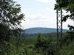 View of Nobscot Hill from Wayland | |
| Highest point | |
| Elevation | 600 ft (180 m) |
| Coordinates | 42°20′45″N 71°26′57″W |
| Geography | |
| Location | Middlesex County, Massachusetts |
| Topo map | USGS Framingham |
Nobscot Hill commands a 360-degree view including Boston, MetroWest, the Blue Hills, Lower Kearsarge, Mount Monadnock, Mount Wachusett, Mount Agamenticus, and all of the unremarkable bumps to the SouthWest.
Tantamous, a medicine man called Old Jethro by the colonists and his son, Peter Jethro, lived on Nobscot Hill at the beginning of King Philip’s War in 1674 before being removed to Deer Island.[2] Revolutionary War General, John Nixon lived and farmed on the north side of Nobscot Hill after the war was over.[3]
References
- "GNIS Detail - Nobscot Hill". geonames.usgs.gov.
- Hudson, Alfred Sereno. (1889). The History of Sudbury, Massachusetts. Town of Sudbury. 661pp.Download PDF
| Articles |
| 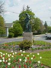 Minuteman statue at the intersection of Main St. and Union Ave. | |||||||||||
|---|---|---|---|---|---|---|---|---|---|---|---|---|---|
| Related Subjects |
| ||||||||||||
| Businesses |
| ||||||||||||
| People | |||||||||||||
| Neighboring Communities | |||||||||||||