Nieuw-Beijerland
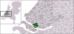
Nieuw-Beijerland is a town in the Dutch province of South Holland. It is a part of the municipality of Hoeksche Waard, and lies about 3 km south of Spijkenisse.
Nieuw-Beijerland | |
|---|---|
Town | |
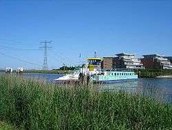 Het veer over het Spui van Hekelingen naar Nieuw-Beijerland | |
 Coat of arms | |
 | |
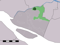 The town centre (dark green) and the statistical district (light green) of Nieuw-Beijerland in the former municipality of Korendijk. | |
| Coordinates: 51°48′43″N 4°20′33″E | |
| Country | Netherlands |
| Province | South Holland |
| Municipality | Hoeksche Waard |
| Population (2001) | |
| • Total | 3,200 |
| Time zone | UTC+1 (CET) |
| • Summer (DST) | UTC+2 (CEST) |
In 2001, the town of Nieuw-Beijerland had 3200 inhabitants. The built-up area of the town was 0.78 km², and contained 1143 residences.[1] The statistical area "Nieuw-Beijerland", which also can include the peripheral parts of the village, as well as the surrounding countryside, has a population of around 3570.[2]
Nieuw-Beijerland was a separate municipality until 1984, when it became part of Korendijk.[3]
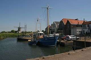
Harbor

Windmill: windmolen de Swaan
References
- Statistics Netherlands (CBS), Bevolkingskernen in Nederland 2001. (Statistics are for the continuous built-up area).
- Statistics Netherlands (CBS), Statline: Kerncijfers wijken en buurten 2003-2005. As of 1 January 2005.
- Ad van der Meer and Onno Boonstra, Repertorium van Nederlandse gemeenten, KNAW, 2006.
External links
| Wikimedia Commons has media related to Nieuw-Beijerland. |
- J. Kuyper, Gemeente Atlas van Nederland, 1865-1870, "Nieuw-Beijerland". Map of the former municipality, around 1868.
This article is issued from Wikipedia. The text is licensed under Creative Commons - Attribution - Sharealike. Additional terms may apply for the media files.