National Register of Historic Places listings in downtown Houston, Texas
This is a list of the National Register of Historic Places in downtown Houston, Texas. It is intended to be a complete list of properties and districts listed on the National Register of Historic Places in the Downtown Houston neighborhood, defined as the area enclosed by Interstate 10, Interstate 45, and Interstate 69.
The locations of National Register properties and districts (at least for all showing latitude and longitude coordinates below) may be seen in a map by clicking on "Map of all coordinates."[1]
| downtown Houston - Houston Heights - inner Harris County - outer Harris County |
- This National Park Service list is complete through NPS recent listings posted June 26, 2020.[2]
Current listings
| [3] | Name on the Register | Image | Date listed[4] | Location | City or town | Description |
|---|---|---|---|---|---|---|
| 1 | 1884 Houston Cotton Exchange Building |  1884 Houston Cotton Exchange Building |
May 6, 1971 (#71000938) |
202 Travis St. 29°45′49″N 95°21′40″W |
Houston | |
| 2 | 500 Jefferson Building |  500 Jefferson Building |
March 6, 2019 (#100003492) |
500 Jefferson St. 29°45′11″N 95°22′25″W |
Houston | |
| 3 | Annunciation Church | 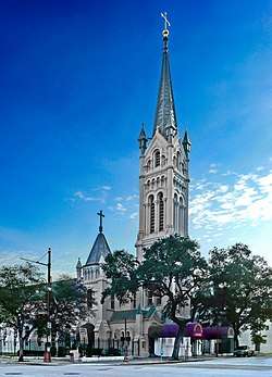 Annunciation Church |
November 3, 1975 (#75001988) |
1618 Texas Ave. 29°45′23″N 95°21′25″W |
Houston | |
| 4 | Antioch Missionary Baptist Church | .jpg) Antioch Missionary Baptist Church |
December 22, 1976 (#76002038) |
500 Clay St. 29°45′23″N 95°22′19″W |
Houston | |
| 5 | Battelstein's | February 6, 2020 (#100004966) |
812 Main St. 29°45′30″N 95°21′51″W |
Houston | ||
| 6 | Beaconsfield | Beaconsfield |
March 29, 1983 (#83004428) |
1700 Main St. 29°45′20″N 95°22′21″W |
Houston | |
| 7 | James Bute Company Warehouse | 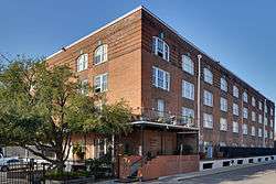 James Bute Company Warehouse |
July 7, 1994 (#94000677) |
711 William St. 29°46′02″N 95°21′14″W |
Houston | |
| 8 | Christ Church | .jpg) Christ Church |
June 15, 1979 (#79002957) |
1117 Texas Ave. 29°45′34″N 95°21′39″W |
Houston | |
| 9 | City National Bank Building | 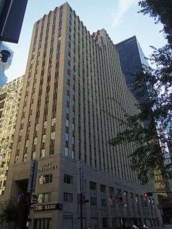 City National Bank Building |
April 3, 2000 (#00000291) |
1001 McKinney Ave. 29°45′25″N 95°21′51″W |
Houston | |
| 10 | Arthur B. Cohn House | .jpg) Arthur B. Cohn House |
November 7, 1985 (#85002771) |
900 block of Avenida De Las Americas 29°45′20″N 95°21′22″W |
Houston | Relocated from original location one block south |
| 11 | Downtown Houston Post Office, Processing and Distribution Center | February 2, 2018 (#100002087) |
401 Franklin St. 29°45′54″N 95°21′53″W |
Houston | ||
| 12 | W. L. Foley Building | .jpg) W. L. Foley Building |
October 11, 1978 (#78002942) |
214-218 Travis St. 29°45′47″N 95°21′41″W |
Houston | |
| 13 | Gulf Building | 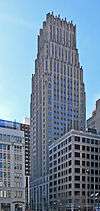 Gulf Building |
August 30, 1983 (#83004436) |
710-724 Main St. 29°46′04″N 95°21′50″W |
Houston | |
| 14 | Houston Bar Center Building | 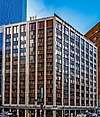 Houston Bar Center Building |
June 26, 2017 (#100001254) |
723 Main St. 29°45′36″N 95°22′09″W |
Houston | |
| 15 | Harris County Courthouse of 1910 | 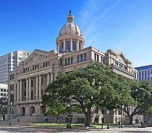 Harris County Courthouse of 1910 |
May 13, 1981 (#81000629) |
301 Fannin St. 29°45′40″N 95°21′34″W |
Houston | |
| 16 | Hogg Building | 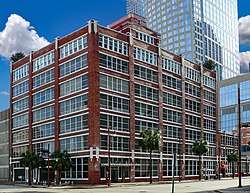 Hogg Building |
July 14, 1978 (#78002943) |
401 Louisiana St. 29°45′45″N 95°21′50″W |
Houston | |
| 17 | Houston City Hall | 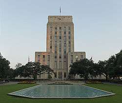 Houston City Hall |
September 18, 1990 (#90001471) |
901 Bagby St. 29°45′36″N 95°22′09″W |
Houston | |
| 18 | Houston Post-Dispatch Building | .jpg) Houston Post-Dispatch Building |
February 14, 2002 (#02000072) |
609 Fannin 29°45′32″N 95°21′41″W |
Houston | |
| 19 | Humble Oil Building | 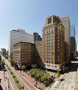 Humble Oil Building |
January 27, 1999 (#99000068) |
1212 Main St. 29°45′18″N 95°22′00″W |
Houston | |
| 20 | Julia Ideson Building | 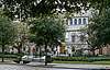 Julia Ideson Building |
November 23, 1977 (#77001447) |
500 McKinney St. 29°45′32″N 95°22′09″W |
Houston | |
| 21 | Kellum-Noble House | .jpg) Kellum-Noble House |
April 3, 1975 (#75001989) |
212 Dallas St. 29°45′31″N 95°22′19″W |
Houston | |
| 22 | Kennedy Bakery | 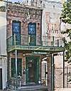 Kennedy Bakery |
July 27, 1979 (#79002963) |
813 Congress St. 29°45′46″N 95°21′41″W |
Houston | |
| 23 | Kress Building | .jpg) Kress Building |
October 4, 2002 (#02001102) |
705 Main St. 29°45′31″N 95°21′46″W |
Houston | |
| 24 | Main Street/Market Square Historic District | .jpg) Main Street/Market Square Historic District |
July 18, 1983 (#83004471) |
Roughly bounded by Buffalo Bayou, Fannin, Texas, and Milam streets 29°45′47″N 95°21′40″W |
Houston | |
| 25 | McKee Street Bridge | 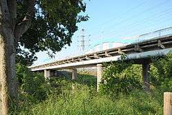 McKee Street Bridge |
September 3, 2002 (#02000729) |
McKee St. and Buffalo Bayou 29°45′57″N 95°21′07″W |
Houston | |
| 26 | Melrose Building | 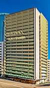 Melrose Building |
September 17, 2014 (#14000627) |
1121 Walker 29°45′25″N 95°21′46″W |
Houston | |
| 27 | Merchants and Manufacturers Building | _Houston.jpg) Merchants and Manufacturers Building |
September 17, 1980 (#80004130) |
University of Houston–Downtown 1 Main St. 29°45′57″N 95°21′32″W |
Houston | |
| 28 | National Biscuit Company Building | 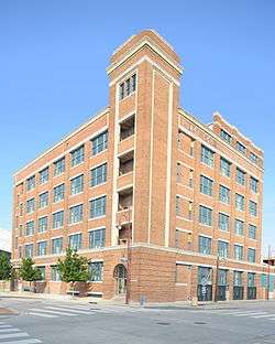 National Biscuit Company Building |
February 20, 1998 (#98000141) |
15 N. Chenevert 29°45′36″N 95°21′08″W |
Houston | |
| 29 | Old Houston National Bank | 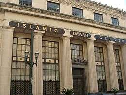 Old Houston National Bank |
July 17, 1975 (#75001990) |
202 Main St. 29°45′47″N 95°21′38″W |
Houston | Now the Islamic Da’wah Center[5] |
| 30 | Palace Hotel |  Palace Hotel |
September 13, 2006 (#06000825) |
216 La Branch 29°45′44″N 95°21′24″W |
Houston | |
| 31 | Paul Building | .jpg) Paul Building |
April 6, 1979 (#79002967) |
1018 Preston Ave. 29°45′39″N 95°21′39″W |
Houston | |
| 32 | Petroleum Building | .jpg) Petroleum Building |
August 8, 2019 (#100004250) |
1314 Texas Avenue 29°45′28″N 95°21′34″W |
Houston | |
| 33 | Rice Hotel | .jpg) Rice Hotel |
June 23, 1978 (#78002947) |
Main St. and Texas Ave. 29°45′37″N 95°21′46″W |
Houston | |
| 34 | Sam Houston Hotel | _(HDR).jpg) Sam Houston Hotel |
April 17, 2002 (#02000276) |
1117 Prairie St. 29°45′42″N 95°21′37″W |
Houston | Now known as Alden Houston. |
| 35 | San Jacinto Street Bridge over Buffalo Bayou | 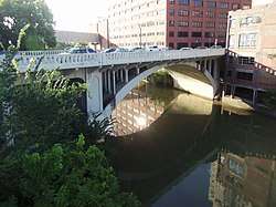 San Jacinto Street Bridge over Buffalo Bayou |
October 16, 2007 (#07001098) |
San Jacinto St. at Buffalo Bayou 29°45′53″N 95°21′27″W |
Houston | |
| 36 | Scanlan Building | .JPG) Scanlan Building |
May 23, 1980 (#80004132) |
405 Main St. 29°45′40″N 95°21′40″W |
Houston | |
| 37 | South Texas National Bank |  South Texas National Bank |
December 8, 1978 (#78002948) |
215 Main St. 29°45′44″N 95°21′36″W |
Houston | Demolished in 1983[6] |
| 38 | Southwestern Bell Capitol Main Office | August 25, 2016 (#16000574) |
1121 Capitol St. & 1114 Texas Ave. 29°45′31″N 95°21′41″W |
Houston | ||
| 39 | State National Bank Building | .jpg) State National Bank Building |
August 11, 1982 (#82004843) |
412 Main St. 29°45′40″N 95°21′42″W |
Houston | |
| 40 | Stowers Building | 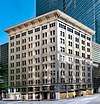 Stowers Building |
June 3, 2015 (#15000335) |
820 Fannin 29°45′27″N 95°21′49″W |
Houston | |
| 41 | Sweeney, Coombs & Fredericks Building | 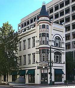 Sweeney, Coombs & Fredericks Building |
June 20, 1974 (#74002074) |
301 Main St. 29°45′43″N 95°21′38″W |
Houston | |
| 42 | Texas Company Building | 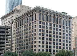 Texas Company Building |
April 2, 2003 (#03000185) |
1111 Rusk 29°45′28″N 95°21′46″W |
Houston | |
| 43 | Texas State Hotel | 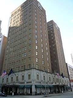 Texas State Hotel |
January 10, 2008 (#07001384) |
720 Fannin 29°45′28″N 95°21′46″W |
Houston | |
| 44 | U.S. Customhouse | U.S. Customhouse |
August 28, 1974 (#74002075) |
701 San Jacinto St. 29°45′26″N 95°21′40″W |
Houston | |
| 45 | Union Station | .jpg) Union Station |
November 10, 1977 (#77001448) |
501 Crawford St. 29°45′25″N 95°21′23″W |
Houston | |
| 46 | Willow Street Pump Station | _Houston.jpg) Willow Street Pump Station |
May 27, 2004 (#04000547) |
University of Houston–Downtown 811 N. San Jacinto St. 29°46′03″N 95°21′26″W |
Houston |
|
Former listings
| [3] | Name on the Register | Image | Date listed | Date removed | Location | City or town | Summary |
|---|---|---|---|---|---|---|---|
| 1 | Macatee Building | .jpg) Macatee Building |
May 24, 1984 (#84001806) | April 15, 1991 | 101 Austin St. 29°45′40″N 95°21′22″W |
Houston | |
| 2 | Pillot Building | 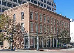 Pillot Building |
June 13, 1974 (#74002073) | October 28, 1994 | 1006 Congress Ave. 29°45′42″N 95°21′37″W |
Houston | Collapsed in 1988, reconstructed with original building materials. |
See also
References
- The latitude and longitude information provided in this table was derived originally from the National Register Information System, which has been found to be fairly accurate for about 99% of listings. Some locations in this table may have been corrected to current GPS standards.
- "National Register of Historic Places: Weekly List Actions". National Park Service, United States Department of the Interior. Retrieved on June 26, 2020.
- Numbers represent an ordering by significant words. Various colorings, defined here, differentiate National Historic Landmarks and historic districts from other NRHP buildings, structures, sites or objects.
- The eight-digit number below each date is the number assigned to each location in the National Register Information System database, which can be viewed by clicking the number.
- "Downtown Houston" (PDF). Houston Downtown Management District. Retrieved 22 April 2015.
- Barna, Joel Warren (Fall 1983). "Easement Down the Road" (PDF). Cite: The Architecture + Design Review of Houston. Retrieved April 22, 2015.
External links
| Wikimedia Commons has media related to National Register of Historic Places in Harris County, Texas. |
| Topics | |
|---|---|
| Lists by state |
|
| Lists by insular areas | |
| Lists by associated state | |
| Other areas | |
| Related | |
| |
This article is issued from Wikipedia. The text is licensed under Creative Commons - Attribution - Sharealike. Additional terms may apply for the media files.