National Register of Historic Places listings in Riverside County, California
This is a list of the National Register of Historic Places listings in Riverside County, California.
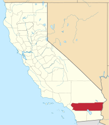
Location of Riverside County in California
This is intended to be a complete list of the properties and districts on the National Register of Historic Places in Riverside County, California, United States. Latitude and longitude coordinates are provided for many National Register properties and districts; these locations may be seen together in an online map.[1]
There are 91 properties and districts listed on the National Register in the county, including 2 National Historic Landmarks.
- This National Park Service list is complete through NPS recent listings posted June 19, 2020.[2]
Current listings
| [3] | Name on the Register[4] | Image | Date listed[5] | Location | City or town | Description |
|---|---|---|---|---|---|---|
| 1 | Administration Building, Sherman Institute | .tiff.jpg) Administration Building, Sherman Institute |
January 9, 1980 (#80000831) |
9010 Magnolia Ave. 33°55′30″N 117°26′15″W |
Riverside | |
| 2 | Dr. Franz Alexander House | 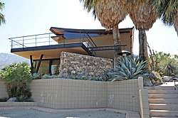 Dr. Franz Alexander House |
March 22, 2016 (#16000093) |
1011 W. Cielo Dr. 33°50′44″N 116°33′35″W |
Palm Springs | |
| 3 | All Souls Universalist Church | 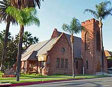 All Souls Universalist Church |
September 18, 1978 (#78000736) |
3657 Lemon St. 33°58′56″N 117°22′14″W |
Riverside | |
| 4 | Andreas Canyon | January 8, 1973 (#73000422) |
Address Restricted |
Palm Springs | ||
| 5 | Archeological Sites CA-RIV-504 and CA-RIV-773 | March 12, 2003 (#03000121) |
Address Restricted |
Blythe | ||
| 6 | Arlington Branch Library and Fire Hall | 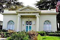 Arlington Branch Library and Fire Hall |
July 22, 1993 (#93000668) |
9556 Magnolia Ave. 33°55′11″N 117°26′48″W |
Riverside | |
| 7 | Armory Hall | 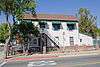 Armory Hall |
January 29, 1992 (#91002032) |
252 N. Main St. 33°40′15″N 117°19′32″W |
Lake Elsinore | |
| 8 | Barker Dam | 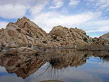 Barker Dam |
October 29, 1975 (#75000173) |
SE of Twentynine Palms in Joshua Tree National Park 34°01′52″N 116°08′39″W |
Twentynine Palms | |
| 9 | Miles C. Bates House |  Miles C. Bates House |
March 26, 2018 (#100002238) |
73697 Santa Rosa Way 33°43′40″N 116°22′45″W |
Palm Desert | |
| 10 | Blythe Intaglios | .jpg) Blythe Intaglios |
August 22, 1975 (#75000452) |
Address Restricted |
Blythe | |
| 11 | Buttercup Farms Pictograph | May 3, 1976 (#76000509) |
Address Restricted |
Perris | ||
| 12 | Cabot's Old Indian Pueblo Museum |  Cabot's Old Indian Pueblo Museum |
March 2, 2012 (#11000942) |
67-616 E. Desert View Ave. 33°57′29″N 116°28′56″W |
Desert Hot Springs | |
| 13 | Carey House | 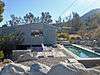 Carey House |
September 28, 2015 (#15000635) |
651 W. Via Escuela 33°50′55″N 116°33′18″W |
Palm Springs | |
| 14 | Andrew Carnegie Library | June 29, 1977 (#77000324) |
8th and Main Sts. 33°52′23″N 117°33′56″W |
Corona | Demolished in 1978 | |
| 15 | William Childs House |  William Childs House |
July 28, 1999 (#99000895) |
1151 Monte Vista Dr. 33°57′32″N 117°20′11″W |
Riverside | |
| 16 | Chinatown | March 1, 1990 (#90000151) |
Brockton and Tequesquite Aves. 33°58′35″N 117°23′05″W |
Riverside | ||
| 17 | Coachella Valley Fish Traps | June 13, 1972 (#72000247) |
Address Restricted |
Valerie | ||
| 18 | Coachella Valley Savings No. 2 | 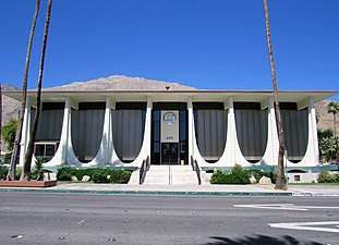 Coachella Valley Savings No. 2 |
December 27, 2016 (#16000885) |
499 S. Palm Canyon Dr. 33°48′58″N 116°32′49″W |
Palm Springs | |
| 19 | Community Settlement House | 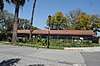 Community Settlement House |
December 21, 2017 (#100001906) |
4366 Bermuda Ave. 33°58′15″N 117°21′47″W |
Riverside | |
| 20 | Corn Springs | 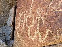 Corn Springs |
October 30, 1998 (#98001286) |
Address Restricted |
Desert Center | |
| 21 | Corona High School | 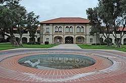 Corona High School |
August 3, 2005 (#05000772) |
815 W. 6th St. 33°52′35″N 117°34′32″W |
Corona | |
| 22 | Crescent Bathhouse | 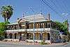 Crescent Bathhouse |
July 30, 1975 (#75000453) |
201 W. Graham Ave. 33°40′09″N 117°19′47″W |
Lake Elsinore | |
| 23 | Desert Queen Mine | 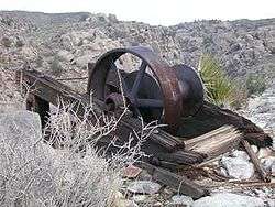 Desert Queen Mine |
January 17, 1976 (#76000216) |
S of Twentynine Palms in Joshua Tree National Park 34°01′26″N 116°04′09″W |
Twentynine Palms | |
| 24 | Edris House |  Edris House |
December 27, 2016 (#16000886) |
1030 W. Cielo Dr. 33°50′45″N 116°33′40″W |
Palm Springs | |
| 25 | Arthur Elrod House | 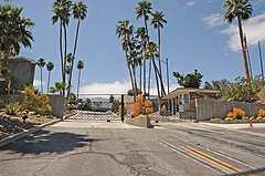 Arthur Elrod House |
April 19, 2016 (#16000169) |
2175 Southridge Dr. 33°47′36″N 116°30′39″W |
Palm Springs | |
| 26 | Estudillo Mansion | 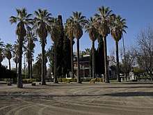 Estudillo Mansion |
October 25, 2001 (#01001178) |
150 S. Dillon 33°46′51″N 116°58′02″W |
San Jacinto | |
| 27 | Federal Post Office |  Federal Post Office |
November 20, 1978 (#78000737) |
3720 Orange St. 33°58′55″N 117°22′18″W |
Riverside | |
| 28 | Fire Station No. 1 |  Fire Station No. 1 |
September 28, 2015 (#15000636) |
277 N. Indian Canyon Dr. 33°49′34″N 116°32′45″W |
Palm Springs | |
| 29 | First Church of Christ, Scientist |  First Church of Christ, Scientist |
June 14, 2016 (#16000357) |
605 S. Riverside Dr. 33°48′37″N 116°32′33″W |
Palm Springs | |
| 30 | First Church of Christ, Scientist | 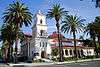 First Church of Christ, Scientist |
September 22, 1992 (#92001250) |
3606 Lemon St. 33°58′57″N 117°22′11″W |
Riverside | |
| 31 | First Congregational Church of Riverside | 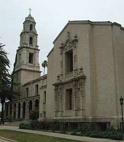 First Congregational Church of Riverside |
April 3, 1997 (#97000297) |
3504 Mission Inn Ave. 33°58′54″N 117°22′16″W |
Riverside | |
| 32 | Frey House II | .jpg) Frey House II |
September 28, 2015 (#15000637) |
686 Palisades Dr. 33°49′24″N 116°33′11″W |
Palm Springs | |
| 33 | Galleano Winery |  Galleano Winery |
June 22, 2003 (#03000533) |
4231 Wineville Rd. 34°00′40″N 117°32′29″W |
Mira Loma | |
| 34 | Rocco Garbani Homestead | December 22, 1999 (#99001593) |
33555 Holland Rd. 33°39′34″N 117°04′24″W |
Winchester | ||
| 35 | Gilman Ranch | 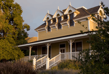 Gilman Ranch |
November 17, 1977 (#76000508) |
1937 W. Gilman St. 33°56′15″N 116°53′54″W |
Banning | |
| 36 | Grand Boulevard Historic District |  Grand Boulevard Historic District |
July 14, 2011 (#11000432) |
Grand Boulevard 33°52′09″N 117°34′02″W |
Corona | |
| 37 | Hamrick House | 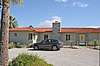 Hamrick House |
September 19, 2016 (#16000635) |
875 W. Chino Canyon Rd. 33°50′48″N 116°33′30″W |
Palm Springs | |
| 38 | Harada House |  Harada House |
September 15, 1977 (#77000325) |
3356 Lemon St. 33°59′06″N 117°22′05″W |
Riverside | |
| 39 | Heritage House |  Heritage House |
February 28, 1973 (#73000423) |
8193 Magnolia Ave. 33°56′05″N 117°25′20″W |
Riverside | |
| 40 | Thomas Jefferson Elementary School | 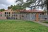 Thomas Jefferson Elementary School |
September 28, 2017 (#100001663) |
1040 S. Vicentia Ave. 33°52′19″N 117°34′33″W |
Corona | |
| 41 | Cornelius Jensen Ranch | 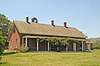 Cornelius Jensen Ranch |
September 6, 1979 (#79000519) |
4350 Riverview Dr 33°59′34″N 117°25′01″W |
Rubidoux | |
| 42 | Kenaston House |  Kenaston House |
December 27, 2016 (#16000887) |
39767 Desert Sun Dr. 33°45′34″N 116°25′05″W |
Rancho Mirage | |
| 43 | Kocher-Samson Building |  Kocher-Samson Building |
September 29, 2015 (#15000638) |
766 N. Palm Canyon Dr. 33°50′01″N 116°32′48″W |
Palm Springs | |
| 44 | Koerner House | 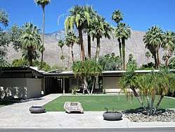 Koerner House |
December 27, 2016 (#16000888) |
1275 S. Calle de Maria 33°48′22″N 116°31′57″W |
Palm Springs | |
| 45 | Krisel Tract Home, 1882 S. Caliente Road (APN 511032005-9) | 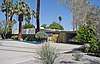 Krisel Tract Home, 1882 S. Caliente Road (APN 511032005-9) |
December 27, 2019 (#100004813) |
1882 South Caliente Rd. 33°47′55″N 116°32′07″W |
Palm Springs (Agua Caliente Indian Reservation) | |
| 46 | Lake Norconian Club | 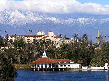 Lake Norconian Club |
February 4, 2000 (#00000033) |
Junction of Fifth and Western Ave. 33°55′30″N 117°34′06″W |
Norco | |
| 47 | Gus Lederer Site | March 12, 2003 (#03000118) |
Address Restricted |
Desert Center | ||
| 48 | Loewy House | 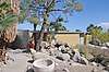 Loewy House |
September 29, 2015 (#15000639) |
600 Panorama Rd. 33°50′43″N 116°33′16″W |
Palm Springs | |
| 49 | Luiseno Ancestral Origin Landscape | October 30, 2014 (#14000851) |
Address Restricted |
Temecula | ||
| 50 | March Field Historic District | March Field Historic District |
December 6, 1994 (#94001420) |
Eschscholtzia Ave., March Air Force Base 33°53′59″N 117°15′17″W |
Riverside | |
| 51 | Martinez Canyon Rockhouse | 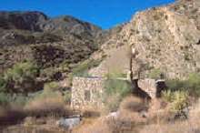 Martinez Canyon Rockhouse |
December 14, 1999 (#99001471) |
BLM, Palm Springs–South Coast Resource Area 33°30′20″N 116°19′31″W |
North Palm Springs | |
| 52 | Martinez Historical District | 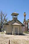 Martinez Historical District |
May 17, 1973 (#73000425) |
Off SR 86 33°33′46″N 116°09′12″W |
Torres-Martinez Indian Reservation | |
| 53 | Masonic Temple | June 6, 1980 (#80000832) |
3650 11th St. 33°58′43″N 117°22′30″W |
Riverside | ||
| 54 | McCoy Spring Archeological Site | May 10, 1982 (#82002226) |
Address Restricted |
Blythe | ||
| 55 | Grace Lewis Miller House |  Grace Lewis Miller House |
March 27, 2020 (#100005158) |
2311 North Indian Canyon Dr. 33°51′03″N 116°32′44″W |
Riverside | |
| 56 | Mission Court Bungalows | 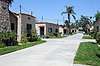 Mission Court Bungalows |
July 8, 1993 (#93000549) |
3355–3373 Second St. and 3354–3362 First St. 33°59′12″N 117°21′55″W |
Riverside | |
| 57 | Mission Inn |  Mission Inn |
May 14, 1971 (#71000173) |
3649 7th St. 33°59′00″N 117°22′18″W |
Riverside | |
| 58 | Mount San Jacinto State Park Historic District | 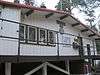 Mount San Jacinto State Park Historic District |
June 25, 2013 (#13000416) |
25905 CA 243 33°45′01″N 116°42′52″W |
Idyllwild | |
| 59 | Murrieta Creek Archeological Area | April 24, 1973 (#73000424) |
Address Restricted |
Temecula | ||
| 60 | North Chuckwalla Mountain Quarry District | August 24, 1981 (#81000165) |
Address Restricted |
Desert Center | ||
| 61 | North Chuckwalla Mountains Petroglyph District Ca-Riv 1383 | September 3, 1981 (#81000166) |
Address Restricted |
Desert Center | ||
| 62 | North Shore Yacht Club | 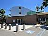 North Shore Yacht Club |
September 28, 2015 (#15000640) |
99-155 Sea View Dr. 33°31′10″N 115°56′14″W |
Mecca | |
| 63 | Thomas O'Donnell House | 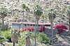 Thomas O'Donnell House |
January 7, 2011 (#10001123) |
447 Alejo Rd. 33°49′49″N 116°33′09″W |
Palm Springs | |
| 64 | Old YWCA Building | 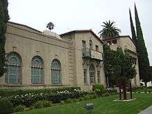 Old YWCA Building |
January 28, 1982 (#82002227) |
3425 Mission Inn Avenue 33°58′54″N 117°22′14″W |
Riverside | |
| 65 | Palm Springs Aerial Tramway Mountain Station | .jpg) Palm Springs Aerial Tramway Mountain Station |
December 27, 2016 (#16000889) |
1 Tram Way 33°48′47″N 116°38′19″W |
Idyllwild vicinity | |
| 66 | Palm Springs City Hall |  Palm Springs City Hall |
September 29, 2015 (#15000641) |
3200 E. Tahquitz Canyon Way 33°49′25″N 116°30′42″W |
Palm Springs | |
| 67 | Palm Springs Desert Museum | 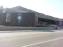 Palm Springs Desert Museum |
December 27, 2016 (#16000890) |
101 Museum Dr. 33°49′27″N 116°33′00″W |
Palm Springs | |
| 68 | Palm Springs Tramway Valley Station | 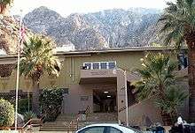 Palm Springs Tramway Valley Station |
September 28, 2015 (#15000642) |
1 Tram Way 33°50′15″N 116°36′50″W |
Palm Springs | |
| 69 | Palm Springs Unified School District Educational Administrative Center | 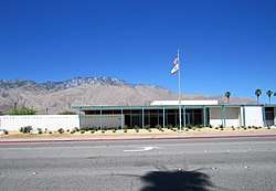 Palm Springs Unified School District Educational Administrative Center |
December 27, 2016 (#16000891) |
333 S. Farrell Dr. 33°49′08″N 116°31′06″W |
Palm Springs | |
| 70 | Pearlman Mountain Cabin | 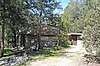 Pearlman Mountain Cabin |
April 19, 2016 (#16000173) |
52820 Middleridge Dr. 33°43′50″N 116°44′27″W |
Idyllwild | |
| 71 | Perris Depot | 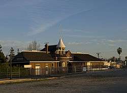 Perris Depot |
August 5, 1994 (#94000819) |
120 W. Fourth St. 33°46′58″N 117°13′46″W |
Perris | |
| 72 | Riverside Municipal Auditorium and Soldiers' Memorial Building | 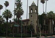 Riverside Municipal Auditorium and Soldiers' Memorial Building |
March 31, 1978 (#78000738) |
3485 7th St. 33°58′55″N 117°22′12″W |
Riverside | |
| 73 | Riverside-Arlington Heights Fruit Exchange | 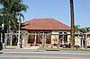 Riverside-Arlington Heights Fruit Exchange |
June 9, 1980 (#80000833) |
3391 7th St. 33°58′52″N 117°22′10″W |
Riverside | |
| 74 | Ryan House and Lost Horse Well | 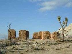 Ryan House and Lost Horse Well |
June 5, 1975 (#75000175) |
S of Twentynine Palms in Joshua Tree National Park 33°59′06″N 116°08′52″W |
Twentynine Palms | |
| 75 | San Pedro, Los Angeles, & Salt Lake RR Depot | 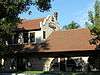 San Pedro, Los Angeles, & Salt Lake RR Depot |
April 18, 1977 (#77000326) |
3751 Vine St. 33°58′45″N 117°21′59″W |
Riverside | |
| 76 | San Timoteo Canyon Schoolhouse |  San Timoteo Canyon Schoolhouse |
January 19, 2001 (#00001646) |
31985 San Timoteo Canyon Rd. 33°58′33″N 117°06′10″W |
Redlands | |
| 77 | Santa Fe Federal Savings and Loan Association |  Santa Fe Federal Savings and Loan Association |
December 27, 2016 (#16000892) |
300 S. Palm Canyon Dr. 33°49′09″N 116°32′48″W |
Palm Springs | |
| 78 | Sieroty House | 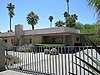 Sieroty House |
September 28, 2015 (#15000643) |
695 E. Vereda Sur 33°50′19″N 116°32′22″W |
Palm Springs | |
| 79 | M. H. Simon's Undertaking Chapel | 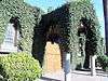 M. H. Simon's Undertaking Chapel |
June 9, 1980 (#80000834) |
3610 11th St. 33°58′43″N 117°22′29″W |
Riverside | |
| 80 | Maurice Smith and Dinah Shore House |  Maurice Smith and Dinah Shore House |
September 23, 2019 (#100004405) |
432 Hermosa Place 33°50′09″N 116°33′07″W |
Palm Springs | |
| 81 | Frank Sinatra House | 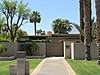 Frank Sinatra House |
December 27, 2016 (#16000893) |
1145 E. Via Colusa Rd. 33°49′52″N 116°32′01″W |
Palm Springs | |
| 82 | Southern Hotel | 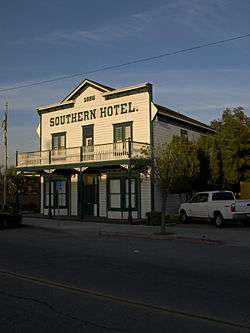 Southern Hotel |
October 15, 1992 (#92001384) |
445 S. D St. 33°46′55″N 117°13′42″W |
Perris | |
| 83 | Steel Development House Number 2 | 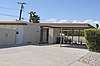 Steel Development House Number 2 |
March 20, 2012 (#12000125) |
3125 N. Sunny View Dr. 33°51′30″N 116°32′40″W |
Palm Springs | |
| 84 | Sutherland Fruit Company | 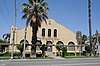 Sutherland Fruit Company |
April 11, 1986 (#86000732) |
3191 Seventh St. 33°58′50″N 117°21′59″W |
Riverside | |
| 85 | Tahquitz Canyon | 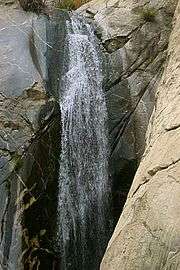 Tahquitz Canyon |
October 31, 1972 (#72000246) |
500 West Mesquite 33°48′31″N 116°33′02″W |
Palm Springs | |
| 86 | Tramway Gas Station | Tramway Gas Station |
September 28, 2015 (#15000645) |
2901 N. Palm Canyon Dr. 33°51′30″N 116°33′29″W |
Palm Springs | Now the Palm Springs Visitor Center |
| 87 | University Heights Junior High School | 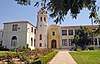 University Heights Junior High School |
June 24, 1993 (#93000547) |
2060 University Ave. 33°58′30″N 117°21′20″W |
Riverside | |
| 88 | Victoria Avenue | 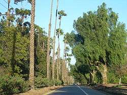 Victoria Avenue |
October 26, 2000 (#00001267) |
Victoria Ave., from Arlington Ave. to Boundary Ln. 33°55′33″N 117°23′57″W |
Riverside | |
| 89 | Wexler House |  Wexler House |
September 23, 2019 (#100004404) |
1272 E. Verbena Dr. 33°50′05″N 116°31′54″W |
Palm Springs | |
| 90 | E. Stewart and Mari Williams House | December 27, 2016 (#16000894) |
Address restricted |
Palm Springs | ||
| 91 | Woman's Improvement Club Clubhouse | 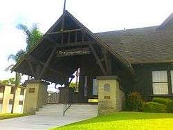 Woman's Improvement Club Clubhouse |
November 3, 1988 (#88002014) |
1101 S. Main St. 33°52′12″N 117°33′58″W |
Corona |
See also
| Wikimedia Commons has media related to National Register of Historic Places in Riverside County, California. |
References
- The latitude and longitude information provided in this table was derived originally from the National Register Information System, which has been found to be fairly accurate for about 99% of listings. Some locations in this table may have been corrected to current GPS standards.
- "National Register of Historic Places: Weekly List Actions". National Park Service, United States Department of the Interior. Retrieved on June 19, 2020.
- Numbers represent an ordering by significant words. Various colorings, defined here, differentiate National Historic Landmarks and historic districts from other NRHP buildings, structures, sites or objects.
- "National Register Information System". National Register of Historic Places. National Park Service. July 9, 2010.
- The eight-digit number below each date is the number assigned to each location in the National Register Information System database, which can be viewed by clicking the number.
External links
- NoeHill Travels in California: Historic Sites in Riverside County for a listing of NRHP and California landmarks
| Topics | |
|---|---|
| Lists by state |
|
| Lists by insular areas | |
| Lists by associated state | |
| Other areas | |
| Related | |
| |
This article is issued from Wikipedia. The text is licensed under Creative Commons - Attribution - Sharealike. Additional terms may apply for the media files.