National Register of Historic Places listings in Garland County, Arkansas
This is a list of the National Register of Historic Places listings in Garland County, Arkansas.
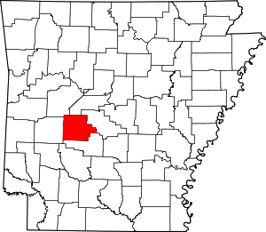
Location of Garland County in Arkansas
This is intended to be a complete list of the properties and districts on the National Register of Historic Places in Garland County, Arkansas, United States. The locations of National Register properties and districts for which the latitude and longitude coordinates are included below, may be seen in a map.[1]
There are 92 properties and districts listed on the National Register in the county, including 1 National Historic Landmark. Another property was once listed but has been removed.
- This National Park Service list is complete through NPS recent listings posted June 19, 2020.[2]
Current listings
| [3] | Name on the Register[4] | Image | Date listed[5] | Location | City or town | Description |
|---|---|---|---|---|---|---|
| 1 | Aristocrat Motor Inn | January 24, 2017 (#100000552) |
240 Central Ave. 34°30′59″N 93°03′13″W |
Hot Springs | ||
| 2 | Army and Navy General Hospital Historic District |  Army and Navy General Hospital Historic District |
February 9, 2007 (#05001590) |
105, 200, 417, 421 and 425 Reserve St. 34°30′43″N 93°03′01″W |
Hot Springs | |
| 3 | Army & Navy Memorial Lodge | September 30, 2019 (#100004497) |
570 Jobs Corps Rd. 34°32′21″N 93°11′48″W |
Royal | ||
| 4 | Bathhouse Row |  Bathhouse Row |
November 13, 1974 (#74000275) |
Central Ave. between Reserve and Fountain Sts. in Hot Springs National Park 34°30′50″N 93°03′13″W |
Hot Springs | |
| 5 | Walter Beauchamp House |  Walter Beauchamp House |
May 19, 1994 (#94000470) |
492 Prospect Ave. 34°30′27″N 93°03′37″W |
Hot Springs | |
| 6 | Belding-Gaines Cemetery | 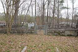 Belding-Gaines Cemetery |
February 25, 1993 (#93000089) |
U.S. Route 270 34°28′06″N 92°58′45″W |
Hot Springs | |
| 7 | Bellaire Court Historic District |  Bellaire Court Historic District |
February 11, 2004 (#04000007) |
637 Park Ave. 34°31′28″N 93°03′11″W |
Hot Springs | |
| 8 | W. C. Brown House | 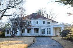 W. C. Brown House |
October 16, 1986 (#86002862) |
2330 Central Ave. 34°29′21″N 93°03′33″W |
Hot Springs | |
| 9 | Buckville Cemetery |  Buckville Cemetery |
September 27, 2007 (#07000994) |
Buckville Rd. 34°36′51″N 93°20′32″W |
Avant | |
| 10 | Butchie's Drive-In |  Butchie's Drive-In |
February 11, 2004 (#04000004) |
534 Park Ave. 34°31′23″N 93°03′13″W |
Hot Springs | |
| 11 | Camp Clearfork Historic District | Camp Clearfork Historic District |
October 21, 1993 (#93001079) |
South of U.S. Route 270 and west of Crystal Springs in the Ouachita National Forest 34°30′28″N 93°23′36″W |
Crystal Springs | |
| 12 | Carpenter Dam | 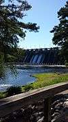 Carpenter Dam |
September 4, 1992 (#92001083) |
1398 Carpenter Dam Rd. 34°26′32″N 93°01′33″W |
Hot Springs | |
| 13 | CCC Company 3767 Powder Magazine Historic District | March 30, 2007 (#07000200) |
K59P Rd., north of Forest Service Rd. 11 (Gladstone Rd.) 34°45′54″N 93°11′48″W |
Jessieville | ||
| 14 | Central Methodist Episcopal Church South |  Central Methodist Episcopal Church South |
September 23, 2011 (#11000689) |
1100 Central Ave. 34°30′17″N 93°03′20″W |
Hot Springs | |
| 15 | Charlton Bathhouse |  Charlton Bathhouse |
October 20, 1993 (#93001080) |
North of U.S. Route 270 and west of Crystal Springs in the Ouachita National Forest 34°31′01″N 93°22′56″W |
Crystal Springs | |
| 16 | Charlton Spillway-Dam |  Charlton Spillway-Dam |
October 21, 1993 (#93001081) |
North of U.S. Route 270 and west of Crystal Springs in the Ouachita National Forest 34°31′03″N 93°22′53″W |
Crystal Springs | |
| 17 | Citizens Building |  Citizens Building |
August 9, 1979 (#79000440) |
723 Central Ave. 34°30′43″N 93°03′51″W |
Hot Springs | |
| 18 | Cleveland Arms Apartment Building | August 2, 2018 (#100002477) |
2410 Central Ave. 34°29′10″N 93°03′33″W |
Hot Springs | ||
| 19 | Bill Clinton Boyhood Home | _002.jpg) Bill Clinton Boyhood Home |
May 18, 1995 (#95000655) |
1011 Park Ave. 34°31′53″N 93°02′45″W |
Hot Springs | |
| 20 | Cottage Courts Historic District | 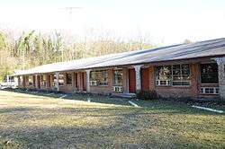 Cottage Courts Historic District |
February 11, 2004 (#04000005) |
609 Park Ave. 34°31′26″N 93°03′12″W |
Hot Springs | |
| 21 | Couchwood | 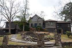 Couchwood |
December 4, 1986 (#86003582) |
On the grounds of the Couchwood estate, 601 Couchwood Rd.[6] 34°26′58″N 92°54′53″W |
Shorewood Hills | Extends into Hot Spring County; listing encompasses artwork of Dionicio Rodriguez on the private estate of Harvey C. Couch. |
| 22 | Couchwood Historic District |  Couchwood Historic District |
May 17, 2001 (#01000487) |
601 Couchwood Rd. 34°26′50″N 92°54′50″W |
Hot Springs | Extends into Hot Spring County; listing encompasses buildings and structures of the private estate of Harvey C. Couch. |
| 23 | Cove Tourist Court |  Cove Tourist Court |
February 11, 2004 (#04000008) |
771 Park Ave. 34°31′38″N 93°03′05″W |
Hot Springs | |
| 24 | Doherty House |  Doherty House |
November 14, 1978 (#78000587) |
705 Malvern Ave. 34°30′16″N 93°02′53″W |
Hot Springs | |
| 25 | Federal Building-U.S. Post Office and Court House |  Federal Building-U.S. Post Office and Court House |
May 5, 2015 (#15000205) |
100 Reserve St. 34°30′42″N 93°03′14″W |
Hot Springs | |
| 26 | First Lutheran Church |  First Lutheran Church |
May 27, 2015 (#15000282) |
1700 Central Ave. 34°29′46″N 93°03′28″W |
Hot Springs | |
| 27 | First Methodist Church Christian Education Building |  First Methodist Church Christian Education Building |
June 7, 2016 (#16000317) |
1100 Central Ave. 34°30′18″N 93°03′19″W |
Hot Springs | |
| 28 | First Presbyterian Church | 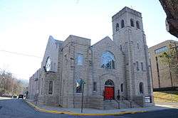 First Presbyterian Church |
December 22, 1982 (#82000817) |
213 Whittington 34°30′58″N 93°03′33″W |
Hot Springs | |
| 29 | Fordyce House |  Fordyce House |
December 22, 1982 (#82000818) |
746 Park Ave. 34°31′45″N 93°02′58″W |
Hot Springs | |
| 30 | Fordyce-Ricks House Historic District | 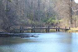 Fordyce-Ricks House Historic District |
October 31, 2003 (#03001098) |
1501 Park Ave. 34°32′11″N 93°02′01″W |
Hot Springs | |
| 31 | Forest Service Headquarters Historic District | 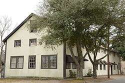 Forest Service Headquarters Historic District |
October 20, 1993 (#93001089) |
South of the junction of Winona and Indiana Sts. 34°29′32″N 93°03′16″W |
Hot Springs | |
| 32 | Garland County Courthouse | 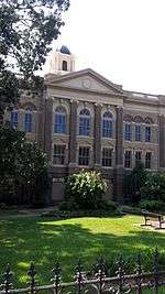 Garland County Courthouse |
December 6, 1979 (#79000441) |
Ouachita and Hawthorne Aves 34°30′17″N 93°03′32″W |
Hot Springs | |
| 33 | Gillham House | 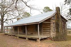 Gillham House |
March 17, 1994 (#94000188) |
County Road 584 north of its junction with U.S. Route 270 34°31′02″N 93°14′28″W |
Royal | |
| 34 | Harley E. Green House |  Harley E. Green House |
July 19, 1979 (#79000439) |
North of Bear 34°32′17″N 93°16′29″W |
Bear | |
| 35 | Greenwood School | January 26, 2018 (#100001995) |
1425 Greenwood Ave. 34°29′40″N 93°04′33″W |
Hot Springs | ||
| 36 | Hill Wheatley Downtowner Motor Inn |  Hill Wheatley Downtowner Motor Inn |
September 27, 2016 (#16000650) |
135 Central Ave. 34°31′04″N 93°03′18″W |
Hot Springs | |
| 37 | Hollywood Cemetery, Confederate Section | 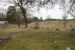 Hollywood Cemetery, Confederate Section |
December 6, 1996 (#96001409) |
Near the junction of Hollywood Ave. and Mote Rd. 34°29′11″N 93°02′33″W |
Hot Springs | |
| 38 | Hot Springs Central Avenue Historic District |  Hot Springs Central Avenue Historic District |
June 25, 1985 (#85001370) |
Central Ave. from Prospect to Park Sts.; also 101 Park Ave. 34°30′53″N 93°03′16″W |
Hot Springs | 101 Park represents a boundary increase of September 19, 2007; a boundary decrease was approved July 8, 2019. |
| 39 | Hot Springs Confederate Monument |  Hot Springs Confederate Monument |
April 26, 1996 (#96000457) |
Landmark Plaza, bounded by Market St. and Ouachita and Central Aves. 34°30′28″N 93°03′18″W |
Hot Springs | |
| 40 | Hot Springs High School | 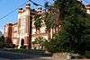 Hot Springs High School |
January 28, 1988 (#87002495) |
Oak St. between Orange and Olive Sts. 34°30′19″N 93°03′12″W |
Hot Springs | |
| 41 | Hot Springs National Guard Armory | June 5, 2017 (#100001006) |
210 Woodbine St. 34°30′14″N 93°03′29″W |
Hot Springs | ||
| 42 | Hot Springs Railroad Warehouse Historic District |  Hot Springs Railroad Warehouse Historic District |
May 27, 1996 (#96000526) |
401-439 Broadway 34°30′17″N 93°03′05″W |
Hot Springs | |
| 43 | Humphrey's Dairy Farm |  Humphrey's Dairy Farm |
July 26, 2012 (#12000275) |
1675 Shady Grove Rd. 34°27′08″N 93°00′03″W |
Hot Springs vicinity | |
| 44 | Humphreys-Ryan House |  Humphreys-Ryan House |
June 2, 2000 (#00000606) |
137 Garland Ave. 34°29′58″N 93°03′28″W |
Hot Springs | |
| 45 | Interstate Orphanage | 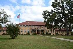 Interstate Orphanage |
December 22, 1982 (#82000832) |
339 Combs 34°29′50″N 93°03′12″W |
Hot Springs | |
| 46 | Iron Springs Dam | 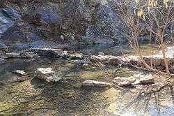 Iron Springs Dam |
October 21, 1993 (#93001090) |
Highway 7 north of Jessieville in the Ouachita National Forest 34°45′43″N 93°04′12″W |
Jessieville | |
| 47 | Iron Springs Shelter No. 1 | 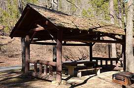 Iron Springs Shelter No. 1 |
October 20, 1993 (#93001091) |
Highway 7 north of Jessieville in the Ouachita National Forest 34°45′41″N 93°04′09″W |
Jessieville | |
| 48 | Iron Springs Shelter No. 2 | 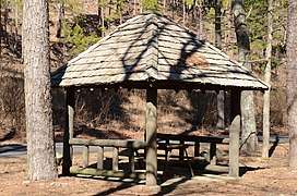 Iron Springs Shelter No. 2 |
October 20, 1993 (#93001092) |
Highway 7 north of Jessieville in the Ouachita National Forest 34°45′40″N 93°04′09″W |
Jessieville | |
| 49 | Jack Tar Hotel and Bathhouse |  Jack Tar Hotel and Bathhouse |
February 21, 2006 (#06000079) |
145 Oriole St. 34°31′45″N 93°02′49″W |
Hot Springs | |
| 50 | Peter Dierks Joers House |  Peter Dierks Joers House |
November 4, 2009 (#09000773) |
2111 Park Ave. 34°32′37″N 93°01′24″W |
Hot Springs | |
| 51 | Jones School |  Jones School |
May 5, 1988 (#88000517) |
Linwood and Hobson Aves. 34°29′51″N 93°03′40″W |
Hot Springs | |
| 52 | Peter Joplin Commercial Block |  Peter Joplin Commercial Block |
March 31, 2000 (#00000294) |
426-432 Ouachita Ave. 34°30′24″N 93°03′30″W |
Hot Springs | |
| 53 | King-Neimeyer-Mathis House |  King-Neimeyer-Mathis House |
September 14, 2002 (#02000955) |
2145 Malvern Rd. 34°28′42″N 93°01′28″W |
Hot Springs | |
| 54 | George Klein Tourist Court Historic District |  George Klein Tourist Court Historic District |
June 8, 1993 (#93000480) |
501 Morrison St. 34°29′42″N 93°03′24″W |
Hot Springs | |
| 55 | Kraemer-Harman House | 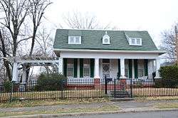 Kraemer-Harman House |
October 21, 1999 (#99001258) |
513 2nd St. 34°29′50″N 93°03′46″W |
Hot Springs | |
| 56 | Langdon Filling Station | 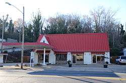 Langdon Filling Station |
February 11, 2004 (#04000003) |
311 Park Ave. 34°31′17″N 93°03′17″W |
Hot Springs | |
| 57 | Little Switzerland | December 4, 1986 (#86003584) |
Address Restricted |
Shorewood Hills | ||
| 58 | Van Lyell House |  Van Lyell House |
August 31, 2004 (#04000504) |
130 Van Lyell Terrace 34°26′18″N 93°05′07″W |
Hot Springs | |
| 59 | Lynwood Tourist Court Historic District |  Lynwood Tourist Court Historic District |
February 11, 2004 (#04000010) |
857 Park Ave. 34°31′45″N 93°02′58″W |
Hot Springs | |
| 60 | Malco Theatre |  Malco Theatre |
January 21, 2010 (#09001246) |
817 Central Ave. 34°30′32″N 93°03′15″W |
Hot Springs | |
| 61 | William H. Martin House |  William H. Martin House |
June 11, 1986 (#86001320) |
815 Quapaw Ave. 34°30′15″N 93°03′47″W |
Hot Springs | |
| 62 | Mayberry Springs | September 5, 1990 (#90001379) |
U.S. Route 270 34°31′01″N 93°18′06″W |
Crystal Springs | (burned down) | |
| 63 | Medical Arts Building |  Medical Arts Building |
November 30, 1978 (#78000588) |
236 Central Ave. 34°30′59″N 93°03′14″W |
Hot Springs | |
| 64 | Missouri-Pacific Railroad Depot-Hot Springs |  Missouri-Pacific Railroad Depot-Hot Springs |
June 11, 1992 (#92000611) |
Junction of Broadway and Market St. 34°30′27″N 93°03′09″W |
Hot Springs | |
| 65 | W. H. Moore House |  W. H. Moore House |
March 27, 1990 (#90000429) |
906 Malvern St. 34°30′04″N 93°02′44″W |
Hot Springs | |
| 66 | Mountainaire Hotel Historic District |  Mountainaire Hotel Historic District |
February 11, 2004 (#04000013) |
1100 Park Ave. 34°31′50″N 93°02′32″W |
Hot Springs | |
| 67 | Old Post Office |  Old Post Office |
April 12, 1990 (#90000547) |
Convention Boulevard 34°30′27″N 93°02′57″W |
Hot Springs | |
| 68 | Opal's Steak House |  Opal's Steak House |
February 11, 2004 (#04000011) |
871 Park Ave. 34°31′47″N 93°02′56″W |
Hot Springs | |
| 69 | Orange Street Presbyterian Church |  Orange Street Presbyterian Church |
March 28, 2002 (#02000259) |
428 Orange St. 34°30′20″N 93°03′22″W |
Hot Springs | |
| 70 | Ouachita Avenue Historic District |  Ouachita Avenue Historic District |
September 23, 2011 (#11000690) |
Bounded by Ouachita Ave., Orange St., Central Ave. & Olive St. 34°30′23″N 93°03′21″W |
Hot Springs | |
| 71 | Park Hotel |  Park Hotel |
December 22, 1982 (#82000819) |
210 Fountain 34°31′04″N 93°03′05″W |
Hot Springs | |
| 72 | Parkway Courts Historic District |  Parkway Courts Historic District |
February 11, 2004 (#04000009) |
815 Park Ave. 34°31′35″N 93°03′07″W |
Hot Springs | |
| 73 | Passmore House |  Passmore House |
October 8, 1976 (#76000408) |
846 Park Ave. 34°31′46″N 93°02′57″W |
Hot Springs | |
| 74 | Perry Plaza Court Historic District |  Perry Plaza Court Historic District |
February 11, 2004 (#04000012) |
1007 Park Ave. 34°31′50″N 93°02′43″W |
Hot Springs | |
| 75 | Plaza Apartments |  Plaza Apartments |
November 5, 1999 (#99001259) |
610 Spring St. 34°30′45″N 93°02′52″W |
Hot Springs | |
| 76 | Pleasant Street Historic District |  Pleasant Street Historic District |
June 20, 2003 (#03000532) |
Roughly bounded by Malvern Ave. and Pleasant, Church, Gulpha, Garden, Grove, and Kirk Sts. 34°30′26″N 93°02′52″W |
Hot Springs | |
| 77 | Quapaw-Prospect Historic District | Quapaw-Prospect Historic District |
March 8, 2002 (#99000821) |
Roughly bounded by Quapaw and Prospect Aves. 34°30′18″N 93°03′47″W |
Hot Springs | |
| 78 | Riviera Hotel | 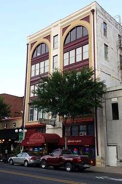 Riviera Hotel |
December 22, 1982 (#82000820) |
719 Central 34°30′32″N 93°03′15″W |
Hot Springs | |
| 79 | Charles N. Rix House |  Charles N. Rix House |
October 15, 1992 (#92001393) |
628 Quapaw Ave. 34°30′22″N 93°03′37″W |
Hot Springs | |
| 80 | St. Luke's Episcopal Church | 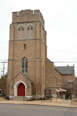 St. Luke's Episcopal Church |
December 22, 1982 (#82000821) |
Spring and Cottage Sts. 34°30′38″N 93°03′07″W |
Hot Springs | |
| 81 | Short-Dodson House |  Short-Dodson House |
May 3, 1976 (#76000409) |
755 Park Ave. 34°31′39″N 93°03′07″W |
Hot Springs | |
| 82 | South Fork Bridge |  South Fork Bridge |
April 9, 1990 (#90000521) |
Off Highway 128 over South Fork 34°36′11″N 92°55′20″W |
Fountain Lake | |
| 83 | Stitt House |  Stitt House |
May 3, 1976 (#76000410) |
824 Park Ave. 34°31′44″N 93°02′59″W |
Hot Springs | |
| 84 | Taylor Rosamond Motel Historic District | 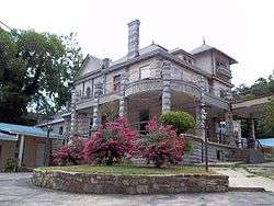 Taylor Rosamond Motel Historic District |
May 26, 2004 (#04000497) |
316 Park Ave. 34°31′17″N 93°03′17″W |
Hot Springs | |
| 85 | Dr. Albert H. Tribble House | January 24, 2019 (#100003327) |
100 Trivista Right 34°29′23″N 93°03′29″W |
Hot Springs | ||
| 86 | Visitors Chapel AME | 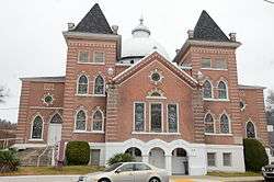 Visitors Chapel AME |
June 2, 1995 (#95000682) |
319 Church St. 34°30′31″N 93°03′01″W |
Hot Springs | |
| 87 | Wade Building | 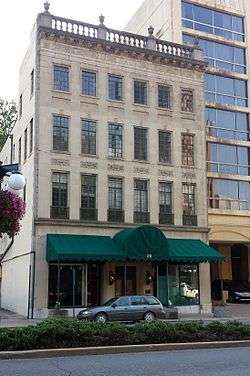 Wade Building |
December 22, 1982 (#82000822) |
231 Central 34°31′01″N 93°03′13″W |
Hot Springs | |
| 88 | Whittington Park Historic District |  Whittington Park Historic District |
December 19, 2012 (#12001055) |
Whittington Ave. & Sabie St. between Water & Woodfin Sts. 34°31′00″N 93°03′57″W |
Hot Springs | |
| 89 | Wildwood | %2C_1_of_4.JPG) Wildwood |
October 8, 1976 (#76000411) |
808 Park Ave. 34°31′42″N 93°03′00″W |
Hot Springs | |
| 90 | Hamp Williams Building | 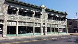 Hamp Williams Building |
September 20, 2007 (#07000972) |
500-504 Ouachita Ave. 34°30′26″N 93°03′32″W |
Hot Springs | |
| 91 | Williams-Wootton House |  Williams-Wootton House |
November 30, 1978 (#78000589) |
420 Quapaw Ave. 34°30′23″N 93°03′35″W |
Hot Springs | |
| 92 | Woodmen of Union Building | 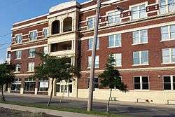 Woodmen of Union Building |
June 27, 1997 (#97000616) |
501 Malvern Ave. 34°30′25″N 93°02′58″W |
Hot Springs |
Former listing
| [3] | Name on the Register | Image | Date listed | Date removed | Location | City or town | Summary |
|---|---|---|---|---|---|---|---|
| 1 | Wheatley Courts | February 11, 2004 (#04000006) | September 29, 2015 | 811 Park Ave. 34°31′42″N 93°03′02″W |
Hot Springs |
See also
| Wikimedia Commons has media related to National Register of Historic Places in Garland County, Arkansas. |
References
- The latitude and longitude information provided in this table was derived originally from the National Register Information System, which has been found to be fairly accurate for about 99% of listings. Some locations in this table may have been corrected to current GPS standards.
- "National Register of Historic Places: Weekly List Actions". National Park Service, United States Department of the Interior. Retrieved on June 19, 2020.
- Numbers represent an ordering by significant words. Various colorings, defined here, differentiate National Historic Landmarks and historic districts from other NRHP buildings, structures, sites or objects.
- "National Register Information System". National Register of Historic Places. National Park Service. March 13, 2009.
- The eight-digit number below each date is the number assigned to each location in the National Register Information System database, which can be viewed by clicking the number.
- Location derived from the Couchwood Historic District article of the Encyclopedia of Arkansas History and Culture; the NRIS lists the site as "Address Restricted"
| Topics | |
|---|---|
| Lists by state |
|
| Lists by insular areas | |
| Lists by associated state | |
| Other areas | |
| Related | |
| |
Municipalities and communities of Garland County, Arkansas, United States | ||
|---|---|---|
| Cities | Map of Arkansas highlighting Garland County | |
| Towns | ||
| CDPs | ||
| Townships |
| |
| Other unincorporated communities | ||
| Footnotes | ‡This populated place also has portions in an adjacent county or counties | |
This article is issued from Wikipedia. The text is licensed under Creative Commons - Attribution - Sharealike. Additional terms may apply for the media files.