National Register of Historic Places listings in Faulkner County, Arkansas
This is a list of the National Register of Historic Places listings in Faulkner County, Arkansas.
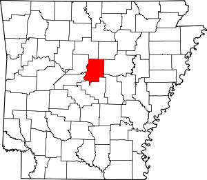
Location of Faulkner County in Arkansas
This is intended to be a complete list of the properties and districts on the National Register of Historic Places in Faulkner County, Arkansas, United States. The locations of National Register properties and districts for which the latitude and longitude coordinates are included below, may be seen in a map.[1]
There are 63 properties and districts listed on the National Register in the county. Three sites that were once listed have been removed.
- This National Park Service list is complete through NPS recent listings posted June 19, 2020.[2]
Current listings
| [3] | Name on the Register[4] | Image | Date listed[5] | Location | City or town | Description |
|---|---|---|---|---|---|---|
| 1 | Administration Building, University of Central Arkansas | 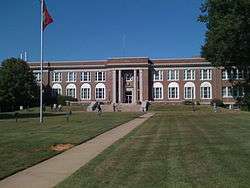 Administration Building, University of Central Arkansas |
January 24, 2011 (#10001153) |
201 Donaghey Ave. 35°04′45″N 92°27′26″W |
Conway | |
| 2 | Blessing Farmstead | 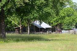 Blessing Farmstead |
September 5, 1990 (#90001369) |
North of Enola 35°15′08″N 92°14′30″W |
Barney | |
| 3 | Brown House | 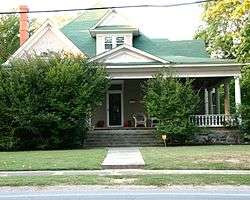 Brown House |
December 22, 1982 (#82000811) |
1604 Caldwell St. 35°05′24″N 92°26′44″W |
Conway | |
| 4 | Cadron Settlement | 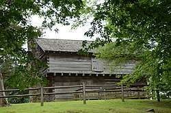 Cadron Settlement |
May 17, 1974 (#74000475) |
Highway 319W at Cadron Settlement Ln. 35°06′26″N 92°32′44″W |
Conway | A Trail of Tears site,[6] with early French and American settlements. |
| 5 | Castleberry-Harrington Historic District | 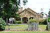 Castleberry-Harrington Historic District |
June 5, 2007 (#07000503) |
Castleberry Rd. 35°15′36″N 92°25′36″W |
Republican | |
| 6 | Century Flyer | 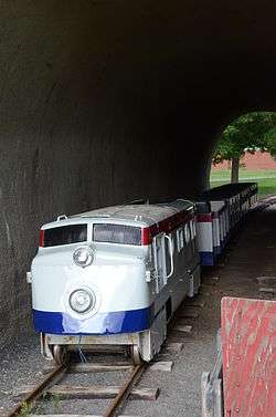 Century Flyer |
May 28, 2010 (#10000284) |
150 E. Siebenmorgan Rd. 35°05′56″N 92°25′45″W |
Conway | Amusement park train on the grounds of the Conway Human Development Center |
| 7 | Church of Christ | 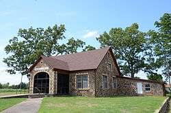 Church of Christ |
February 15, 2005 (#05000040) |
Highway 310 35°19′33″N 92°20′07″W |
Guy | |
| 8 | Conway Commercial Historic District |  Conway Commercial Historic District |
September 23, 2010 (#10000779) |
Roughly bounded by Main St. on the south, Harkrider St. and Spencer St. on the east, just south of Mill St. to the north, and Locust St. 35°05′34″N 92°26′24″W |
Conway | |
| 9 | Conway Confederate Monument | 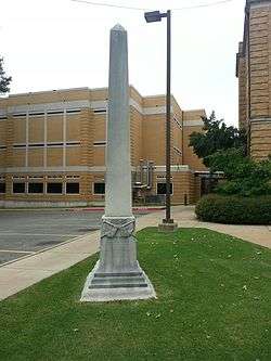 Conway Confederate Monument |
April 26, 1996 (#96000455) |
Southwestern corner of the courthouse lawn, east of the junction of Robinson Ave. and Center St. 35°05′19″N 92°26′35″W |
Conway | |
| 10 | Earl and Oza Crownover-Brown House |  Earl and Oza Crownover-Brown House |
March 2, 2006 (#06000088) |
133 S. Broadway 35°21′25″N 92°24′48″W |
Damascus | |
| 11 | O.L. Dunaway House |  O.L. Dunaway House |
July 19, 1996 (#96000797) |
920 Center St. 35°05′26″N 92°26′42″W |
Conway | |
| 12 | Richard and Mettie Ealy House | 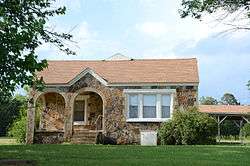 Richard and Mettie Ealy House |
September 30, 2005 (#05001069) |
280 Solomon Grove Rd. 35°18′45″N 92°26′51″W |
Twin Groves | |
| 13 | Farmers State Bank | 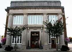 Farmers State Bank |
December 22, 1982 (#82000812) |
1001 Front St. 35°05′31″N 92°26′28″W |
Conway | |
| 14 | Faulkner County Courthouse | 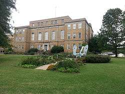 Faulkner County Courthouse |
November 27, 1995 (#95001381) |
801 Locust St. 35°05′20″N 92°26′34″W |
Conway | |
| 15 | Faulkner County Jail | 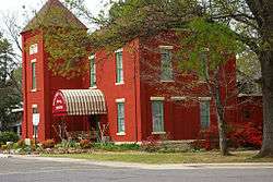 Faulkner County Jail |
July 20, 1978 (#78000585) |
Courthouse Sq. 35°05′21″N 92°26′37″W |
Conway | |
| 16 | First United Methodist Church | 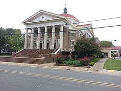 First United Methodist Church |
November 20, 1992 (#92001623) |
Northwestern corner of the junction of Prince and Clifton Sts. 35°05′32″N 92°26′44″W |
Conway | |
| 17 | Frauenthal & Schwarz Building | 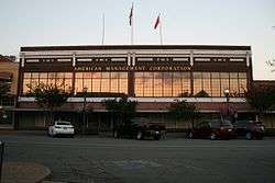 Frauenthal & Schwarz Building |
October 23, 1992 (#92000956) |
824 Front St. 35°05′29″N 92°26′27″W |
Conway | |
| 18 | Frauenthal House | 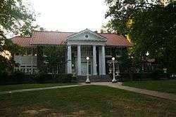 Frauenthal House |
December 22, 1982 (#82000814) |
631 Western 35°05′14″N 92°27′28″W |
Conway | |
| 19 | Galloway Hall | 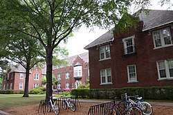 Galloway Hall |
December 22, 1982 (#82000953) |
Hendrix College campus 35°06′06″N 92°26′28″W |
Conway | |
| 20 | Dennis and Christine Garrison House |  Dennis and Christine Garrison House |
September 29, 2005 (#05001070) |
105 Garrison Rd. 35°14′25″N 92°27′03″W |
Greenbrier | |
| 21 | Greeson-Cone House |  Greeson-Cone House |
September 7, 1995 (#95001094) |
928 Center St. 35°05′28″N 92°26′41″W |
Conway | |
| 22 | Guy High School Gymnasium |  Guy High School Gymnasium |
September 10, 1992 (#92001196) |
Highway 25 35°19′24″N 92°19′24″W |
Guy | |
| 23 | Guy Home Economics Building |  Guy Home Economics Building |
September 10, 1992 (#92001197) |
Highway 25 35°19′25″N 92°19′22″W |
Guy | |
| 24 | Charlie Hall House | 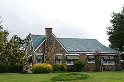 Charlie Hall House |
June 1, 2005 (#05000492) |
221 Old U.S. Route 65 35°20′25″N 92°23′59″W |
Twin Groves | |
| 25 | Hall-Hogan Grocery Store | 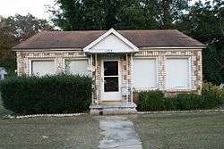 Hall-Hogan Grocery Store |
September 30, 2013 (#13000785) |
1364 Mitchell 35°05′53″N 92°26′58″W |
Conway | |
| 26 | Frank U. Halter House | 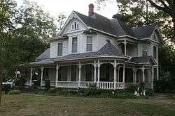 Frank U. Halter House |
August 29, 1980 (#80000776) |
1355 College Ave. 35°05′03″N 92°26′26″W |
Conway | |
| 27 | Hardy Cemetery |  Hardy Cemetery |
October 8, 2009 (#09000798) |
722 Highway 225, E. 35°15′24″N 92°15′15″W |
Centerville | |
| 28 | Harton House | 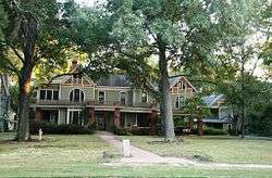 Harton House |
May 25, 1979 (#79000438) |
1821 Robinson Ave. 35°05′16″N 92°26′56″W |
Conway | |
| 29 | D.O. Harton House | 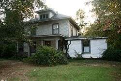 D.O. Harton House |
July 19, 1996 (#96000796) |
607 Davis St. 35°05′11″N 92°26′53″W |
Conway | |
| 30 | Hendrix College Addition Neighborhood Historic District |  Hendrix College Addition Neighborhood Historic District |
September 20, 2007 (#07000973) |
Roughly bounded by Washington Ave., Fleming St., Harkrider St., and Winfield St. 35°06′16″N 92°26′34″W |
Conway | |
| 31 | Michael M. Hiegel House | 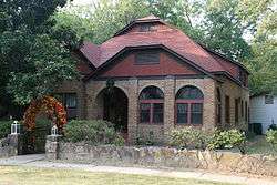 Michael M. Hiegel House |
August 14, 1998 (#98000912) |
504 2nd St. 35°05′17″N 92°25′57″W |
Conway | |
| 32 | E.E. Hooten House | 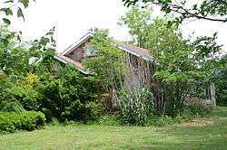 E.E. Hooten House |
February 15, 2005 (#05000039) |
400 Highway 25, N. 35°19′13″N 92°20′17″W |
Guy | |
| 33 | Farris and Evelyn Langley House |  Farris and Evelyn Langley House |
June 1, 2005 (#05000493) |
12 Langley Ln. 35°17′17″N 92°23′53″W |
Republican | |
| 34 | Lasley's College Apartments |  Lasley's College Apartments |
May 25, 2011 (#11000300) |
1916 & 1922 Bruce St. 35°04′58″N 92°27′03″W |
Conway | |
| 35 | Lee Service Station |  Lee Service Station |
February 15, 2005 (#05000044) |
28 S. Broadway 35°21′56″N 92°24′38″W |
Damascus | |
| 36 | Liberty School Cafeteria |  Liberty School Cafeteria |
September 10, 1992 (#92001195) |
Highway 36, north of its junction with U.S. Route 64 35°04′53″N 92°18′21″W |
Hamlet | |
| 37 | J.E. Little House | 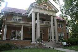 J.E. Little House |
January 26, 1999 (#98001631) |
427 Western Ave. 35°05′03″N 92°27′22″W |
Conway | |
| 38 | Martin Hall | 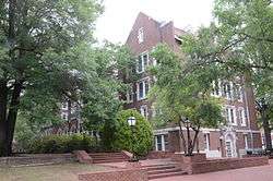 Martin Hall |
December 22, 1982 (#82000815) |
Hendrix College campus 35°05′58″N 92°26′28″W |
Conway | |
| 39 | Merritt House | 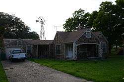 Merritt House |
September 28, 2005 (#05001071) |
139 N. Broadview 35°15′15″N 92°23′16″W |
Greenbrier | |
| 40 | S.D. Merritt House | 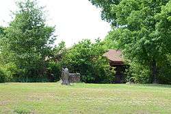 S.D. Merritt House |
February 15, 2005 (#05000038) |
45 Highway 25, N. 35°16′24″N 92°22′59″W |
Greenbrier | |
| 41 | Military Road-Cadron Segment | January 28, 2004 (#03001490) |
Address Restricted |
Conway | A segment of the Trail of Tears[6] | |
| 42 | Mt. Zion Missionary Baptist Church | 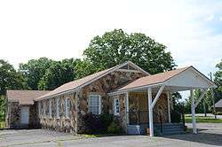 Mt. Zion Missionary Baptist Church |
February 5, 2009 (#09000003) |
249 Highway 107 35°11′46″N 92°12′12″W |
Enola | |
| 43 | Oak Grove Cemetery Historic Section | 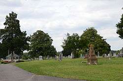 Oak Grove Cemetery Historic Section |
November 4, 2009 (#09000341) |
E. Bruce St. approximately 0.3 miles (0.48 km) east of Harkrider St. 35°04′51″N 92°25′50″W |
Conway | |
| 44 | Silas Owens Sr. House | 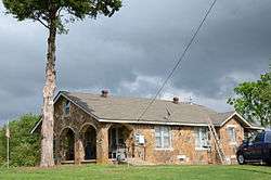 Silas Owens Sr. House |
February 15, 2005 (#05000045) |
157 Solomon Grove Rd. 35°19′16″N 92°26′04″W |
Twin Groves | |
| 45 | Patton House | 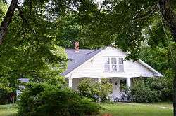 Patton House |
September 30, 1993 (#93001026) |
Highway 25 35°12′04″N 92°27′09″W |
Wooster | |
| 46 | President's House | 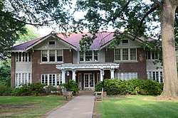 President's House |
December 22, 1982 (#82000816) |
Hendrix College campus 35°05′53″N 92°26′32″W |
Conway | Now known as Ellis Hall |
| 47 | Quattlebaum-Pelletier House | 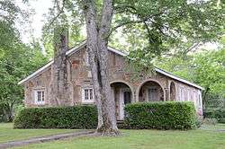 Quattlebaum-Pelletier House |
June 1, 2005 (#05000494) |
43 Ozark 35°18′10″N 92°23′56″W |
Twin Groves | |
| 48 | Frank E. Robins House | 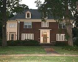 Frank E. Robins House |
May 20, 1994 (#94000497) |
567 Locust St. 35°05′09″N 92°26′29″W |
Conway | |
| 49 | Reuben W. Robins House | 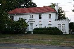 Reuben W. Robins House |
September 28, 2005 (#05001072) |
508 Locust St. 35°05′14″N 92°26′26″W |
Conway | |
| 50 | Robinson Historic District | 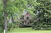 Robinson Historic District |
January 29, 2001 (#00001645) |
Roughly bounded by Cross, Prince, Faulkner, and Watkins Sts., and Robinson Ave. 35°05′23″N 92°26′54″W |
Conway | |
| 51 | James and Jewell Salter House | June 1, 2005 (#05000495) |
159 S. Broadview 35°12′50″N 92°23′19″W |
Greenbrier | ||
| 52 | Scull Historic District | 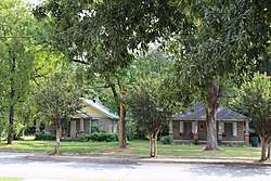 Scull Historic District |
September 21, 2017 (#100001647) |
428 & 432 Conway Blvd. 35°05′02″N 92°26′37″W |
Conway | |
| 53 | Sellers House | 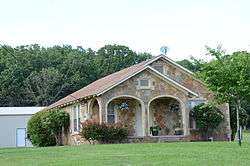 Sellers House |
February 15, 2005 (#05000042) |
89 Acklin Gap Rd. 35°08′05″N 92°23′23″W |
Conway | |
| 54 | S.G. Smith House | 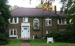 S.G. Smith House |
December 22, 1982 (#82000853) |
1837 Caldwell St. 35°05′24″N 92°27′01″W |
Conway | |
| 55 | Solomon Grove Smith-Hughes Building | 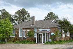 Solomon Grove Smith-Hughes Building |
December 9, 1994 (#94001461) |
South of County Road 29 35°19′14″N 92°26′00″W |
Twin Groves | |
| 56 | Spears House | 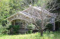 Spears House |
February 15, 2005 (#05000043) |
1235 U.S. Route 65, N. 35°17′11″N 92°23′32″W |
Greenbrier | |
| 57 | Springfield Bridge | 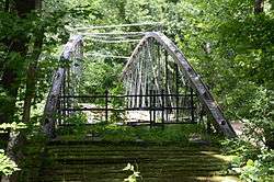 Springfield Bridge |
July 21, 1988 (#88000660) |
Beaverfork Lake Park 35°08′30″N 92°27′13″W |
Conway | Moved in 2017. |
| 58 | Titan II ICBM Launch Complex 374-5 Site | 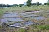 Titan II ICBM Launch Complex 374-5 Site |
February 18, 2000 (#98001433) |
East of U.S. Route 65, 0.4 miles (0.64 km) north of its junction with E. Cadron Ridge Rd. 35°09′52″N 92°23′46″W |
Springhill | |
| 59 | Tyler-Southerland House | 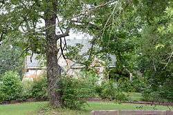 Tyler-Southerland House |
October 19, 2005 (#05001168) |
36 Southerland 35°04′17″N 92°24′20″W |
Conway | |
| 60 | University of Central Arkansas Historic District | 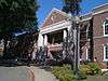 University of Central Arkansas Historic District |
March 13, 2013 (#13000064) |
201 Donaghey Ave. 35°04′49″N 92°27′18″W |
Conway | |
| 61 | Earl and Mildred Ward House | 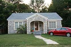 Earl and Mildred Ward House |
October 19, 2005 (#05001169) |
1157 Mitchell St. 35°05′40″N 92°26′59″W |
Conway | |
| 62 | Washburn House | 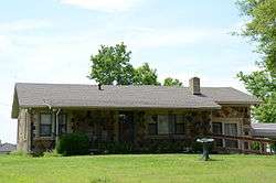 Washburn House |
January 23, 2007 (#06001279) |
40 Battles Loop 35°19′03″N 92°21′31″W |
Guy | |
| 63 | Young Memorial | 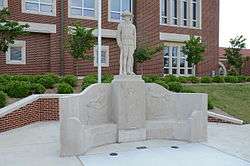 Young Memorial |
July 19, 1996 (#96000758) |
1601 Harkrider Dr., north of Reynolds Science Hall 35°06′01″N 92°26′30″W |
Conway |
Former listings
| [3] | Name on the Register | Image | Date listed | Date removed | Location | City or town | Summary |
|---|---|---|---|---|---|---|---|
| 1 | First Baptist Church | 1982 (#82000813) | January 14, 2002 | Davis and Robinson Street |
Conway | ||
| 2 | Main Hall, Central College | December 6, 1975 (#75000385) | June 3, 1986 | 1509 College Ave., Central Baptist College |
Conway | ||
| 3 | Joe and Nina Webb House | October 19, 2005 (#05001171) | September 25, 2012 | 2945 Prince |
Conway |
See also
| Wikimedia Commons has media related to National Register of Historic Places in Faulkner County, Arkansas. |
References
- The latitude and longitude information provided in this table was derived originally from the National Register Information System, which has been found to be fairly accurate for about 99% of listings. Some locations in this table may have been corrected to current GPS standards.
- "National Register of Historic Places: Weekly List Actions". National Park Service, United States Department of the Interior. Retrieved on June 19, 2020.
- Numbers represent an ordering by significant words. Various colorings, defined here, differentiate National Historic Landmarks and historic districts from other NRHP buildings, structures, sites or objects.
- "National Register Information System". National Register of Historic Places. National Park Service. March 13, 2009.
- The eight-digit number below each date is the number assigned to each location in the National Register Information System database, which can be viewed by clicking the number.
- "Trail Of Tears National Historic Trail: National Register Research". National Park Service. Retrieved January 22, 2013.
| Topics | |
|---|---|
| Lists by state |
|
| Lists by insular areas | |
| Lists by associated state | |
| Other areas | |
| Related | |
| |
Municipalities and communities of Faulkner County, Arkansas, United States | ||
|---|---|---|
| Cities | Map of Arkansas highlighting Faulkner County | |
| Towns | ||
| Unincorporated communities | ||
| Footnotes | ‡This populated place also has portions in an adjacent county or counties | |
This article is issued from Wikipedia. The text is licensed under Creative Commons - Attribution - Sharealike. Additional terms may apply for the media files.