National Register of Historic Places listings in Chittenden County, Vermont
This is a list of the National Register of Historic Places listings in Chittenden County, Vermont.

Location of Chittenden County in Vermont
This is intended to be a complete list of the properties and districts on the National Register of Historic Places in Chittenden County, Vermont, United States. Latitude and longitude coordinates are provided for many National Register properties and districts; these locations may be seen together in a map.[1]
There are 108 properties and districts listed on the National Register in the county, including 3 National Historic Landmarks. One property was once listed, but has been removed.
- This National Park Service list is complete through NPS recent listings posted June 26, 2020.[2]
| Addison - Bennington - Caledonia - Chittenden - Essex - Franklin - Grand Isle - Lamoille - Orange - Orleans - Rutland - Washington - Windham - Windsor |
Current listings
| [3] | Name on the Register[4] | Image | Date listed[5] | Location | City or town | Description |
|---|---|---|---|---|---|---|
| 1 | Ethan Allen Homestead | 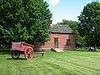 Ethan Allen Homestead |
July 24, 1986 (#86002265) |
Off Van Patten Parkway 44°30′29″N 73°13′48″W |
Burlington | |
| 2 | Apartment Building at 27 and 31 Peru Street and 29 Johnson Street | 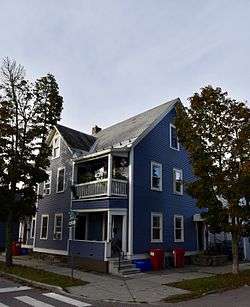 Apartment Building at 27 and 31 Peru Street and 29 Johnson Street |
January 22, 2014 (#13001119) |
27 and 31 Peru Street and 29 Johnson Street 44°28′57″N 73°12′59″W |
Burlington | |
| 3 | Martin M. Bates Farmstead | 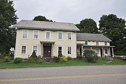 Martin M. Bates Farmstead |
November 21, 1991 (#91001676) |
Huntington Rd. north of Huntington 44°21′57″N 72°59′48″W |
Richmond | |
| 4 | Battery Street Historic District | 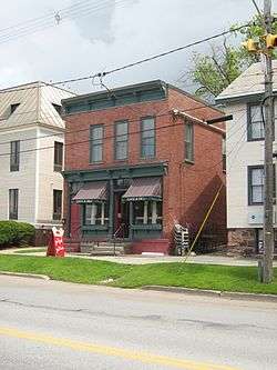 Battery Street Historic District |
November 2, 1977 (#77000098) |
Roughly bounded by Lake Champlain and Main, Maple, and St. Pauls Sts. (both sides); also roughly bounded by Brown's Court and King, Adams, and Union Sts.; also 214-240 Pine St., excluding 235 44°28′29″N 73°13′05″W |
Burlington | Second and third sets of boundaries represents boundary increases of June 28, 1984 and July 24, 2014 respectively |
| 5 | Wilson Alwyn "Snowflake" Bentley House | 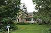 Wilson Alwyn "Snowflake" Bentley House |
July 3, 1980 (#80004501) |
Southeast of Jericho on Nashville Rd. 44°27′01″N 72°55′57″W |
Jericho | |
| 6 | Buell Street-Bradley Street Historic District | 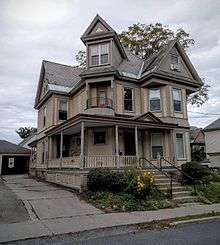 Buell Street-Bradley Street Historic District |
November 13, 1995 (#95001260) |
2-71 Bradley St., 24-125 Buell St., 16-75 Orchard Terr., 9-96 S. Union St., 11-87 Hungerford Terr. 44°28′45″N 73°12′31″W |
Burlington | |
| 7 | Burlington Bay Horse Ferry | December 15, 1993 (#93001384) |
In Burlington Bay, between Lone Rock Point and the Burlington breakwater[6] 44°29′07″N 73°14′35″W |
Burlington | Shipwreck of a horse-powered ferry | |
| 8 | Burlington Breakwater | 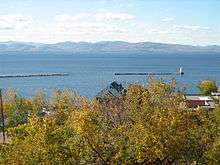 Burlington Breakwater |
June 6, 2003 (#02000711) |
Burlington Harbor 44°28′32″N 73°13′33″W |
Burlington | Built to calm the waters of Lake Champlain against Burlington harbor. |
| 9 | Burlington Montgomery Ward Building | 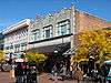 Burlington Montgomery Ward Building |
May 30, 1991 (#91000673) |
52-54 Church St. 44°28′44″N 73°12′46″W |
Burlington | |
| 10 | Burlington Traction Company | 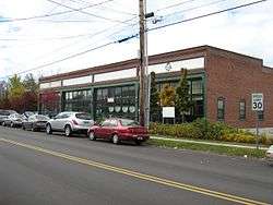 Burlington Traction Company |
October 7, 2004 (#04001133) |
662 Riverside Ave. and 321-343 N. Winooski Ave. 44°29′29″N 73°12′22″W |
Burlington | First housing streetcars, then buses, now several small businesses and apartments. |
| 11 | Roswell Butler House | November 8, 2001 (#01001226) |
6 Carmichael St. 44°30′34″N 73°05′05″W |
Essex | ||
| 12 | Carnegie Building of the Fletcher Free Library | 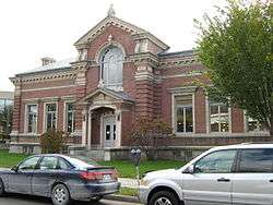 Carnegie Building of the Fletcher Free Library |
August 18, 1976 (#76000138) |
College St. and S. Winooski Ave. 44°28′37″N 73°12′39″W |
Burlington | |
| 13 | Champlain School | 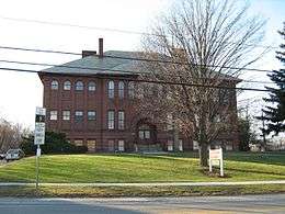 Champlain School |
December 10, 1982 (#82001761) |
817 Pine St. 44°27′25″N 73°12′55″W |
Burlington | Former elementary school, now apartments (with addition in rear) |
| 14 | Charlotte Center Historic District | 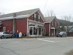 Charlotte Center Historic District |
July 19, 1984 (#84003460) |
Church Hill and Hinesburg Rds. 44°18′52″N 73°14′23″W |
Charlotte | |
| 15 | Giles Chittenden Farmstead | October 29, 1993 (#93001160) |
Governor Chittenden Rd., northeast of Williston village center 44°26′59″N 73°02′43″W |
Williston | ||
| 16 | Martin Chittenden House | 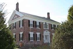 Martin Chittenden House |
January 9, 1978 (#78000230) |
West of Jericho on Vermont Route 117 44°27′28″N 73°01′13″W |
Jericho | |
| 17 | Church Street Historic District |  Church Street Historic District |
July 29, 2010 (#09000915) |
Generally the Church St. corridor, along with flanking blocks of Bank, Cherry, College, and Main Streets 44°28′40″N 73°12′45″W |
Burlington | |
| 18 | City Hall Park Historic District | 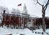 City Hall Park Historic District |
June 9, 1983 (#83003206) |
Church, College, Main, and St. Paul Sts. 44°28′35″N 73°12′49″W |
Burlington | |
| 19 | District No. 5 Schoolhouse | 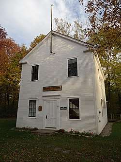 District No. 5 Schoolhouse |
April 5, 2018 (#100002311) |
32 Pleasant Valley Rd. 44°30′33″N 72°53′44″W |
Underhill | |
| 20 | Downtown Essex Junction Commercial Historic District | 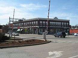 Downtown Essex Junction Commercial Historic District |
November 1, 2004 (#04001216) |
3-17 and 8-12 Main St., 2-28 Railroad Ave., and 2 Railroad St. 44°29′36″N 73°06′35″W |
Essex Junction | |
| 21 | Dumas Tenements | September 18, 2012 (#11000928) |
114 W. Allen & 114 W. Canal Sts. 44°29′28″N 73°11′29″W |
Winooski | ||
| 22 | Duplex at 22-26 Johnson Street | May 1, 2012 (#12000292) |
22-26 Johnson St. 44°28′56″N 73°12′58″W |
Burlington | ||
| 23 | Duplex at 73-75 Sherman Street | December 31, 2013 (#13001029) |
73-75 Sherman St. 44°28′55″N 73°13′07″W |
Burlington | ||
| 24 | Ethan Allen Engine Company No. 4 | 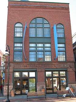 Ethan Allen Engine Company No. 4 |
April 16, 1971 (#71000056) |
135 Church St. 44°28′36″N 73°12′46″W |
Burlington | |
| 25 | First Baptist Church | 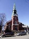 First Baptist Church |
March 2, 2001 (#01000217) |
81 St. Paul St. 44°28′40″N 73°12′52″W |
Burlington | |
| 26 | First Methodist Church of Burlington | 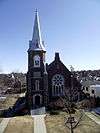 First Methodist Church of Burlington |
October 5, 1978 (#78000231) |
S. Winooski Ave. 44°28′43″N 73°12′38″W |
Burlington | |
| 27 | William Fitzgerald Block | 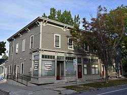 William Fitzgerald Block |
May 1, 2012 (#12000293) |
57-63 N. Champlain St. 44°28′56″N 73°13′04″W |
Burlington | |
| 28 | Follett House | 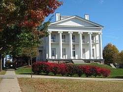 Follett House |
October 30, 1972 (#72000091) |
63 College St. 44°28′36″N 73°13′04″W |
Burlington | |
| 29 | Fort Ethan Allen Historic District | 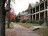 Fort Ethan Allen Historic District |
September 14, 1995 (#95001102) |
Junction of Vermont Route 15 and Barnes Avenue 44°30′19″N 73°08′56″W |
Colchester and Essex | |
| 30 | Galusha House | 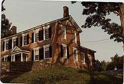 Galusha House |
October 10, 1978 (#78000232) |
South of Jericho 44°30′09″N 72°59′38″W |
Jericho | Home of Truman Galusha, son of Jonas Galusha. |
| 31 | GENERAL BUTLER (shipwreck) | October 22, 1998 (#98001269) |
Burlington Bay 44°28′19″N 73°13′42″W |
Burlington | ||
| 32 | Grasse Mount | 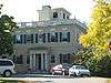 Grasse Mount |
April 11, 1973 (#73000193) |
411 Main St. 44°28′36″N 73°12′13″W |
Burlington | |
| 33 | Gray Rocks | 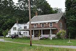 Gray Rocks |
December 27, 1996 (#96001534) |
U.S. Route 2, near its junction with Interstate 89 44°24′05″N 72°58′29″W |
Richmond | |
| 34 | Head of Church Street Historic District | 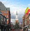 Head of Church Street Historic District |
July 15, 1974 (#74000207) |
Pearl and Church Sts. 44°28′51″N 73°12′48″W |
Burlington | |
| 35 | Hinesburg Town Forest |  Hinesburg Town Forest |
June 7, 2016 (#15001037) |
Hayden Hill Rd. 44°19′47″N 73°02′42″W |
Hinesburg | |
| 36 | Holmes Creek Covered Bridge | 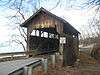 Holmes Creek Covered Bridge |
September 6, 1974 (#74000326) |
Northwest of Charlotte over Holmes Creek 44°20′00″N 73°16′55″W |
Charlotte | |
| 37 | Honey Hollow Camp | 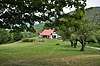 Honey Hollow Camp |
December 29, 1994 (#94001512) |
Honey Hollow Rd. 44°21′02″N 72°55′06″W |
Bolton | |
| 38 | House at 44 Front Street | 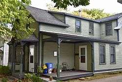 House at 44 Front Street |
October 16, 2008 (#08000997) |
42-44 Front St. 44°29′00″N 73°13′13″W |
Burlington | |
| 39 | Howard Mortuary Chapel | 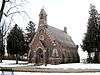 Howard Mortuary Chapel |
October 21, 1999 (#99001272) |
455 North Ave. 44°29′36″N 73°13′49″W |
Burlington | |
| 40 | Huntington Lower Village Church | 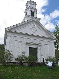 Huntington Lower Village Church |
August 23, 1984 (#84003463) |
2156 Main Rd. 44°19′35″N 72°59′21″W |
Huntington | Now houses the local library. |
| 41 | Jericho Center Historic District | 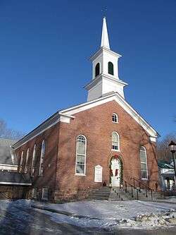 Jericho Center Historic District |
May 26, 1983 (#83003207) |
Brown's Trace, Bolger Hill and Varney Rds. 44°28′13″N 72°58′20″W |
Jericho | |
| 42 | Jericho Village Historic District | 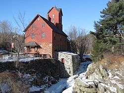 Jericho Village Historic District |
November 5, 1992 (#92001533) |
Vermont Route 15, Plains Rd., Mill St., and Old Pump Rd. 44°30′19″N 72°59′45″W |
Jericho | |
| 43 | Dan Johnson Farmstead | November 4, 1993 (#93001178) |
Junction of U.S. Route 2 and Johnson Ln. 44°25′50″N 73°03′22″W |
Williston | ||
| 44 | Jonesville Academy | 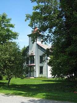 Jonesville Academy |
November 2, 1982 (#82001762) |
South of Jonesville at Cochran and Waterbury Rds. 44°22′53″N 72°56′18″W |
Jonesville | |
| 45 | Martin L. Kelsey House |  Martin L. Kelsey House |
February 24, 1983 (#83003208) |
43 Elmwood Ave 44°28′54″N 73°12′50″W |
Burlington | |
| 46 | Lakeside Development | Lakeside Development |
April 12, 1982 (#82001699) |
Lakeside, Central, Conger, Wright, and Harrison Aves. 44°27′35″N 73°13′15″W |
Burlington | |
| 47 | LeClair Avenue Historic District | April 2, 2012 (#11000831) |
6, 7, 8, 11, 14 LeClair Ave., 11-13, 12, 20 North St. 44°29′39″N 73°11′23″W |
Winooski | ||
| 48 | LeFerriere House |  LeFerriere House |
August 8, 2008 (#07000499) |
171-173 Intervale Ave. 44°29′21″N 73°12′37″W |
Burlington | Misspelled "LeFarriere" in the register listing. |
| 49 | Mad River Glen Ski Area Historic District |  Mad River Glen Ski Area Historic District |
July 5, 2012 (#12000409) |
VT 17 (McCullough Turnpike) 44°12′07″N 72°55′02″W |
Buels Gore | Mostly in Fayston in Washington County |
| 50 | Main Street-College Street Historic District |  Main Street-College Street Historic District |
October 13, 1988 (#88001850) |
Roughly bounded by College, S. Williams and Main Sts., and S. Winooski Ave. 44°28′44″N 73°12′22″W |
Burlington | |
| 51 | McNeil Homestead |  McNeil Homestead |
June 17, 1982 (#82001700) |
Wings Point Rd. 44°18′12″N 73°18′05″W |
Charlotte | |
| 52 | Methodist Episcopal Church of Winooski | 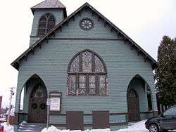 Methodist Episcopal Church of Winooski |
March 2, 2001 (#01000216) |
24 W Allen St. 44°29′28″N 73°11′16″W |
Winooski | |
| 53 | Mintzer House |  Mintzer House |
August 8, 2008 (#07000498) |
175-177 Intervale Ave. 44°29′26″N 73°12′37″W |
Burlington | |
| 54 | Moquin's Bakery | 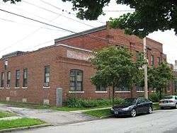 Moquin's Bakery |
June 27, 1997 (#97000645) |
78 Rose St. 44°29′13″N 73°13′00″W |
Burlington | |
| 55 | Moran Municipal Generation Station | 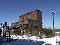 Moran Municipal Generation Station |
December 17, 2010 (#10001041) |
475 Lake St. 44°28′53″N 73°13′24″W |
Burlington | |
| 56 | Mount Philo State Park | 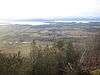 Mount Philo State Park |
November 29, 2001 (#01001286) |
5425 Mount Philo Rd. 44°16′40″N 73°12′40″W |
Charlotte | |
| 57 | Murray-Isham Farm | December 7, 1992 (#92001668) |
3515 Oak Hill Rd. (Town Highway 1) 44°23′34″N 73°05′47″W |
Williston | ||
| 58 | Normand House | 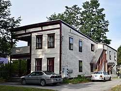 Normand House |
August 8, 2008 (#07000497) |
163-165, 165 rear Intervale Ave. 44°29′25″N 73°12′38″W |
Burlington | |
| 59 | North Street Historic District | 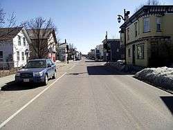 North Street Historic District |
December 21, 2001 (#01001364) |
Roughly along North St., from North Ave. to N. Winooski Ave. 44°29′03″N 73°13′01″W |
Burlington | |
| 60 | O.J. WALKER (shipwreck) | October 22, 1998 (#98001270) |
Burlington Bay 44°28′44″N 73°14′27″W |
Burlington | ||
| 61 | Old Ohavi Zedek Synagogue | 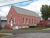 Old Ohavi Zedek Synagogue |
January 31, 1978 (#78000233) |
Archibald and Hyde Sts. 44°29′18″N 73°12′26″W |
Burlington | |
| 62 | Old Red Mill and Mill House | 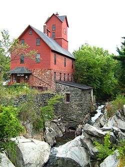 Old Red Mill and Mill House |
July 31, 1972 (#72000113) |
Vermont Route 15 44°30′17″N 73°00′00″W |
Jericho | |
| 63 | Old Stone House | 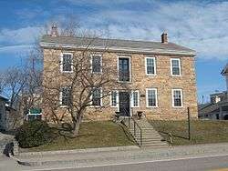 Old Stone House |
May 8, 1973 (#73000271) |
73 E. Allen St. 44°29′29″N 73°11′00″W |
Winooski | |
| 64 | Charles R. Palmer House | 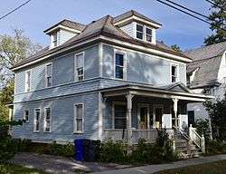 Charles R. Palmer House |
August 30, 2005 (#05000947) |
201 and 203 N. Willard St. 44°29′12″N 73°12′22″W |
Burlington | |
| 65 | Pearl Street Historic District | 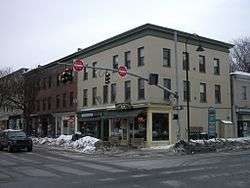 Pearl Street Historic District |
November 1, 1984 (#84000416) |
Roughly 184 to 415 Pearl St., Orchard Terr., and Winooski Ave. 44°28′50″N 73°12′29″W |
Burlington | |
| 66 | Cicero Goddard Peck House | 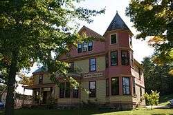 Cicero Goddard Peck House |
November 10, 2010 (#10000890) |
18 Mechanicsville Rd. 44°19′55″N 73°06′36″W |
Hinesburg | |
| 67 | PHOENIX (Shipwreck) | November 5, 1998 (#98001268) |
Colchester Shoal, Colchester Reef 44°33′11″N 73°19′52″W |
Colchester | ||
| 68 | Pine Street Industrial Historic District | October 16, 2017 (#100001751) |
Pine St. 44°28′16″N 73°12′55″W |
Burlington | ||
| 69 | Porter Screen Company | 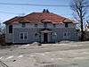 Porter Screen Company |
November 15, 1979 (#79000219) |
110 E. Spring St. 44°29′37″N 73°10′54″W |
Winooski | |
| 70 | Preston-Lafreniere Farm | 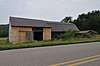 Preston-Lafreniere Farm |
February 5, 1999 (#99000138) |
Junction of Duxbury Rd. and Honey Hollow Rd. 44°22′29″N 72°54′33″W |
Bolton | |
| 71 | Proctor Maple Research Farm | September 13, 1999 (#99001050) |
UVM Rd. 44°31′37″N 72°51′57″W |
Underhill | ||
| 72 | Quinlan's Covered Bridge | 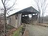 Quinlan's Covered Bridge |
September 10, 1974 (#74000208) |
South of East Charlotte over Lewis Creek 44°16′35″N 73°11′04″W |
East Charlotte | |
| 73 | Redstone Historic District | 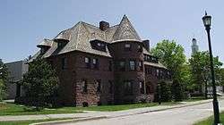 Redstone Historic District |
November 14, 1991 (#91001614) |
S. Prospect St. 44°28′12″N 73°11′54″W |
Burlington | |
| 74 | Remington-Williamson Farm | 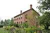 Remington-Williamson Farm |
November 19, 2001 (#01001239) |
4282 Main Rd. 44°18′00″N 72°58′14″W |
Huntington | |
| 75 | Richmond Congregational Church | 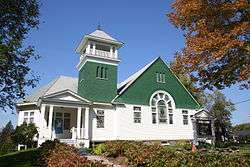 Richmond Congregational Church |
March 29, 2001 (#01000326) |
Junction of Bridge and Church St. 44°24′14″N 72°59′46″W |
Richmond | |
| 76 | Richmond Underwear Company Building | 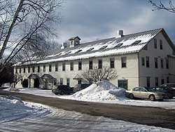 Richmond Underwear Company Building |
May 7, 1992 (#92000465) |
Millet St. 44°24′24″N 72°59′38″W |
Richmond | |
| 77 | John B. Robarge Duplex | 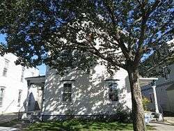 John B. Robarge Duplex |
August 6, 2005 (#05000805) |
58-60 N. Champlain St. 44°29′03″N 73°13′02″W |
Burlington | |
| 78 | Roberge-Desautels Apartment House | 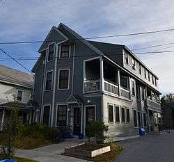 Roberge-Desautels Apartment House |
January 22, 2014 (#13001120) |
54 N. Champlain St. 44°28′55″N 73°13′02″W |
Burlington | |
| 79 | Daniel Webster Robinson House | 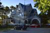 Daniel Webster Robinson House |
April 22, 1982 (#82001701) |
384 and 388 Main St. 44°28′35″N 73°12′13″W |
Burlington | Shingle Style transitional with elements of Georgian, Queen Anne, and Colonial (revival) styles; now a fraternity house. |
| 80 | Round Church | 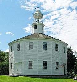 Round Church |
June 20, 1974 (#74000355) |
Bridge St. and Cochran Rd. 44°23′56″N 72°59′58″W |
Richmond | Built in 1812–1813, a rare, well-preserved example of a sixteen-sided meetinghouse |
| 81 | Lucy Ruggles House | 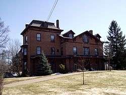 Lucy Ruggles House |
December 16, 2005 (#05001421) |
262 S. Prospect St. 44°28′23″N 73°12′00″W |
Burlington | |
| 82 | Saltus Grocery Store | 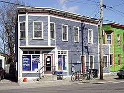 Saltus Grocery Store |
November 19, 2001 (#01001238) |
299-301 N. Winooski Ave. 44°29′18″N 73°12′28″W |
Burlington | |
| 83 | Sand Bar State Park | 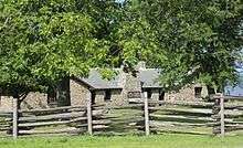 Sand Bar State Park |
February 14, 2002 (#02000028) |
1215 U.S. Route 2 44°37′37″N 73°14′27″W |
Milton | |
| 84 | Seguin Covered Bridge | 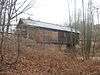 Seguin Covered Bridge |
September 6, 1974 (#74000209) |
Roscoe Road over Lewis Creek 44°17′20″N 73°09′03″W |
East Charlotte | Misspelled "Sequin" in the National Register. |
| 85 | Shelburne Farms | 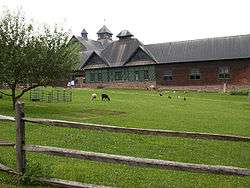 Shelburne Farms |
August 11, 1980 (#80000330) |
Off U.S. Route 7 44°23′37″N 73°14′53″W |
Shelburne | Created in 1886 by Dr. William Seward Webb and Eliza Osgood Vanderbilt Webb as a model agricultural estate. |
| 86 | Shelburne Village Historic District |  Shelburne Village Historic District |
July 27, 1990 (#90001055) |
Area north and south of the junction of U.S. Route 7, Harbor Rd. and Falls Rd., including the area south and east of the LaPlatte River and U.S. Route 7 44°22′51″N 73°13′36″W |
Shelburne | |
| 87 | South Union Street Historic District | 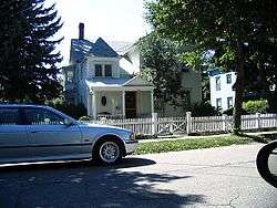 South Union Street Historic District |
October 31, 1988 (#88001946) |
S. Union St. between Howard and Main 44°28′16″N 73°12′30″W |
Burlington | |
| 88 | South Willard Street Historic District | November 3, 1988 (#88002226) |
S. Willard St. 44°28′21″N 73°12′23″W |
Burlington | ||
| 89 | Stannard House | February 4, 2019 (#100003416) |
3 George St. 44°28′50″N 73°12′54″W |
Burlington | ||
| 90 | Sutton Farm | October 7, 2004 (#04001132) |
4592 Dorset St. 44°24′13″N 73°10′41″W |
Shelburne | ||
| 91 | Tavern on Mutton Hill | 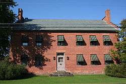 Tavern on Mutton Hill |
December 10, 1982 (#82001763) |
Church Hill Rd. 44°19′30″N 73°14′15″W |
Charlotte | |
| 92 | TICONDEROGA | .jpg) TICONDEROGA |
October 15, 1966 (#66000797) |
Shelburne Museum 44°22′37″N 73°13′53″W |
Shelburne | 220-foot (67 m) steamboat built in Shelburne, Vermont in 1906. |
| 93 | Lee Tracy House | 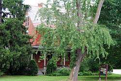 Lee Tracy House |
December 22, 1983 (#83004226) |
U.S. Route 7 44°22′54″N 73°13′42″W |
Shelburne | |
| 94 | U.S. Post Office and Custom House |  U.S. Post Office and Custom House |
November 21, 1972 (#72000114) |
Southeastern corner of Main and Church Sts. 44°28′33″N 73°12′44″W |
Burlington | |
| 95 | Underhill State Park | 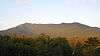 Underhill State Park |
June 21, 2002 (#02000665) |
352 Mountain Rd. 44°31′34″N 72°49′58″W |
Underhill | |
| 96 | University Green Historic District |  University Green Historic District |
April 14, 1975 (#75000139) |
University of Vermont campus 44°28′39″N 73°12′02″W |
Burlington | |
| 97 | Edward Wells House |  Edward Wells House |
October 3, 1979 (#79000220) |
61 Summit St. 44°28′28″N 73°12′11″W |
Burlington | |
| 98 | Wells-Jackson Carriage House Complex | 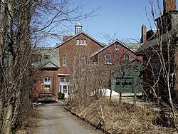 Wells-Jackson Carriage House Complex |
December 10, 1982 (#82001764) |
192-194 Jackson Court and 370 Maple St. 44°28′30″N 73°12′17″W |
Burlington | |
| 99 | Wells-Richardson Complex | 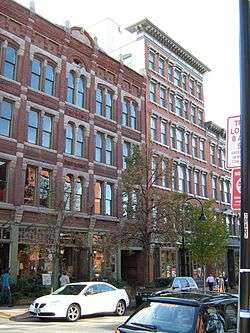 Wells-Richardson Complex |
March 5, 1979 (#79000221) |
Main, Pine, College, and St. Paul Sts. 44°28′35″N 73°12′54″W |
Burlington | |
| 100 | West Milton Bridge | 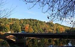 West Milton Bridge |
September 8, 1992 (#92001173) |
Town Highway 40 over the Lamoille River 44°37′56″N 73°10′18″W |
Milton | |
| 101 | M. S. Whitcomb Farm | 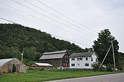 M. S. Whitcomb Farm |
September 30, 1993 (#93001010) |
U.S. Route 2 44°23′45″N 72°57′25″W |
Richmond | |
| 102 | Williston Congregational Church | 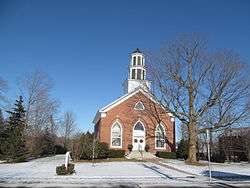 Williston Congregational Church |
May 17, 1973 (#73000194) |
Center of Williston Village on US 2 44°26′20″N 73°04′23″W |
Williston | |
| 103 | Williston Village Historic District | 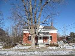 Williston Village Historic District |
December 19, 1979 (#79000222) |
U.S. Route 2, specifically over Allen Brook 44°26′16″N 73°04′14″W |
Williston | Allen Brook location represents a boundary increase of September 4, 1992 |
| 104 | Winooski Archeological Site | January 5, 1978 (#78000234) |
Address Restricted |
Winooski | ||
| 105 | Winooski Block | 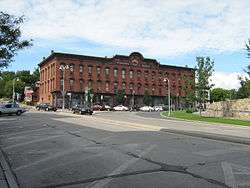 Winooski Block |
November 20, 1974 (#74000210) |
E. Allen and Main Sts. 44°29′30″N 73°11′11″W |
Winooski | |
| 106 | Winooski Falls Mill District | 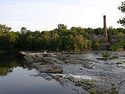 Winooski Falls Mill District |
February 9, 1979 (#79000223) |
Northern bank of the Winooski River to Center and Canal Sts., southern bank to Barrett St.; also 485-497 Colchester Ave., 5-21 Mill St., and 8-32 Barrett St., Burlington; also 110 W. Canal St. 44°29′20″N 73°11′15″W |
Winooski | Second and third sets of boundaries represent boundary increases of September 30, 1993 and November 12, 2009 respectively |
| 107 | Winooski River Bridge | 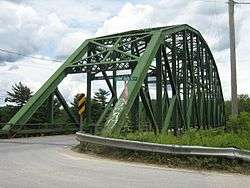 Winooski River Bridge |
May 30, 1990 (#90000775) |
U.S. Route 2 over the Winooski River 44°25′24″N 73°01′01″W |
Richmond | |
| 108 | Winterbotham Estate | 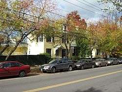 Winterbotham Estate |
May 12, 1975 (#75000140) |
163 S. Willard St. 44°28′33″N 73°12′22″W |
Burlington |
Former listings
| [3] | Name on the Register | Image | Date listed | Date removed | Location | City or town | Summary |
|---|---|---|---|---|---|---|---|
| 1 | Chittenden County Courthouse | 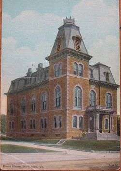 Chittenden County Courthouse |
April 11, 1973 (#73000192) | March 22, 2016 | 180 Church St. 44°28′02″N 73°12′44″W |
Burlington | Demolished |
See also
| Wikimedia Commons has media related to National Register of Historic Places in Chittenden County, Vermont. |
References
- The latitude and longitude information provided in this table was derived originally from the National Register Information System, which has been found to be fairly accurate for about 99% of listings. Some locations in this table may have been corrected to current GPS standards.
- "National Register of Historic Places: Weekly List Actions". National Park Service, United States Department of the Interior. Retrieved on June 26, 2020.
- Numbers represent an ordering by significant words. Various colorings, defined here, differentiate National Historic Landmarks and historic districts from other NRHP buildings, structures, sites or objects.
- "National Register Information System". National Register of Historic Places. National Park Service. April 24, 2008.
- The eight-digit number below each date is the number assigned to each location in the National Register Information System database, which can be viewed by clicking the number.
- Location derived from this Lake Champlain Maritime Museum webpage; the NRIS lists the site as "Address Restricted"
| Topics | |
|---|---|
| Lists by state |
|
| Lists by insular areas | |
| Lists by associated state | |
| Other areas | |
| Related | |
| |
Municipalities and communities of Chittenden County, Vermont, United States | ||
|---|---|---|
Shire town: Burlington | ||
| Cities | Map of Vermont highlighting Chittenden County | |
| Towns | ||
| Villages | ||
| CDPs |
| |
| Unincorporated communities | ||
This article is issued from Wikipedia. The text is licensed under Creative Commons - Attribution - Sharealike. Additional terms may apply for the media files.