Charlotte, Vermont
Charlotte /ʃɑːrˈlɒt/ is a town in Chittenden County, Vermont, United States. The town was named for Sofia Charlotte of Mecklenburg-Strelitz, Queen of England and wife of King George III. The population of the town was 3,754 at the 2010 census.[3]
Charlotte, Vermont | |
|---|---|
 Charlotte town hall | |
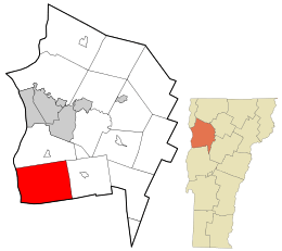 Location in Chittenden County and the state of Vermont. | |
 Charlotte, Vermont Location in the United States | |
| Coordinates: 44°18′33″N 73°14′6″W | |
| Country | United States |
| State | Vermont |
| County | Chittenden |
| Communities | Charlotte Cedar Beach East Charlotte Prindle Corners |
| Area | |
| • Total | 50.3 sq mi (130.4 km2) |
| • Land | 41.3 sq mi (106.9 km2) |
| • Water | 9.1 sq mi (23.6 km2) |
| Elevation | 354 ft (108 m) |
| Population (2010) | |
| • Total | 3,754 |
| • Density | 91/sq mi (35.1/km2) |
| Time zone | UTC-5 (Eastern (EST)) |
| • Summer (DST) | UTC-4 (EDT) |
| ZIP code | 05445 |
| Area code(s) | 802 |
| FIPS code | 50-13300[1] |
| GNIS feature ID | 1462068[2] |
| Website | www |
Geography
Charlotte is located in the southwest corner of Chittenden County. It is bordered to the north by the town of Shelburne, to the east by Hinesburg, to the southeast by Monkton in Addison County, and to the south by Ferrisburgh in Addison County. To the west the town extends to the New York/Vermont border in the middle of Lake Champlain. According to the United States Census Bureau, the town has a total area of 50.3 square miles (130.4 km2), of which 41.3 square miles (106.9 km2) is land and 9.1 square miles (23.6 km2), or 18.08%, is water.[3]
Charlotte is home to 990-foot-high (300 m) Mount Philo. The park was established in 1924 and is open seasonally.
Demographics
.jpg)
| Historical population | |||
|---|---|---|---|
| Census | Pop. | %± | |
| 1790 | 635 | — | |
| 1800 | 1,231 | 93.9% | |
| 1810 | 1,679 | 36.4% | |
| 1820 | 1,526 | −9.1% | |
| 1830 | 1,702 | 11.5% | |
| 1840 | 1,620 | −4.8% | |
| 1850 | 1,634 | 0.9% | |
| 1860 | 1,589 | −2.8% | |
| 1870 | 1,430 | −10.0% | |
| 1880 | 1,342 | −6.2% | |
| 1890 | 1,240 | −7.6% | |
| 1900 | 1,254 | 1.1% | |
| 1910 | 1,163 | −7.3% | |
| 1920 | 1,160 | −0.3% | |
| 1930 | 1,089 | −6.1% | |
| 1940 | 1,082 | −0.6% | |
| 1950 | 1,215 | 12.3% | |
| 1960 | 1,271 | 4.6% | |
| 1970 | 1,802 | 41.8% | |
| 1980 | 2,561 | 42.1% | |
| 1990 | 3,148 | 22.9% | |
| 2000 | 3,569 | 13.4% | |
| 2010 | 3,754 | 5.2% | |
| Est. 2014 | 3,856 | [5] | 2.7% |
| U.S. Decennial Census[6] | |||
As of the census[1] of 2000, there were 3,569 people, 1,287 households, and 990 families residing in the town. The population density was 86.0 people per square mile (33.2/km2). There were 1,500 housing units at an average density of 36.2 per square mile (14.0/km2). The racial makeup of the town was 97.93% White, 0.20% African American, 0.06% Native American, 0.59% Asian, 0.45% from other races, and 0.78% from two or more races. Hispanic or Latino of any race were 0.70% of the population.
There were 1,287 households, out of which 42.6% had children under the age of 18 living with them, 66.7% were married couples living together, 6.9% had a female householder with no husband present, and 23.0% were non-families. 15.7% of all households were made up of individuals, and 4.3% had someone living alone who was 65 years of age or older. The average household size was 2.77 and the average family size was 3.12.
In the town, the population was spread out, with 29.7% under the age of 18, 4.4% from 18 to 24, 28.1% from 25 to 44, 30.1% from 45 to 64, and 7.7% who were 65 years of age or older. The median age was 39 years. For every 100 females, there were 97.6 males. For every 100 females age 18 and over, there were 93.7 males.
The median income for a household in the town was $62,313, and the median income for a family was $71,090. Males had a median income of $52,470 versus $35,156 for females. The per capita income for the town was $33,942. About 4.5% of families and 5.0% of the population were below the poverty line, including 7.5% of those under age 18 and 3.6% of those age 65 or over.
Public transportation
U.S. Route 7 runs north-south through the town.
Hourly ferry service between Essex, New York and Charlotte is provided by the Lake Champlain Transportation Company. Most years in the past decade, the ferry service has run year-round, with exception of a few days of winter rough or ice filled lake surface. A commuter bus operating morning and evening stops on US Route 7 at Ferry Road for transport to and from Burlington.
By 2022 it is anticipated that Amtrak's Ethan Allen Express train will make a stop at Vergennes, 11 miles to the south.
Media
The Citizen is a weekly newspaper mailed to all residents of Charlotte and nearby Hinesburg. It was established in 2006 as the Charlotte Citizen but changed its name in 2011 when the publication expanded into Hinesburg. In May 2017, The Citizen was acquired by the owners of the Stowe Reporter,[7] who then created the Vermont Community Newspaper Group in 2019.[8]
Notable people
- John Dewey, American psychologist, philosopher, educator, social critic and political activist. Briefly taught in a private school for girls after graduating from the University of Vermont around 1880.
- Lane Gibson, sound engineer
- Wilfred Grenfell, medical humanitarian in Newfoundland and Labrador
- Jeffrey Hollender, American businessperson, entrepreneur, author, and activist. He is well known for his roles as CEO, co-founder, and later Chief Inspired Protagonist and Executive Chairperson of Seventh Generation Inc.
- Melvin Kaplan, oboist and founder of the Vermont Mozart Festival
- Dan Kiley, landscape architect (deceased)
- Abel E. Leavenworth, educator and soldier
- Cyrus Pringle, botanist (deceased)
References
- "U.S. Census website". United States Census Bureau. Retrieved 2008-01-31.
- "US Board on Geographic Names". United States Geological Survey. 2007-10-25. Retrieved 2008-01-31.
- "Geographic Identifiers: 2010 Census Summary File 1 (G001): Charlotte town, Chittenden County, Vermont". U.S. Census Bureau, American Factfinder. Archived from the original on February 13, 2020. Retrieved August 18, 2015.
- Chittenden County Regional Planning Commission (2016). Zoning Map Charlotte Vermont (pdf) (Map) (Updated 2018 ed.). 1:14,400. Town of Charlotte, Vermont.
- "Annual Estimates of the Resident Population for Incorporated Places: April 1, 2010 to July 1, 2014". Retrieved June 4, 2015.
- "U.S. Decennial Census". United States Census Bureau. Retrieved May 16, 2015.
- Walters, John (31 May 2017). "Media Note: Stowe Reporter Owners Buy Shelburne, Charlotte Newspapers". Seven Days VT. Retrieved 8 April 2020.
- "Newspaper group has new name, six weekly papers". Stowe Today. 24 Jan 2019. Retrieved 2020-04-08.
External links
| Wikimedia Commons has media related to Charlotte, Vermont. |
Municipalities and communities of Chittenden County, Vermont, United States | ||
|---|---|---|
Shire town: Burlington | ||
| Cities |  Map of Vermont highlighting Chittenden County | |
| Towns | ||
| Villages | ||
| CDPs |
| |
| Unincorporated communities | ||
| Authority control |
|
|---|