Namkha, Nepal
Namkha (Nepali: नाम्खा) is a largest rural municipality (by area) of Nepal located in Humla District of Karnali Province. [1]
Namkha नाम्खा | |
|---|---|
 Namkha Location in Nepal | |
| Coordinates: 30°3′36″N 81°27′36″E | |
| Country | |
| Province | Karnali |
| District | Humla |
| No. of wards | 6 |
| Established | 10 March 2017 |
| Government | |
| • Type | Rural council |
| • Chairperson | Mr. Vishnu Bahadur Tamang |
| • Vice-chairperson | Mr. Pema Tamang |
| Area | |
| • Total | 2,419.64 km2 (934.23 sq mi) |
| Area rank | Largest Rural municipality |
| Population (2011) | |
| • Total | 3,900 |
| • Density | 1.6/km2 (4.2/sq mi) |
| Time zone | UTC+5:45 (NST) |
| Headquarters | Muchu |
| Website | namkhamun |
The total area of the rural municipality is 2,419.64 square kilometres (934.23 sq mi) and total population is 3900 individuals (as of 2011 Nepal census) only. The rural municipality is divided into 6 wards.[2]
The rural municipality was established on 10 March 2017, when Government of Nepal restricted all old administrative structure (Village development committee) and announced 744 local level units (although the number increased to 753 later) as per the new constitution of Nepal 2015.[3] [4]
Hepka, Khagalgaun, Muchu and Limi Village development committees were incorporated to form this new rural municipality. The headquarters of the municipality is situated at Yalwang (Muchu)[2]
References
- "स्थानीय तहहरुको विवरण" [Details of the local level bodies]. www.mofald.gov.np/en (in Nepali). Ministry of Federal Affairs and Local Development. Archived from the original on 31 August 2018. Retrieved 17 July 2018.
- "District Corrected Last for RAJAPATRA" (PDF). www.mofald.gov.np. Retrieved 17 July 2018.
- "New local level structure comes into effect from today". www.thehimalayantimes.com. The Himalayan Times. 10 March 2017. Retrieved 17 July 2018.
- "New local level units come into existence". www.kathmandupost.ekantipur.com. 11 March 2017. Retrieved 18 July 2018.
External links
Headquarters: Simikot | ||
| Rural municipalities: | 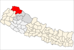 | |
List of municipalities and rural municipalities of Nepal | ||