Nagarpur Upazila
Nagarpur (Bengali: নাগরপুর) is an Upazila of Tangail District in the Division of Dhaka, Bangladesh. Nagarpur Thana was established in 1906 and was converted into an upazila in 1983.
Nagarpur নাগরপুর | |
|---|---|
Upazila | |
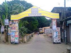 Nagarpur Upazila Gate | |
 Nagarpur Location in Bangladesh | |
| Coordinates: 24°3′N 89°52.5′E | |
| Country | |
| Division | Dhaka Division |
| District | Tangail District |
| Established on | 9 September 1983 |
| Area | |
| • Total | 262.7 km2 (101.4 sq mi) |
| Population (2011) | |
| • Total | 288,092 |
| • Density | 1,097/km2 (2,840/sq mi) |
| Time zone | UTC+6 (BST) |
| Postal Code | 1936 |
| Website | nagarpur |
Geography
Nagarpur is located at 24.0500°N 89.8750°E. The total area of the Upazila is 266.7 km2.
Demographics
As of the 2011 Bangladesh census, Nagarpur has a population of 288092. There are households 66523 in total.[1] Nagarpur Town has an area of 4.68 km2. The town has a population of 13110; male 51.25%, female 48.75%; density of population is 2801 per km2.
Administration
Nagarpur Upazila is divided into 12 union parishads: Bekra, Bhadra, Bharra, Dhubaria, Duptiair, Gayhata, Mamudnagar, Moka, Nagarpur, Pakutia, Sahabatpur, and Salimabad. The union parishads are subdivided into 212 mauzas and 243 villages.
Education
Nagarpur has an average literacy rate of 42.7% (Male-46.3%, Female-39.6%).[2]
See also
- Upazilas of Bangladesh
- Districts of Bangladesh
- Divisions of Bangladesh
- Union Councils of Tangail District
References
- "Tangail Table C-01 : Area, Households, Population, Density by Residence and Community" (PDF). bbs.gov.bd. Archived from the original (PDF) on 2014-11-13. Retrieved 2016-03-01.
- "Tangail Table C-06 : Distribution of Population aged 7 years and above by Literacy, Sex, Residence and Community" (PDF). bbs.gov.bd. Archived from the original (PDF) on 2014-11-13. Retrieved 2016-02-25.
| Upazila/Thana: | ||
|---|---|---|
Headquarters: Dhaka | ||
| Dhaka District | 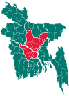 | |
| Faridpur District | ||
| Gazipur District | ||
| Gopalganj District | ||
| Kishoreganj District | ||
| Madaripur District |
| |
| Manikganj District | ||
| Munshiganj District |
| |
| Narayanganj District | ||
| Narsingdi District | ||
| Rajbari District |
| |
| Shariatpur District |
| |
| Tangail District | ||