NOAA-7
NOAA-7, designated NOAA-C before launch, was an American weather satellite launched in June 1981 as part of the National Oceanic and Atmospheric Administration's Polar Operational Environmental Satellites (POES) program. It was used to support the Global Atmospheric Research Program (GARP) during 1978–1984. An earlier launch, NOAA-B, was scheduled to become NOAA-7, however NOAA-B failed to reach its required orbit.[4]
| Mission type | Weather satellite |
|---|---|
| Operator | NOAA |
| COSPAR ID | 1981-059A |
| SATCAT no. | 12553 |
| Spacecraft properties | |
| Spacecraft type | TIROS-N |
| Manufacturer | RCA Astro Electronics |
| Launch mass | 588.9 kilograms (1,298 lb)[1] |
| Start of mission | |
| Launch date | June 23, 1981, 10:52:59 UTC[2] |
| Rocket | Atlas E/F Star-37S-ISS |
| Launch site | Vandenberg SLC-3W |
| End of mission | |
| Disposal | Decommissioned |
| Deactivated | June 1986 |
| Orbital parameters | |
| Reference system | Geocentric |
| Regime | Low Earth |
| Semi-major axis | 7,213.53 kilometers (4,482.28 mi) |
| Eccentricity | 0.001076 |
| Perigee altitude | 834 kilometers (518 mi) |
| Apogee altitude | 850 kilometers (530 mi) |
| Inclination | 98.87 degrees |
| Period | 101.62 minutes |
| Epoch | December 8, 2013, 13:05:54 UTC[3] |
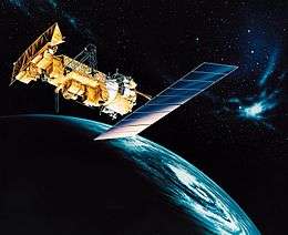
TIROS-N | |
The launch of NOAA-7 took place at 10:52:59 UTC (3:53 a.m. PST) on June 23, 1981 from Space Launch Complex 3W at the Vandenberg Air Force Base in California. NOAA-7 was launched atop an Atlas E/F rocket with a Star-37S-ISS upper stage.
The NOAA-7 satellite had a mass of 588.9 kilograms (1,298 lb). The satellite's design provided an economical and stable sun synchronous platform for advanced operational instruments to measure the Earth's atmosphere, its surface and cloud cover, and the near space environment. The primary sensors included an Advanced Very High Resolution Radiometer (AVHRR) and a TIROS Operational Vertical Sounder (TOVS). One of the primary mission sensors, the High Resolution Infrared Radiation Sounder (HIRS), failed February 7, 1985.[5] There were a number of secondary experiments on-board NOAA-7. These include a Space Environment Monitor (SEM) and a Data Collection and Platform Location System (DCPLS). The United States Air Force also provided a contamination monitor to assess contamination sources, levels and effects for consideration on future spacecraft.
NOAA-7 was based upon the Block 5D spacecraft bus developed for the U.S. Air Force. The satellite was capable of maintaining an earth-pointing accuracy of better than ±0.1° with a motion rate of less than 0.035 degrees/second.[1]
NOAA-7 was withdrawn from use in June 1986 after its power system malfunctioned.[6] In August 1997 the decommissioned satellite experienced an abrupt 1 second change in orbital period. At the same time 3 new debris particles were observed. It is unclear if this was caused by an internal release of energy or collision with an unidentified object.[7] As of December 8, 2013, the derelict satellite remains in a 834 by 850 km (518 by 528 mi) orbit, inclined at 98.87 degrees and with a period of 101.62 minutes.[3]
References
- "NOAA 7". National Space Science Data Center. Retrieved December 8, 2013.
- McDowell, Jonathan. "Launch Log". Jonathan's Space Page. Retrieved December 8, 2013.
- "NOAA 7 Satellite details 1981-059A NORAD 12553". N2YO. December 8, 2013. Retrieved December 8, 2013.
- Bell, Peter M. (1980). "NOAA-B satellite mission unsuccessful". Eos, Transactions, American Geophysical Union. 61: 515. Bibcode:1980EOSTr..61R.515B. doi:10.1029/eo061i027p00515-03. Retrieved September 2, 2014.
- NOAA-K (PDF) (Booklet), Greenbelt, Maryland: NASA Goddard Space Flight Center, 1997, p. 20, NP-1997-12-052-GSFC, retrieved June 12, 2015
- "The NOAA Series". NASA GSFC. Retrieved December 8, 2013.
- "The Orbital Debris Quarterly News" (PDF). NASA Johnson Space Center. Retrieved August 27, 2014.