Myingyan
Myingyan (Burmese: မြင်းခြံ; MLCTS: mrang:hkram, [mjɪ́ɰ̃d͡ʑàɰ̃]) is a city and district in the Mandalay Division of central Myanmar, previously, it was a district in the Meiktila Division of Upper Burma. It is currently the capital of Myingyan Township and lies along the National Highway 2. As of 2014, the city had a population of 276,096 and the district had 1,055,957. It lies in the valley of the Ayeyarwady River, to the south of Mandalay, on the east bank of the river. The area around the town is flat, especially to the north and along the banks of the Ayeyarwady. Inland the country rises in gently undulating slopes. The most noticeable feature is Popa Hill, an extinct volcano, to the south-east. The highest peak is 4,962 ft. above sea-level. The climate is dry, with high south winds from March until September. The annual rainfall averages about 35 in. The temperature varies between 106 and 70 Fahrenheit. The ordinary crops are millet, sesame, cotton, maize, rice and a great variety of peas and beans. There are no forests, but a great deal of low scrubland. Myingyan is the head of the branch railway to Thazi and the main line between Yangon and Mandalay.
Myingyan မြင်းခြံမြို့ | |
|---|---|
Town | |
 Myingyan railway station | |
 Myingyan Location in Myanmar | |
| Coordinates: 21°27′36″N 95°23′18″E | |
| Country | |
| Region | Mandalay Region |
| District | Myingyan District |
| Township | Myingyan Township |
| Population (2014) | |
| • Total | 91,542 |
| Time zone | UTC+6.30 (MST) |
Myingyan Prison in Myingyan District was known as the most infamous detention center among Burma's political prisoners for its atrocities from early 1990s' to October 1999 when the International Committee for Red Cross (ICRC) was granted an access to the prison.
Climate
| Climate data for Myingyan (1981–2010) | |||||||||||||
|---|---|---|---|---|---|---|---|---|---|---|---|---|---|
| Month | Jan | Feb | Mar | Apr | May | Jun | Jul | Aug | Sep | Oct | Nov | Dec | Year |
| Average high °C (°F) | 29.2 (84.6) |
32.9 (91.2) |
37.3 (99.1) |
40.0 (104.0) |
38.3 (100.9) |
36.3 (97.3) |
36.0 (96.8) |
34.9 (94.8) |
34.1 (93.4) |
33.3 (91.9) |
31.1 (88.0) |
28.7 (83.7) |
34.3 (93.7) |
| Average low °C (°F) | 12.3 (54.1) |
14.8 (58.6) |
19.5 (67.1) |
25.5 (77.9) |
26.8 (80.2) |
26.8 (80.2) |
26.8 (80.2) |
26.3 (79.3) |
25.7 (78.3) |
24.3 (75.7) |
19.7 (67.5) |
14.2 (57.6) |
21.9 (71.4) |
| Average rainfall mm (inches) | 1.2 (0.05) |
2.5 (0.10) |
2.9 (0.11) |
17.6 (0.69) |
91.4 (3.60) |
85.1 (3.35) |
57.2 (2.25) |
105.8 (4.17) |
151.7 (5.97) |
101.6 (4.00) |
25.8 (1.02) |
3.6 (0.14) |
646.4 (25.45) |
| Source: Norwegian Meteorological Institute[1] | |||||||||||||
References
- "Myanmar Climate Report" (PDF). Norwegian Meteorological Institute. pp. 23–36. Archived from the original (PDF) on 8 October 2018. Retrieved 1 December 2018.

Capital: Mandalay | ||
| Kyaukse District |  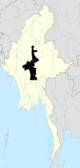 | |
| Mandalay District | ||
| Meiktila District | ||
| Myingyan District | ||
| Nyaung-U District |
| |
| Pyinoolwin District | ||
| Yamethin District | ||
| Main cities and towns | ||