Yamethin Township
Yamethin Township is a township of Yamethin District in the Mandalay Region of Burma (Myanmar). The administrative seat and principal city is Yamethin, which is also the major rail stop in the township.
Yamethin Township ရမည်းသင်းမြို့နယ် | |
|---|---|
Township | |
 Yamethin Township | |
| Coordinates: 20°26′N 96°09′E | |
| Country | |
| Region | Mandalay Region |
| District | Yamethin |
| Capital | Yamethin |
| Time zone | UTC+6:30 (MST) |
Communities
Among the many communities in Yamethin Township are: North and South Pyar Si, Upper and Lower Warpyutaung (Wapyudaung), and Yebyu.
History
Yamethin Township was established as a town during the time of King Duttabaung in 170 BE (Buddhist Era). The town was formerly known as Nwamethin (နွားမည်းသင်း), in reference to the preponderance of black cows in the area. Over time, the town's name evolved to Namethin and to Yamethin, which is the modern-day name.[2]
Climate
| Climate data for Yamethin (1981–2010) | |||||||||||||
|---|---|---|---|---|---|---|---|---|---|---|---|---|---|
| Month | Jan | Feb | Mar | Apr | May | Jun | Jul | Aug | Sep | Oct | Nov | Dec | Year |
| Average high °C (°F) | 30.2 (86.4) |
33.2 (91.8) |
36.3 (97.3) |
38.0 (100.4) |
35.5 (95.9) |
32.4 (90.3) |
31.7 (89.1) |
31.6 (88.9) |
32.3 (90.1) |
32.6 (90.7) |
30.7 (87.3) |
29.2 (84.6) |
32.8 (91.0) |
| Average low °C (°F) | 13.2 (55.8) |
15.3 (59.5) |
19.9 (67.8) |
24.1 (75.4) |
24.5 (76.1) |
24.0 (75.2) |
23.6 (74.5) |
23.5 (74.3) |
23.4 (74.1) |
22.9 (73.2) |
19.2 (66.6) |
14.7 (58.5) |
20.7 (69.3) |
| Average rainfall mm (inches) | 1.7 (0.07) |
2.6 (0.10) |
8.8 (0.35) |
25.1 (0.99) |
136.0 (5.35) |
104.8 (4.13) |
96.8 (3.81) |
117.1 (4.61) |
152.4 (6.00) |
140.2 (5.52) |
48.8 (1.92) |
9.3 (0.37) |
843.6 (33.21) |
| Source: Norwegian Meteorological Institute[3] | |||||||||||||
Demographics
2014
| Historical population | ||
|---|---|---|
| Year | Pop. | ±% |
| 1973 | 145,207 | — |
| 1983 | 181,973 | +25.3% |
| 2014 | 258,091 | +41.8% |
| Source: [4], [5] | ||
The 2014 Myanmar Census reported that Pyinmana Township had a population of 258,091.[6] The population density was 119.1 people per km².[6] The census reported that the median age was 28.4 years, and a sex ratio of 95 males per 100 females.[6] There were 57,259 households; the mean household size was 4.1.[6]
References
- "President inspects dredging at Kyee Ni Lake in Yamethin Township". www.president-office.gov.mm/en/. Retrieved 23 March 2015.
- "ရမည်းသင်းမြို့နယ်ဒေသဆိုင်ရာအချက်အလက်များ" (PDF). General Administration Department. 2017.
- "Myanmar Climate Report" (PDF). Norwegian Meteorological Institute. pp. 23–36. Archived from the original (PDF) on 8 October 2018. Retrieved 1 December 2018.
- Mandalay Division 1983 Population Census (PDF). Rangoon: Immigration and Manpower Department. 1986.
- ၁၉၇၃ ခုနှစ်၊ လူဦးရေသန်းခေါင်စာရင်း (မန္တလေးတိုင်း) (PDF) (in Burmese). ပြည်ထဲရေးနှင့်သာသနာရေးဝန်ကြီးဌာန.
- "Yamethin Township Report" (PDF). 2014 Myanmar Population and Housing Census. October 2017.
External links
- "Yamethin Township - Mandalay Division" Map ID: MIMU 154v01, Creation Date: 17 May 2010, Myanmar Information Management Unit (MIMU)
- Township 151 on "Myanmar States/Divisions & Townships Overview Map" Myanmar Information Management Unit (MIMU)
- "Yamethin Google Satellite Map" Maplandia
Capital: | |
|
Capital: Mandalay | ||
| Kyaukse District |  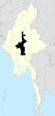 | |
| Mandalay District | ||
| Meiktila District | ||
| Myingyan District | ||
| Nyaung-U District |
| |
| Pyinoolwin District | ||
| Yamethin District | ||
| Main cities and towns | ||